« Back to Jefferson County Rivers
Milwaukee River at Milwaukee-Estabrook Park
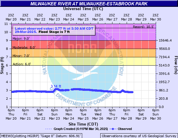
Critical Stages
6' - Action
7' - Flood
8' - Moderate
9' - Major
Latest Observation
Updated: 6:09 PM LMT 12/31/00
Status: Obs Not Current
Stage: -999 ft
Flow: -999 kcfs
Forecast
Forecast not available for this location.
| Time | Stage (ft) | Flow (kcfs) |
|---|---|---|
| 4:00 PM 11/20 | 1.02 | 0.084 |
| 3:30 PM 11/20 | 1.3 | 0.225 |
| 3:15 PM 11/20 | 1.3 | 0.225 |
| 3:00 PM 11/20 | 1.3 | 0.225 |
| 2:30 PM 11/20 | 1.3 | 0.225 |
| 2:15 PM 11/20 | 1.3 | 0.225 |
| 2:00 PM 11/20 | 1.3 | 0.225 |
| 1:30 PM 11/20 | 1.3 | 0.225 |
| 1:15 PM 11/20 | 1.3 | 0.225 |
| 1:00 PM 11/20 | 1.3 | 0.225 |
| 12:30 PM 11/20 | 1.3 | 0.225 |
| 12:15 PM 11/20 | 1.3 | 0.225 |
| 12:00 PM 11/20 | 1.63 | 0.373 |
| 11:30 AM 11/20 | 1.97 | 0.588 |
| 11:15 AM 11/20 | 1.96 | 0.581 |
| 5:30 PM 10/25 | 1 | 0 |
| 5:15 PM 10/25 | 1 | 0 |
| 5:00 PM 10/25 | 1 | 0 |
| 2:30 PM 10/25 | 1 | 0 |
| 2:15 PM 10/25 | 1 | 0 |
| 2:00 PM 10/25 | 1 | 0 |
| 1:30 PM 10/25 | 1.01 | 0 |
| 1:15 PM 10/25 | 1.01 | 0 |
| 1:00 PM 10/25 | 1.01 | 0 |
| 12:30 PM 10/25 | 1.01 | 0 |
| 12:15 PM 10/25 | 1.01 | 0 |
| 12:00 PM 10/25 | 1.01 | 0 |
| 11:30 AM 10/25 | 1.01 | 0 |
| 11:15 AM 10/25 | 1.01 | 0 |
| 11:00 AM 10/25 | 1.01 | 0 |
10.5' -
There is widespread flooding in the Glendale area. Floodwaters inundate much of Lincoln Park and Kletsch Park. Streets affected in Glendale include Bender Road, North Milwaukee River Parkway, Port Washington Road including a hotel. Floodwaters back into the tributary of Lincoln Creek and affect some streets along Lincoln Creek.
9.3' -
Streets and parks in Glendale are affected by floodwaters. Streets affected inclue Bender Road, West Riverview Drive, North River Forest Drive and North Sunny Point Road. Parts of Lincoln Park and Kletsch Park are flooded.
8.5' -
Parts of Lincoln Park and Kletsch Park are flooded. Parts of Riverview Drive are flooded. Floodwaters affect property along North Sunny Point Road in the Glendale area as well as the Hilton Hotel property along Port Washington Road.
8' -
Floodwaters affect property along Port Washington Road including the Hilton Hotel.
7' -
Floodwaters affect property along Port Washington Road including the Hilton Hotel.
6' -
There is general overflow of the lowest banks resulting in minor lowland flooding mainly in the Glendale area.
5.5' -
There is minor lowland flooding.
| Date | Stage (ft) |
|---|---|
| Aug 10, 2025 | 11.2 |
| Jul 22, 2010 | 10.48 |
| Jun 21, 1997 | 10 |
| Apr 21, 1973 | 9.29 |
| Jun 7, 2008 | 8.07 |
| Mar 31, 1960 | 8.05 |
| Apr 3, 1959 | 7.92 |
| Mar 19, 1948 | 7.55 |
| Mar 24, 1975 | 7.53 |
| Aug 6, 1998 | 7.5 |
| Jul 2, 1978 | 7.46 |
| Apr 9, 2015 | 7.15 |
| May 17, 2020 | 7.13 |
| Mar 22, 1952 | 7.13 |
| Jun 24, 1940 | 7.1 |
| Mar 15, 1946 | 7 |
| May 24, 2004 | 6.93 |
| Jun 5, 1953 | 6.89 |
| Apr 19, 1993 | 6.87 |
| Aug 28, 2018 | 6.85 |
Data provided by the National Weather Service.