« Back to Jefferson County Rivers
Milwaukee River at Waubeka
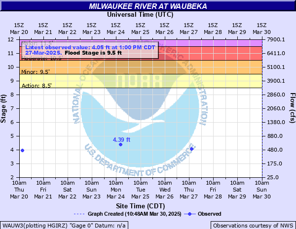
Critical Stages
8.5' - Action
9.5' - Flood
10.5' - Moderate
11.5' - Major
Latest Observation
Updated: 9:17 AM CST 12/2/25
Status: Obs Not Current
Stage: 4.4 ft
Flow: 0.622 kcfs
Forecast
Forecast not available for this location.
| Time | Stage (ft) | Flow (kcfs) |
|---|---|---|
| 9:17 AM 12/2 | 4.4 | 0.622 |
| 12:51 PM 11/28 | 3.44 | 0.283 |
| 9:10 AM 11/25 | 2.88 | 0.144 |
| 9:36 AM 11/20 | 2.95 | 0.162 |
| 1:54 PM 11/13 | 2.72 | 0.11 |
| 9:19 AM 11/10 | 2.8 | 0.126 |
| 12:38 PM 11/6 | 2.85 | 0.137 |
| 8:12 AM 11/3 | 2.84 | 0.135 |
11' -
Streets affected by floodwaters in the Waubeka area include River Street, County Highway Z and Memorial Drive. Much of Waubedonia and Marie Kraus Parks are flooded. Floodwaters affect low spots in Fredonia.
10' -
There is widespread flooding of back yards of homes in the Waubeka area along Second Street and County Highway Z. There is extensive flooding downstream in Waubedonia and Marie Kraus Parks.
9.5' -
Water approaches some homes in Waubeka in the area of Second Street and County Highway Z. There is significant flooding downstream in Waubedonia Park and Marie Kraus Park.
9' -
There is flooding of back yards of homes along Second Street and County Highway Z in the Waubeka area. There is flooding downstream in Waubedonia and Marie Kraus Parks.
8.5' -
There is minor flooding of back yards of homes along Second Street and County Highway Z in Waubeka. There is minor flooding downstream in Waubedonia Park.
| Date | Stage (ft) |
|---|---|
| Mar 16, 2019 | 13.77 |
| Mar 23, 1975 | 11.35 |
| Mar 14, 2007 | 10.67 |
| Jun 13, 2004 | 10.61 |
| Jun 9, 2008 | 10.49 |
| Jun 13, 2008 | 10.42 |
| Jan 9, 2008 | 9.77 |
| Oct 2, 2019 | 9.61 |
| May 23, 2004 | 8.97 |
| Apr 12, 2013 | 8.87 |
| Mar 12, 2010 | 7.86 |
| Mar 23, 2011 | 7.21 |
| Mar 16, 2008 | 7.06 |
| Apr 13, 2008 | 6.59 |
| Jul 16, 2010 | 6.2 |
| Feb 20, 2011 | 5.76 |
Data provided by the National Weather Service.