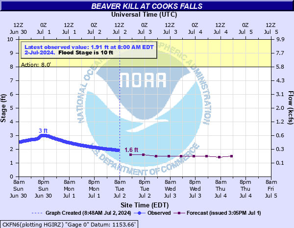
Beaver Kill at Cooks Falls
Critical Stages
8' - Action
10' - Flood
16' - Moderate
18' - Major
Latest Observation
Updated: 10:00 PM EST 12/6/25
Status: No Flooding
Stage: 2.07 ft
Flow: 0.292 kcfs
Forecast
| Time | Stage (ft) | Flow (kcfs) |
|---|---|---|
| 1 AM 12/7 | 2 | 0.274 |
| 7 AM 12/7 | 2 | 0.274 |
| 1 PM 12/7 | 2 | 0.274 |
| 7 PM 12/7 | 2 | 0.274 |
| 1 AM 12/8 | 1.9 | 0.25 |
| 7 AM 12/8 | 1.9 | 0.25 |
| 1 PM 12/8 | 1.9 | 0.25 |
| 7 PM 12/8 | 1.9 | 0.25 |
| 1 AM 12/9 | 1.9 | 0.25 |
| 7 AM 12/9 | 1.9 | 0.25 |
| Time | Stage (ft) | Flow (kcfs) |
|---|---|---|
| 10:00 PM 12/6 | 2.07 | 0.292 |
| 9:45 PM 12/6 | 2.07 | 0.292 |
| 9:30 PM 12/6 | 2.07 | 0.292 |
| 9:15 PM 12/6 | 2.08 | 0.295 |
| 9:00 PM 12/6 | 2.08 | 0.295 |
| 8:45 PM 12/6 | 2.08 | 0.295 |
| 8:30 PM 12/6 | 2.09 | 0.297 |
| 8:15 PM 12/6 | 2.09 | 0.297 |
| 8:00 PM 12/6 | 2.09 | 0.297 |
| 7:45 PM 12/6 | 2.1 | 0.3 |
| 7:30 PM 12/6 | 2.1 | 0.3 |
| 7:15 PM 12/6 | 2.1 | 0.3 |
| 7:00 PM 12/6 | 2.11 | 0.303 |
| 6:45 PM 12/6 | 2.11 | 0.303 |
| 6:30 PM 12/6 | 2.12 | 0.305 |
| 6:15 PM 12/6 | 2.12 | 0.305 |
| 6:00 PM 12/6 | 2.13 | 0.308 |
| 5:45 PM 12/6 | 2.13 | 0.308 |
| 5:30 PM 12/6 | 2.13 | 0.308 |
| 5:15 PM 12/6 | 2.14 | 0.311 |
| 5:00 PM 12/6 | 2.14 | 0.311 |
| 4:45 PM 12/6 | 2.14 | 0.311 |
| 4:30 PM 12/6 | 2.15 | 0.313 |
| 4:15 PM 12/6 | 2.15 | 0.313 |
| 4:00 PM 12/6 | 2.16 | 0.316 |
| 3:45 PM 12/6 | 2.16 | 0.316 |
| 3:30 PM 12/6 | 2.16 | 0.316 |
| 3:15 PM 12/6 | 2.16 | 0.316 |
| 3:00 PM 12/6 | 2.16 | 0.316 |
| 2:45 PM 12/6 | 2.16 | 0.316 |
21.1' -
FEMA flood insurance risk maps indicate that this stage corresponds to the 0.2% (500 year) flood level. Your property is at risk for flooding during a record flood event. A 500 year flood is a flood that has a 0.2 percent chance of occurring in any year. A flood of this magnitude has not occurred here since record keeping began.
20.55' -
This is the river stage corresponding to the June 2006 flood of record.
18.98' -
This is the crest of the April 2005 major flood which resulted in several million dollars of damage to over 100 buildings and six bridges.
18.7' -
FEMA flood insurance risk maps indicate that this stage corresponds to the 1% (100 year) floodplain. Your property is at risk for flooding during a major event. A 100 year flood is a flood that has a 1 percent chance of occurring in any year. In the past, water has reached this level one time since record keeping began.
18' -
This is the major flood stage. Numerous properties and structures are flooded from Cooks Falls to East Branch.
17.8' -
This is the crest of the January 19, 1996 rapid snow melt and heavy rainfall flood.
16' -
Water spreads across Cooks Falls Road from Cooks Falls to Butternut Grove. Properties and homes near the fire station are affected by flood waters. Chiloway Road in Horton is flooded out at this level.
12' -
Between 12 and 16 feet, recreation areas, campgrounds and some low lying properties along the river become flooded from Cooks Falls to East Branch.
10' -
Minor flooding of lowland agricultural areas begins along the river.
| Date | Stage (ft) |
|---|---|
| Jun 28, 2006 | 20.55 |
| Apr 3, 2005 | 18.98 |
| Aug 24, 1933 | 17.8 |
| Jan 19, 1996 | 17.79 |
| Sep 18, 2004 | 17.67 |
| Dec 17, 2000 | 16.34 |
| Mar 31, 1951 | 16.02 |
| Oct 1, 2010 | 15.69 |
| Aug 28, 2011 | 15.6 |
| Nov 26, 1950 | 15.52 |
| Dec 21, 1957 | 15.42 |
| Mar 14, 1977 | 15.2 |
| Jul 28, 1969 | 15.11 |
| Mar 18, 1936 | 15.02 |
| Sep 30, 1924 | 15 |
| Nov 9, 1996 | 14.79 |
| Sep 27, 1942 | 14.71 |
| Dec 2, 1996 | 14.67 |
| Sep 19, 2012 | 14.58 |
| Aug 11, 1938 | 14.51 |
Data provided by the National Weather Service.