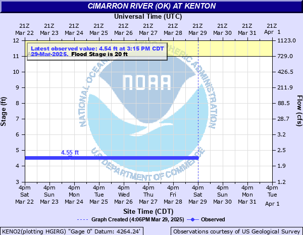
Cimarron River (OK) at Kenton
Critical Stages
11' - Action
20' - Flood
23' - Moderate
28' - Major
Latest Observation
Updated: 5:15 AM CST 12/16/25
Status: No Flooding
Stage: 4.53 ft
Flow: 0.0003 kcfs
Forecast
Forecast not available for this location.
| Time | Stage (ft) | Flow (kcfs) |
|---|---|---|
| 5:15 AM 12/16 | 4.53 | 0.0003 |
| 5:00 AM 12/16 | 4.52 | 0.0003 |
| 4:45 AM 12/16 | 4.52 | 0.0003 |
| 4:30 AM 12/16 | 4.52 | 0.0003 |
| 4:15 AM 12/16 | 4.52 | 0.0003 |
| 4:00 AM 12/16 | 4.52 | 0.0003 |
| 3:45 AM 12/16 | 4.52 | 0.0003 |
| 3:30 AM 12/16 | 4.52 | 0.0003 |
| 3:15 AM 12/16 | 4.52 | 0.0003 |
| 3:00 AM 12/16 | 4.52 | 0.0003 |
| 2:45 AM 12/16 | 4.52 | 0.0003 |
| 2:30 AM 12/16 | 4.52 | 0.0003 |
| 2:15 AM 12/16 | 4.52 | 0.0003 |
| 2:00 AM 12/16 | 4.52 | 0.0003 |
| 1:45 AM 12/16 | 4.52 | 0.0003 |
| 1:30 AM 12/16 | 4.52 | 0.0003 |
| 1:15 AM 12/16 | 4.52 | 0.0003 |
| 1:00 AM 12/16 | 4.52 | 0.0003 |
| 12:45 AM 12/16 | 4.52 | 0.0003 |
| 12:30 AM 12/16 | 4.52 | 0.0003 |
| 12:15 AM 12/16 | 4.52 | 0.0003 |
| 12:00 AM 12/16 | 4.52 | 0.0003 |
| 11:45 PM 12/15 | 4.52 | 0.0003 |
| 11:30 PM 12/15 | 4.52 | 0.0003 |
| 11:15 PM 12/15 | 4.52 | 0.0003 |
| 11:00 PM 12/15 | 4.52 | 0.0003 |
| 10:45 PM 12/15 | 4.52 | 0.0003 |
| 10:30 PM 12/15 | 4.52 | 0.0003 |
| 10:15 PM 12/15 | 4.52 | 0.0003 |
| 10:00 PM 12/15 | 4.52 | 0.0003 |
28' -
Several miles of ranch land flood. County road, just northeast of Kenton inundated. Several homes may flood. Northwest corner of the Kenton community is threatened by floodwaters.
23' -
Approaches to the bridge on the county highway, 2 miles northeast of Kenton may become impassable. Several residents likely cutoff. Thousands of acres of ranch land flood with cattle losses possible.
20' -
Significant ranch land flooding occurs. Damage to fences likely. Flooding along the north carrizo creek will enhance flooding at its confluence, two miles downstream from the gage site. Secondary roads may flood downstream and isolate residents. Several low water crossings in along the river are inundated and impassable.
11' -
Bankfull stage. Water is up to the lowest natural banks but within secondary banks. Low water crossings upstream and downstream are likely flooded. Fences below the secondary bank could sustain damage. No other known threats.
| Date | Stage (ft) |
|---|---|
| Oct 17, 1965 | 22.32 |
| Jul 30, 2017 | 22.31 |
| Jun 25, 1977 | 21.62 |
| Aug 4, 2013 | 21.47 |
| Jun 5, 1978 | 20.74 |
| Jun 8, 2013 | 20.45 |
| Jul 6, 1958 | 18.67 |
| Aug 12, 1997 | 17.64 |
| Jul 15, 2014 | 17.56 |
| Jul 30, 2014 | 17.26 |
| Jul 10, 2014 | 17.01 |
| Jul 26, 2009 | 16.54 |
| May 2, 1999 | 16.11 |
| Jul 29, 1997 | 16.11 |
| Jul 31, 2017 | 14.39 |
| Aug 10, 1997 | 13.96 |
| Aug 6, 1997 | 13.27 |
| Apr 22, 2010 | 11.99 |
| May 31, 2021 | 11.74 |
| Aug 11, 1997 | 11.73 |
Data provided by the National Weather Service.