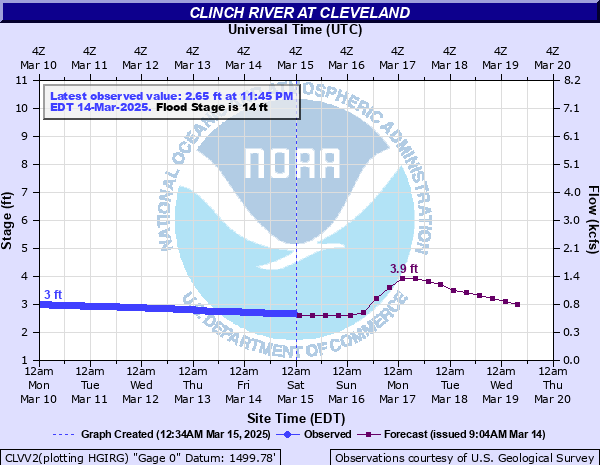
Clinch River at Cleveland
Critical Stages
12' - Action
14' - Flood
19' - Moderate
24' - Major
Latest Observation
Updated: 2:45 PM EST 12/12/25
Status: No Flooding
Stage: 2.68 ft
Flow: 0.584 kcfs
Forecast
| Time | Stage (ft) | Flow (kcfs) |
|---|---|---|
| 7 PM 12/12 | 2.7 | 0.593 |
| 1 AM 12/13 | 2.7 | 0.593 |
| 7 AM 12/13 | 2.7 | 0.593 |
| 1 PM 12/13 | 2.7 | 0.593 |
| 7 PM 12/13 | 2.6 | 0.546 |
| 1 AM 12/14 | 2.6 | 0.546 |
| 7 AM 12/14 | 2.5 | 0.5 |
| 1 PM 12/14 | 2.5 | 0.5 |
| 7 PM 12/14 | 2.5 | 0.5 |
| 1 AM 12/15 | 2.4 | 0.447 |
| 7 AM 12/15 | 2.4 | 0.447 |
| 1 PM 12/15 | 2.4 | 0.447 |
| 7 PM 12/15 | 2.4 | 0.447 |
| 1 AM 12/16 | 2.4 | 0.447 |
| 7 AM 12/16 | 2.3 | 0.397 |
| 1 PM 12/16 | 2.3 | 0.397 |
| 7 PM 12/16 | 2.3 | 0.397 |
| 1 AM 12/17 | 2.3 | 0.397 |
| 7 AM 12/17 | 2.3 | 0.397 |
| Time | Stage (ft) | Flow (kcfs) |
|---|---|---|
| 2:45 PM 12/12 | 2.68 | 0.584 |
| 2:30 PM 12/12 | 2.68 | 0.584 |
| 2:15 PM 12/12 | 2.68 | 0.584 |
| 2:00 PM 12/12 | 2.68 | 0.584 |
| 1:45 PM 12/12 | 2.68 | 0.584 |
| 1:30 PM 12/12 | 2.68 | 0.584 |
| 1:15 PM 12/12 | 2.68 | 0.584 |
| 1:00 PM 12/12 | 2.68 | 0.584 |
| 12:45 PM 12/12 | 2.68 | 0.584 |
| 12:30 PM 12/12 | 2.68 | 0.584 |
| 12:15 PM 12/12 | 2.68 | 0.584 |
| 12:00 PM 12/12 | 2.68 | 0.584 |
| 11:45 AM 12/12 | 2.68 | 0.584 |
| 11:30 AM 12/12 | 2.67 | 0.579 |
| 11:15 AM 12/12 | 2.67 | 0.579 |
| 11:00 AM 12/12 | 2.67 | 0.579 |
| 10:45 AM 12/12 | 2.66 | 0.574 |
| 10:30 AM 12/12 | 2.66 | 0.574 |
| 10:15 AM 12/12 | 2.66 | 0.574 |
| 10:00 AM 12/12 | 2.65 | 0.569 |
| 9:45 AM 12/12 | 2.65 | 0.569 |
| 9:30 AM 12/12 | 2.64 | 0.564 |
| 9:15 AM 12/12 | 2.64 | 0.564 |
| 9:00 AM 12/12 | 2.63 | 0.56 |
| 8:45 AM 12/12 | 2.63 | 0.56 |
| 8:30 AM 12/12 | 2.63 | 0.56 |
| 8:15 AM 12/12 | 2.63 | 0.56 |
| 8:00 AM 12/12 | 2.63 | 0.56 |
| 7:45 AM 12/12 | 2.63 | 0.56 |
| 7:30 AM 12/12 | 2.63 | 0.56 |
26.4' -
Water floods the lower ramp of Route 82 bridge, and affects 50 to 75 houses and 400 acres.
24' -
The old elementary school location begins to flood, and the river reaches the bottom of the Highway 82 bridge in Cleveland. About 30 to 40 houses are flooded with around 250 acres inundated.
21' -
The water treatment plant and several houses are flooded, along with about 100 acres in the area around Cleveland.
19' -
Water affects a few houses both on Main Street and adjacent to the ballpark entrance, and approximately 35 acres about two miles up and downstream from the Highway 82 bridge.
18' -
Water begins to affect a few houses immediately along the river downstream from the ballpark, flooding approximately 25 acres. The ballpark is mostly inundated.
16' -
Approximately 10 acres are flooded, including at the ballpark.
14' -
Flooding affects the pumping station for the water treatment plant.
| Date | Stage (ft) |
|---|---|
| Apr 5, 1977 | 26.4 |
| Jan 30, 1957 | 24.4 |
| Mar 12, 1963 | 22.7 |
| Mar 18, 2002 | 21.81 |
| Jan 26, 1978 | 20.87 |
| Aug 14, 1940 | 20.6 |
| Feb 16, 2025 | 20.48 |
| Feb 6, 2020 | 20.43 |
| Dec 22, 1926 | 20.1 |
| Mar 17, 1973 | 19.94 |
| May 7, 1984 | 19.46 |
| Mar 30, 1975 | 18.88 |
| May 7, 1971 | 18.82 |
| Mar 5, 2015 | 18.66 |
| Dec 31, 1969 | 18.63 |
| Feb 11, 1994 | 18.54 |
| Feb 18, 1944 | 17.95 |
| Jan 21, 1979 | 17.85 |
| Nov 20, 2003 | 17.85 |
| Mar 14, 1975 | 17.6 |
Data provided by the National Weather Service.