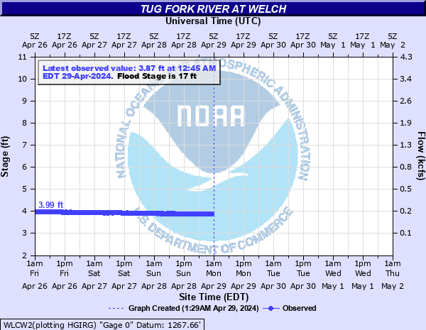
Tug Fork River at Welch
Critical Stages
15' - Action
17' - Flood
19' - Moderate
20' - Major
Latest Observation
Updated: 2:45 PM EST 12/12/25
Status: No Flooding
Stage: 3.4 ft
Flow: 0.115 kcfs
Forecast
Forecast not available for this location.
| Time | Stage (ft) | Flow (kcfs) |
|---|---|---|
| 2:45 PM 12/12 | 3.4 | 0.115 |
| 2:30 PM 12/12 | 3.4 | 0.115 |
| 2:15 PM 12/12 | 3.4 | 0.115 |
| 2:00 PM 12/12 | 3.4 | 0.115 |
| 1:45 PM 12/12 | 3.41 | 0.116 |
| 1:30 PM 12/12 | 3.41 | 0.116 |
| 1:15 PM 12/12 | 3.41 | 0.116 |
| 1:00 PM 12/12 | 3.41 | 0.116 |
| 12:45 PM 12/12 | 3.41 | 0.116 |
| 12:30 PM 12/12 | 3.41 | 0.116 |
| 12:15 PM 12/12 | 3.41 | 0.116 |
| 12:00 PM 12/12 | 3.41 | 0.116 |
| 11:45 AM 12/12 | 3.41 | 0.116 |
| 11:30 AM 12/12 | 3.41 | 0.116 |
| 11:15 AM 12/12 | 3.41 | 0.116 |
| 11:00 AM 12/12 | 3.41 | 0.116 |
| 10:45 AM 12/12 | 3.41 | 0.116 |
| 10:30 AM 12/12 | 3.41 | 0.116 |
| 10:15 AM 12/12 | 3.41 | 0.116 |
| 10:00 AM 12/12 | 3.41 | 0.116 |
| 9:45 AM 12/12 | 3.42 | 0.118 |
| 9:30 AM 12/12 | 3.42 | 0.118 |
| 9:15 AM 12/12 | 3.42 | 0.118 |
| 9:00 AM 12/12 | 3.42 | 0.118 |
| 8:45 AM 12/12 | 3.42 | 0.118 |
| 8:30 AM 12/12 | 3.42 | 0.118 |
| 8:15 AM 12/12 | 3.42 | 0.118 |
| 8:00 AM 12/12 | 3.43 | 0.119 |
| 7:45 AM 12/12 | 3.43 | 0.119 |
| 7:30 AM 12/12 | 3.43 | 0.119 |
20' -
Hemphill area is flooded. Other homes and businesses along the river in Welch are flooded.
19' -
Flooding of homes near bridge next to gage. Tug Road, Slick Rock Road, and Wilson Street in Hemphill area are flooded.
18' -
Wilson Street and Slick Rock Road begin to flood in the Hemphill area.
17' -
Church parking lot in Hemphill begins to flood. Route 16 dip between Hemphill and Welch starts to flood.
| Date | Stage (ft) |
|---|---|
| Feb 16, 2025 | 22.1 |
| May 2, 2002 | 22.1 |
| Jul 8, 2001 | 19.77 |
| Nov 19, 2003 | 15.17 |
| May 16, 1996 | 13.41 |
| Feb 6, 2020 | 12.92 |
| Apr 24, 1987 | 11.9 |
| Feb 22, 2003 | 11.63 |
| Feb 11, 1994 | 11.45 |
| Jan 31, 2013 | 10.86 |
| May 6, 1989 | 10.65 |
| Apr 17, 1998 | 10.4 |
| Apr 14, 2004 | 10.17 |
| Mar 24, 1993 | 9.63 |
| Feb 10, 1990 | 9.02 |
| Dec 2, 1991 | 8.04 |
| Mar 30, 1991 | 7.45 |
| Dec 25, 1987 | 5.22 |
Data provided by the National Weather Service.