« Back to Litchfield Public Library District Rivers
Kaskaskia River at Shelbyville
Critical Stages
548' - Action
549' - Flood
557' - Moderate
558' - Major
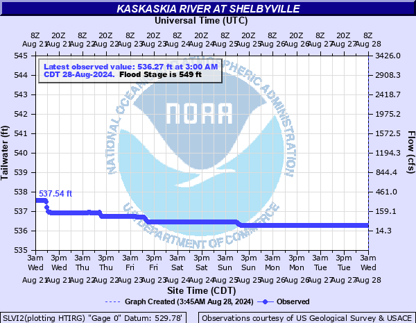
Latest Observation
Updated: 6:30 AM CST 12/6/25
Status: No Flooding
Stage: 536.43 ft
Flow: 0.0589 kcfs
Forecast
Forecast not available for this location.
| Time | Stage (ft) | Flow (kcfs) |
|---|---|---|
| 6:30 AM 12/6 | 536.43 | 0.0589 |
| 6:00 AM 12/6 | 536.43 | 0.0589 |
| 5:30 AM 12/6 | 536.43 | 0.0589 |
| 5:00 AM 12/6 | 536.43 | 0.0589 |
| 4:30 AM 12/6 | 536.43 | 0.0589 |
| 4:00 AM 12/6 | 536.43 | 0.0589 |
| 3:30 AM 12/6 | 536.43 | 0.0589 |
| 3:00 AM 12/6 | 536.43 | 0.0589 |
| 2:30 AM 12/6 | 536.43 | 0.0589 |
| 2:00 AM 12/6 | 536.43 | 0.0589 |
| 1:30 AM 12/6 | 536.43 | 0.0589 |
| 1:00 AM 12/6 | 536.43 | 0.0589 |
| 12:30 AM 12/6 | 536.43 | 0.0589 |
| 12:00 AM 12/6 | 536.43 | 0.0589 |
| 11:30 PM 12/5 | 536.43 | 0.0589 |
| 11:00 PM 12/5 | 536.43 | 0.0589 |
| 10:30 PM 12/5 | 536.43 | 0.0589 |
| 10:00 PM 12/5 | 536.43 | 0.0589 |
| 9:30 PM 12/5 | 536.43 | 0.0589 |
| 9:00 PM 12/5 | 536.43 | 0.0589 |
| 8:30 PM 12/5 | 536.43 | 0.0589 |
| 8:00 PM 12/5 | 536.43 | 0.0589 |
| 7:30 PM 12/5 | 536.43 | 0.0589 |
| 7:00 PM 12/5 | 536.43 | 0.0589 |
| 6:30 PM 12/5 | 536.43 | 0.0589 |
| 6:00 PM 12/5 | 536.43 | 0.0589 |
| 5:30 PM 12/5 | 536.43 | 0.0589 |
| 5:00 PM 12/5 | 536.43 | 0.0589 |
| 4:30 PM 12/5 | 536.43 | 0.0589 |
| 4:00 PM 12/5 | 536.43 | 0.0589 |
549' -
Some low lying areas begin to flood.
| Date | Stage (ft) |
|---|---|
| Jun 29, 1957 | 558.15 |
| May 19, 1943 | 556.95 |
| May 8, 1908 | 556.9 |
| Jan 5, 1950 | 556.41 |
| May 27, 1968 | 555.48 |
| Feb 11, 1959 | 554.28 |
| Apr 24, 1944 | 554.28 |
| Feb 22, 1951 | 554 |
| Sep 30, 1911 | 553.9 |
| Jun 25, 1960 | 553.45 |
| Jun 7, 1947 | 553.04 |
| Dec 10, 1966 | 553 |
| Jul 11, 1942 | 553 |
| Mar 22, 1962 | 552.93 |
| Apr 4, 1945 | 552.9 |
| Apr 24, 1964 | 552.85 |
| Aug 2, 1958 | 552.42 |
| May 12, 1961 | 552.31 |
| Jan 31, 1969 | 552.2 |
| Apr 14, 1909 | 551.9 |
Data provided by the National Weather Service.