« Back to Little Horse Creek Rivers
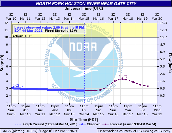
North Fork Holston River near Gate City
Critical Stages
10' - Action
12' - Flood
15' - Moderate
18' - Major
Latest Observation
Updated: 11:15 PM EST 12/11/25
Status: No Flooding
Stage: 2.56 ft
Flow: 0.53 kcfs
Forecast
| Time | Stage (ft) | Flow (kcfs) |
|---|---|---|
| 1 AM 12/12 | 2.6 | 0.551 |
| 7 AM 12/12 | 2.6 | 0.551 |
| 1 PM 12/12 | 2.6 | 0.551 |
| 7 PM 12/12 | 2.6 | 0.551 |
| 1 AM 12/13 | 2.6 | 0.551 |
| 7 AM 12/13 | 2.6 | 0.551 |
| 1 PM 12/13 | 2.5 | 0.5 |
| 7 PM 12/13 | 2.5 | 0.5 |
| 1 AM 12/14 | 2.5 | 0.5 |
| 7 AM 12/14 | 2.4 | 0.446 |
| 1 PM 12/14 | 2.4 | 0.446 |
| 7 PM 12/14 | 2.4 | 0.446 |
| 1 AM 12/15 | 2.4 | 0.446 |
| 7 AM 12/15 | 2.3 | 0.39 |
| 1 PM 12/15 | 2.3 | 0.39 |
| 7 PM 12/15 | 2.3 | 0.39 |
| 1 AM 12/16 | 2.3 | 0.39 |
| 7 AM 12/16 | 2.3 | 0.39 |
| Time | Stage (ft) | Flow (kcfs) |
|---|---|---|
| 12:15 AM 12/12 | 2.56 | 0.53 |
| 12:00 AM 12/12 | 2.56 | 0.53 |
| 11:45 PM 12/11 | 2.56 | 0.53 |
| 11:30 PM 12/11 | 2.56 | 0.53 |
| 11:15 PM 12/11 | 2.56 | 0.53 |
| 11:00 PM 12/11 | 2.56 | 0.53 |
| 10:45 PM 12/11 | 2.57 | 0.536 |
| 10:30 PM 12/11 | 2.57 | 0.536 |
| 10:15 PM 12/11 | 2.57 | 0.536 |
| 10:00 PM 12/11 | 2.57 | 0.536 |
| 9:45 PM 12/11 | 2.57 | 0.536 |
| 9:30 PM 12/11 | 2.57 | 0.536 |
| 9:15 PM 12/11 | 2.57 | 0.536 |
| 9:00 PM 12/11 | 2.57 | 0.536 |
| 8:45 PM 12/11 | 2.57 | 0.536 |
| 8:30 PM 12/11 | 2.57 | 0.536 |
| 8:15 PM 12/11 | 2.57 | 0.536 |
| 8:00 PM 12/11 | 2.57 | 0.536 |
| 7:45 PM 12/11 | 2.57 | 0.536 |
| 7:30 PM 12/11 | 2.57 | 0.536 |
| 7:15 PM 12/11 | 2.57 | 0.536 |
| 7:00 PM 12/11 | 2.58 | 0.541 |
| 6:45 PM 12/11 | 2.58 | 0.541 |
| 6:30 PM 12/11 | 2.58 | 0.541 |
| 6:15 PM 12/11 | 2.58 | 0.541 |
| 6:00 PM 12/11 | 2.58 | 0.541 |
| 5:45 PM 12/11 | 2.58 | 0.541 |
| 5:30 PM 12/11 | 2.58 | 0.541 |
| 5:15 PM 12/11 | 2.58 | 0.541 |
| 5:00 PM 12/11 | 2.58 | 0.541 |
23' -
Water may reach floors of shopping center immediately downstream from the Hwy 23 bridge.
21.5' -
The river reaches the bottom of the Highway 23 bridge and the area around the bridge is flooded. Around 100 acres are also affected.
20' -
More homes are flooded and 50 to 75 acres are inundated. Flooding of Warm Springs Road near Apple Orchard Road.
19' -
Portions of Newland Hollow Road begin to flood.
18' -
Several homes are flooded and 20 to 30 acres are inundated.
14' -
Flooding begins on North Holston River Drive beneath the West Carters Valley Road bridge. County Road 614 is cut off 1 1/2 miles downstream from the Highway 23 bridge.
12' -
Water begins to cover River Road and some low lying county roads.
10' -
Caution stage.
| Date | Stage (ft) |
|---|---|
| Feb 1, 1862 | 22.5 |
| Apr 5, 1977 | 19.79 |
| Mar 18, 2002 | 19.36 |
| Apr 24, 2017 | 18.54 |
| Feb 12, 2018 | 17.45 |
| Jan 30, 1957 | 16.73 |
| Mar 12, 1963 | 16.42 |
| Feb 7, 2020 | 16.33 |
| Apr 13, 2020 | 15.97 |
| Feb 16, 2025 | 15.89 |
| Feb 24, 2019 | 15.89 |
| Mar 30, 1975 | 15.83 |
| Dec 11, 1972 | 15.62 |
| May 8, 1984 | 15.27 |
| Mar 17, 1973 | 15.14 |
| Nov 20, 2003 | 15.1 |
| Feb 11, 1994 | 15 |
| Mar 28, 2021 | 14.99 |
| Aug 14, 1940 | 14.75 |
| Feb 18, 1944 | 14.44 |
Data provided by the National Weather Service.