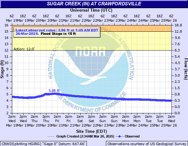
Sugar Creek (IN) at Crawfordsville
Critical Stages
12' - Action
15' - Flood
17' - Moderate
21' - Major
Latest Observation
Updated: 12:45 AM EST 12/10/25
Status: No Flooding
Stage: 2.97 ft
Flow: 0.0461 kcfs
Forecast
Forecast not available for this location.
| Time | Stage (ft) | Flow (kcfs) |
|---|---|---|
| 12:45 AM 12/10 | 2.97 | 0.0461 |
| 12:30 AM 12/10 | 2.96 | 0.0447 |
| 12:15 AM 12/10 | 2.96 | 0.0447 |
| 12:00 AM 12/10 | 2.96 | 0.0447 |
| 11:45 PM 12/9 | 2.96 | 0.0447 |
| 11:30 PM 12/9 | 2.96 | 0.0447 |
| 11:15 PM 12/9 | 2.96 | 0.0447 |
| 11:00 PM 12/9 | 2.95 | 0.0433 |
| 10:45 PM 12/9 | 2.95 | 0.0433 |
| 10:30 PM 12/9 | 2.94 | 0.042 |
| 10:15 PM 12/9 | 2.94 | 0.042 |
| 10:00 PM 12/9 | 2.94 | 0.042 |
| 9:45 PM 12/9 | 2.93 | 0.0406 |
| 9:30 PM 12/9 | 2.92 | 0.0393 |
| 9:15 PM 12/9 | 2.93 | 0.0406 |
| 9:00 PM 12/9 | 2.92 | 0.0393 |
| 8:45 PM 12/9 | 2.92 | 0.0393 |
| 8:30 PM 12/9 | 2.91 | 0.038 |
| 8:15 PM 12/9 | 2.9 | 0.0368 |
| 8:00 PM 12/9 | 2.91 | 0.038 |
| 7:45 PM 12/9 | 2.9 | 0.0368 |
| 7:30 PM 12/9 | 2.9 | 0.0368 |
| 7:15 PM 12/9 | 2.9 | 0.0368 |
| 7:00 PM 12/9 | 2.9 | 0.0368 |
| 6:45 PM 12/9 | 2.9 | 0.0368 |
| 6:30 PM 12/9 | 2.9 | 0.0368 |
| 6:15 PM 12/9 | 2.9 | 0.0368 |
| 6:00 PM 12/9 | 2.9 | 0.0368 |
| 5:45 PM 12/9 | 2.9 | 0.0368 |
| 5:30 PM 12/9 | 2.9 | 0.0368 |
24.5' -
Record flooding. Businesses and homes flooded. Numerous roads underwater.
23' -
Near record flooding is in progress.
21' -
Major flooding is in progress. Evacuations necessary along SR 234 just east of Shades State Park. Buildings at Crawfordsville Power Plant flood. Business and residence just north of Sugar Creek along U.S. 231 flood.
20' -
Mobile homes extensively flood in a camping area about 1/2 mile upstream of US Hwy 136 in the Crawfordsville area.
19' -
Residences and SR 234 in northeast Parke County begin to flood. Extensive flooding north of Sugar Creek near U.S. 231 is in progress. Flooding begins on Crawfordsville Power Plant grounds. Extensive agricultural flooding is in progress. Extensive flooding of low areas of Shades and Turkey Run State Parks.
18.5' -
A mobile home park at Darlington may flood extensively and a few evacuations may be necessary.
17' -
Flooding is in progress along Sugar Creek. Montgomery CR 175 E, Rock River Ridge Road and other roads are impassable. Flooding begins north of Sugar Creek along U.S. 231.
15' -
Montgomery County Road 175 E, Rock River Ridge Road and other county roads begin to flood. Higher campgrounds begin to flood. Agricultural flooding is in progress.
13' -
Bankfull level is reached. Agricultural flooding begins. Low campgrounds flood. Trails in Shades and Turkey Run State Parks near Sugar Creek begin to flood.
6' -
Level considered unsafe for canoeing on Sugar Creek.
5' -
Level that restrictions begin on canoeing on Sugar Creek.
| Date | Stage (ft) |
|---|---|
| Mar 27, 1913 | 17.3 |
| Apr 19, 2013 | 15.33 |
| Jun 28, 1957 | 14.4 |
| Mar 24, 1927 | 14.1 |
| May 21, 1927 | 14.1 |
| May 18, 1943 | 14.02 |
| Apr 21, 1964 | 13.4 |
| Dec 30, 1990 | 13.19 |
| Jan 4, 1950 | 13.12 |
| Feb 24, 1985 | 12.44 |
| Jun 12, 1998 | 12.43 |
| Sep 1, 1950 | 12.35 |
| May 28, 1956 | 12.33 |
| May 13, 2002 | 12.32 |
| Mar 12, 1939 | 12.07 |
| Nov 13, 1992 | 11.5 |
| Aug 3, 1958 | 11.24 |
| Jan 27, 1962 | 11.22 |
| May 11, 1943 | 11.21 |
| Mar 4, 1963 | 11.17 |
Data provided by the National Weather Service.