Wabash River at Montezuma
Critical Stages
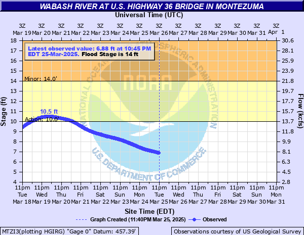
10' - Action
14' - Flood
24' - Moderate
31' - Major
Latest Observation
Updated: 12:45 AM EST 12/10/25
Status: No Flooding
Stage: 3.17 ft
Flow: 1.53 kcfs
Forecast
Forecast not available for this location.
| Time | Stage (ft) | Flow (kcfs) |
|---|---|---|
| 12:45 AM 12/10 | 3.17 | 1.53 |
| 12:30 AM 12/10 | 3.16 | 1.51 |
| 12:15 AM 12/10 | 3.18 | 1.54 |
| 12:00 AM 12/10 | 3.18 | 1.54 |
| 11:45 PM 12/9 | 3.17 | 1.53 |
| 11:30 PM 12/9 | 3.17 | 1.53 |
| 11:15 PM 12/9 | 3.17 | 1.53 |
| 11:00 PM 12/9 | 3.17 | 1.53 |
| 10:45 PM 12/9 | 3.17 | 1.53 |
| 10:30 PM 12/9 | 3.18 | 1.54 |
| 10:15 PM 12/9 | 3.16 | 1.51 |
| 10:00 PM 12/9 | 3.17 | 1.53 |
| 9:45 PM 12/9 | 3.16 | 1.51 |
| 9:30 PM 12/9 | 3.15 | 1.5 |
| 9:15 PM 12/9 | 3.15 | 1.5 |
| 9:00 PM 12/9 | 3.15 | 1.5 |
| 8:45 PM 12/9 | 3.16 | 1.51 |
| 8:30 PM 12/9 | 3.15 | 1.5 |
| 8:15 PM 12/9 | 3.16 | 1.51 |
| 8:00 PM 12/9 | 3.15 | 1.5 |
| 7:45 PM 12/9 | 3.16 | 1.51 |
| 7:30 PM 12/9 | 3.16 | 1.51 |
| 7:15 PM 12/9 | 3.16 | 1.51 |
| 7:00 PM 12/9 | 3.16 | 1.51 |
| 6:45 PM 12/9 | 3.16 | 1.51 |
| 6:30 PM 12/9 | 3.17 | 1.53 |
| 6:15 PM 12/9 | 3.17 | 1.53 |
| 6:00 PM 12/9 | 3.16 | 1.51 |
| 5:45 PM 12/9 | 3.17 | 1.53 |
| 5:30 PM 12/9 | 3.17 | 1.53 |
34' -
A record flood is in progress. Many evacuations in southern Montezuma are necessary. High water in southern Montezuma is 4 to 6 feet deep. Flood waters are at the edge of Hillsdale.
31' -
Major flooding is in progress. Extensive flooding in southern portion of Montezuma. The town of Mecca is cut into two parts by backwater from the Wabash River up Raccoon Creek.
30.5' -
A dangerous flood is in progress. Water backs in old Wabash-Erie canal and begins to flood southeast part of Montezuma. Residents on Water Street must evacuate. Streets near park begin to flood.
29' -
Extensive flooding is in progress. Sandbagging begins in the town of Montezuma.
28' -
Flooding affects residential and commercial property in lowest areas along Water Street and in southern Montezuma. County Road 725 south of Hillsdale begins to flood.
27' -
Extensive agricultural flooding is in progress. State Road 234 near Lodi may have as much as one foot of water on it. Several county roads extensively flooded in Vermillion...Fountain and Parke Counties.
26' -
Extensive lowland flooding in progress. Flood waters at the edge of SR 234 near Lodi just west of the bridge over the Wabash River. Several county roads in Fountain, Parke and Vermillion counties are flooded, some by more than 2 feet of water.
25.5' -
Extensive lowland flooding in progress. The eastern most part of Vermillion CR 600 S impassable just north of U.S. 36. The lowest portions of Wabash Road west of Parke CR 600 W begin to flood. Montezuma Public Access Site and low portions of Montezuma Park under water.
24' -
Floodwater is near the top of all agricultural levees. Some county roads are impassable. High water isolates a few rural residents. Basement flooding begins along Water Street in Montezuma. Medusa Aggregates Company Plant Number 9 begins to flood.
20' -
Park in southern Montezuma begins to flood. Higher bottomlands begin to flood. Water backs up most local tributaries. River water is at the top of some private levees. Lowest county roads begin to flood. Parke CR 75 W begins to flood.
18' -
Montezuma agricultural levee is overtopped. Fourteen hundred acres of low bottomlands flood.
14' -
Several hundred acres of bottomlands along the right bank from the mouth of Sugar Creek to northern edge of Montezuma begin to flood.
10' -
Water level prevents bottomlands protected by levees from draining.
| Date | Stage (ft) |
|---|---|
| Mar 27, 1913 | 34 |
| May 20, 1943 | 32.83 |
| Jun 15, 1958 | 32.06 |
| Jan 15, 2005 | 31.97 |
| Apr 21, 2013 | 31.9 |
| Feb 26, 1985 | 30.89 |
| Jul 12, 2003 | 30.43 |
| Dec 31, 2015 | 30.1 |
| Feb 9, 2008 | 29.99 |
| Jan 1, 1991 | 29.98 |
| Apr 15, 1994 | 29.81 |
| Feb 24, 2018 | 29.72 |
| Jan 7, 1950 | 29.57 |
| Feb 14, 1959 | 29.31 |
| Apr 29, 2011 | 29.25 |
| Jan 16, 1950 | 29.1 |
| Feb 1, 1969 | 28.99 |
| Feb 4, 1968 | 28.3 |
| May 14, 1933 | 28.19 |
| Jun 16, 1998 | 27.8 |
Data provided by the National Weather Service.