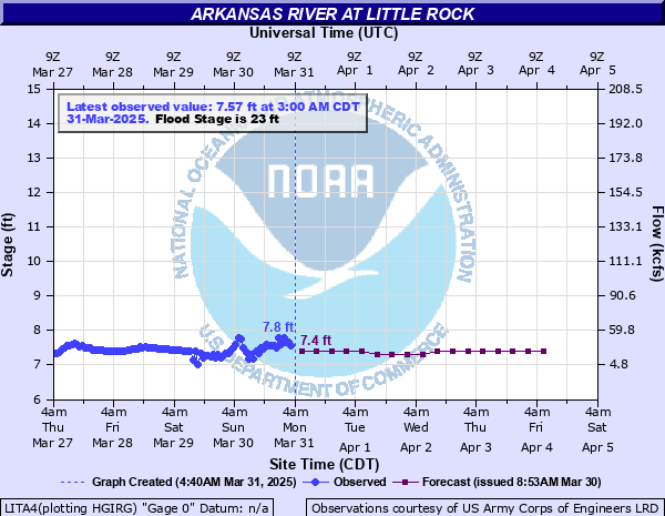
Arkansas River at Little Rock
Critical Stages
18' - Action
23' - Flood
25' - Moderate
27' - Major
Latest Observation
Updated: 7:00 PM CST 12/8/25
Status: No Flooding
Stage: 7.38 ft
Flow: 28.4 kcfs
Forecast
| Time | Stage (ft) | Flow (kcfs) |
|---|---|---|
| 12 AM 12/9 | 7.3 | 17.2 |
| 6 AM 12/9 | 7.3 | 17.2 |
| 12 PM 12/9 | 7.3 | 17.2 |
| 6 PM 12/9 | 7.3 | 17.2 |
| 12 AM 12/10 | 7.3 | 17.2 |
| 6 AM 12/10 | 7.3 | 17.2 |
| 12 PM 12/10 | 7.3 | 17.2 |
| 6 PM 12/10 | 7.3 | 17.2 |
| 12 AM 12/11 | 7.3 | 17.2 |
| 6 AM 12/11 | 7.3 | 17.2 |
| 12 PM 12/11 | 7.3 | 17.2 |
| 6 PM 12/11 | 7.3 | 17.2 |
| 12 AM 12/12 | 7.3 | 17.2 |
| 6 AM 12/12 | 7.3 | 17.2 |
| 12 PM 12/12 | 7.3 | 17.2 |
| 6 PM 12/12 | 7.3 | 17.2 |
| 12 AM 12/13 | 7.3 | 17.2 |
| 6 AM 12/13 | 7.3 | 17.2 |
| Time | Stage (ft) | Flow (kcfs) |
|---|---|---|
| 7:00 PM 12/8 | 7.38 | 28.4 |
| 6:00 PM 12/8 | 7.46 | 39.7 |
| 5:00 PM 12/8 | 7.29 | 16 |
| 4:00 PM 12/8 | 7.45 | 38.1 |
| 3:00 PM 12/8 | 7.44 | 36.5 |
| 2:00 PM 12/8 | 7.48 | 40.5 |
| 1:00 PM 12/8 | 7.47 | 40.1 |
| 12:00 PM 12/8 | 7.47 | 40.1 |
| 11:00 AM 12/8 | 7.48 | 40.5 |
| 10:00 AM 12/8 | 7.46 | 39.7 |
| 9:00 AM 12/8 | 7.45 | 38.1 |
| 8:00 AM 12/8 | 7.52 | 41.9 |
| 7:00 AM 12/8 | 7.37 | 27.2 |
| 6:00 AM 12/8 | 7.28 | 14.9 |
| 5:00 AM 12/8 | 7.37 | 27.2 |
| 4:00 AM 12/8 | 7.32 | 20 |
| 3:00 AM 12/8 | 7.4 | 30.9 |
| 2:00 AM 12/8 | 7.39 | 29.6 |
| 1:00 AM 12/8 | 7.41 | 32.2 |
| 12:00 AM 12/8 | 7.46 | 39.7 |
| 11:00 PM 12/7 | 7.45 | 38.1 |
| 10:00 PM 12/7 | 7.39 | 29.6 |
| 9:00 PM 12/7 | 7.23 | 9.74 |
| 8:00 PM 12/7 | 7.24 | 10.6 |
| 7:00 PM 12/7 | 7.22 | 8.95 |
| 6:00 PM 12/7 | 7.2 | 7.55 |
| 5:00 PM 12/7 | 7.2 | 7.55 |
| 4:00 PM 12/7 | 7.22 | 8.95 |
| 3:00 PM 12/7 | 7.19 | 6.94 |
| 2:00 PM 12/7 | 7.25 | 11.5 |
34.6' -
Flood of record, June 1833.
29' -
Baring Cross, Dixie, and Eastgate areas of North Little Rock are affected.
27' -
Shillcutt Bayou backwater flooding near 37th and 38th Streets west of State Highway 365. The County Farm Road area floods from backwater up the Little Maumelle River, several homes are impacted by access problems. The Arkansas River crested in May 8th 1990 at 27.7 feet.
26' -
Fourche Dam Pike and the community south of the road begins flooding from backwater up Fourche Creek. Burns Park golf course partially flooded from backwater up Shillcutt Bayou.
25' -
Areas on the North Little Rock side near White Oak and Shilcutt Bayous may be affected. Lower areas of Burns Park inundated by backwater.
24' -
Homes on Gribble Street in the Crockett Addition may be affected. Riverfront Park inside the levee flooded. Beck Road, County Farm Road, and Isabell Lane will become inundated.
23' -
Bankfull stage. Rebsamen Park Golf Course, Murray Park, and Riverfront Park partially flooded. Marine terminal and commercial facilities downstream of the Interstate 30 Bridge are affected.
21' -
North Little Rock must close sewer system flood gates to prevent backwater flooding up sewers. Water will be encroaching on homes in Two Rivers Park area along the Arkansas River.
18' -
Farmlands downstream of Little Rock are effected. The Bill Clark Presidential Park Wetlands are inundated. Portions of Burns Park, Cooks Landing, and the Arkansas River Trail on the North Little Rock side are inundated.
| Date | Stage (ft) |
|---|---|
| Jun 17, 1833 | 34.6 |
| Apr 20, 1927 | 33 |
| May 25, 1844 | 32.6 |
| Jun 13, 1877 | 30.5 |
| Apr 21, 1945 | 30.45 |
| May 27, 1943 | 30.05 |
| Jun 5, 2019 | 29.71 |
| Aug 1, 1866 | 29.7 |
| Apr 17, 1844 | 29.6 |
| Mar 22, 1858 | 29.6 |
| Jul 7, 1876 | 29.3 |
| May 1, 1826 | 29.2 |
| May 6, 1840 | 29.1 |
| Jun 5, 1823 | 28.5 |
| May 16, 1943 | 28.34 |
| Mar 1, 1867 | 28.3 |
| Jun 22, 1935 | 28.18 |
| Jun 23, 1935 | 28.18 |
| Apr 21, 1945 | 28.13 |
| Feb 23, 1857 | 28.1 |
Data provided by the National Weather Service.