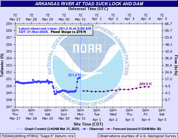
Arkansas River at Toad Suck Lock and Dam
Critical Stages
273' - Action
275' - Flood
278' - Moderate
280' - Major
Latest Observation
Updated: 8:00 PM CST 12/8/25
Status: No Flooding
Stage: 250.5 ft
Flow: 13.1 kcfs
Forecast
| Time | Stage (ft) | Flow (kcfs) |
|---|---|---|
| 12 AM 12/9 | 249.6 | 6.69 |
| 6 AM 12/9 | 249.6 | 6.69 |
| 12 PM 12/9 | 249.5 | 6.1 |
| 6 PM 12/9 | 249.4 | 5.27 |
| 12 AM 12/10 | 249.3 | 4.55 |
| 6 AM 12/10 | 249.3 | 4.55 |
| 12 PM 12/10 | 249.3 | 4.55 |
| 6 PM 12/10 | 249.3 | 4.55 |
| 12 AM 12/11 | 249.3 | 4.55 |
| 6 AM 12/11 | 249.3 | 4.55 |
| 12 PM 12/11 | 249.3 | 4.55 |
| 6 PM 12/11 | 249.4 | 5.27 |
| 12 AM 12/12 | 249.4 | 5.27 |
| 6 AM 12/12 | 249.5 | 6.1 |
| 12 PM 12/12 | 249.5 | 6.1 |
| 6 PM 12/12 | 249.5 | 6.1 |
| 12 AM 12/13 | 249.5 | 6.1 |
| 6 AM 12/13 | 249.5 | 6.1 |
| Time | Stage (ft) | Flow (kcfs) |
|---|---|---|
| 8:00 PM 12/8 | 250.5 | 13.1 |
| 7:00 PM 12/8 | 250.49 | 13 |
| 6:00 PM 12/8 | 250.51 | 13.1 |
| 5:00 PM 12/8 | 250.56 | 13.6 |
| 4:00 PM 12/8 | 250.68 | 14.6 |
| 3:00 PM 12/8 | 250.87 | 16 |
| 2:00 PM 12/8 | 251.21 | 18.8 |
| 1:00 PM 12/8 | 251.21 | 18.8 |
| 12:00 PM 12/8 | 251.2 | 18.7 |
| 11:00 AM 12/8 | 251.19 | 18.6 |
| 10:00 AM 12/8 | 251.19 | 18.6 |
| 9:00 AM 12/8 | 251.17 | 18.4 |
| 8:00 AM 12/8 | 251.11 | 17.9 |
| 7:00 AM 12/8 | 251.04 | 17.3 |
| 6:00 AM 12/8 | 250.93 | 16.4 |
| 5:00 AM 12/8 | 250.74 | 15 |
| 4:00 AM 12/8 | 250.24 | 11 |
| 3:00 AM 12/8 | 250.18 | 10.6 |
| 2:00 AM 12/8 | 249.97 | 9.22 |
| 1:00 AM 12/8 | 249.45 | 5.67 |
| 12:00 AM 12/8 | 249.2 | 3.93 |
| 11:00 PM 12/7 | 249.3 | 4.55 |
| 10:00 PM 12/7 | 249.32 | 4.68 |
| 9:00 PM 12/7 | 249.32 | 4.68 |
| 8:00 PM 12/7 | 249.24 | 4.16 |
| 7:00 PM 12/7 | 248.82 | 2.24 |
| 6:00 PM 12/7 | 248.75 | 2.02 |
| 5:00 PM 12/7 | 248.76 | 2.06 |
| 4:00 PM 12/7 | 248.76 | 2.06 |
| 3:00 PM 12/7 | 248.76 | 2.06 |
285.4' -
Highest stage since completion of the McClellan Kerr Arkansas River Navigation System in 1969. Surpassed the 1990 stage by 2.4 feet.
283' -
Until 2019, the stage of 282.9 in May 1990 was highest since completion of the McClellan Kerr Arkansas River Navigation System in 1969. Levees in Toad Suck community overtopped. Toad Suck store affected. Perry County Levee District Number One was overtopped.
282' -
State Highway 216 south of Perryville, State Highway 10 west of Perry, and State Highway 113 south of Bigalow are flooded from backwaters of the Fourche La Fave Fiver. State Highway 60 west of Toad Suck closed. County roads in Mayflower area are flooded. Flood crested at 282.57 in January 2016.
280' -
Portions of the Treasure Hills Subdivision north of Conway may be flooded from backwaters of East Cadron Creek. Several roads west of Mayflower including Jones Lane, Easterwood Point, Sand Gap, Raney Pavillion, and Windsong Way will be inundated. Flood crested at 280.45 in June 2015.
279' -
More farmland in Perry County flooded from backwaters up the Fourche La Fave River. Also, backwater up Cadron Creek may close State Highway 25 west of Conway. Parking lot of the Lock and Dam flooded and water over lock walls.
278' -
Lollie Community affected. Additional farmlands in Faulkner County flooded by backwater up Palarm Creek and Tupelo Bayou.
277' -
Additional residences in Toad Suck Community are affected along the right descending bank near State Highway 60 Bridge. Extensive farmlands along the river in Perry, Conway, and Faulkner counties inundated.
275' -
Mobile homes in the Toad Suck Community on the right descending bank near the State Highway 60 Bridge are threatened.
| Date | Stage (ft) |
|---|---|
| Jun 4, 2019 | 285.4 |
| May 7, 1990 | 282.9 |
| Jan 1, 2016 | 282.57 |
| Jun 3, 2015 | 280.45 |
| Dec 4, 1982 | 280.2 |
| Apr 24, 1973 | 279.7 |
| Oct 12, 1986 | 279.5 |
| Apr 28, 2011 | 278.9 |
| Mar 21, 2008 | 278.8 |
| Nov 26, 1974 | 278.5 |
| May 13, 2015 | 278.13 |
| Jun 17, 1995 | 277.08 |
| Apr 12, 2008 | 276.4 |
| May 13, 1993 | 276 |
| Apr 7, 2025 | 275.14 |
| Apr 25, 2004 | 275.03 |
| Dec 17, 1992 | 274.9 |
| Apr 10, 2002 | 272.91 |
| Dec 18, 2001 | 272.38 |
| Nov 6, 1994 | 270.82 |
Data provided by the National Weather Service.