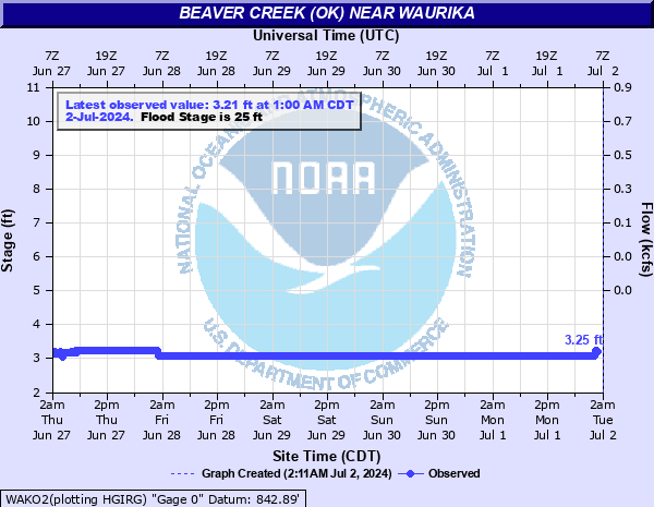
Beaver Creek (OK) at Waurika
Critical Stages
20' - Action
25' - Flood
27.5' - Moderate
31' - Major
Latest Observation
Updated: 7:00 PM CST 12/6/25
Status: No Flooding
Stage: 3.08 ft
Flow: -999 kcfs
Forecast
Forecast not available for this location.
| Time | Stage (ft) | Flow (kcfs) |
|---|---|---|
| 7:00 PM 12/6 | 3.08 | -999 |
| 6:45 PM 12/6 | 3.08 | -999 |
| 6:30 PM 12/6 | 3.08 | -999 |
| 6:15 PM 12/6 | 3.08 | -999 |
| 6:00 PM 12/6 | 3.08 | -999 |
| 5:45 PM 12/6 | 3.08 | -999 |
| 5:30 PM 12/6 | 3.08 | -999 |
| 5:15 PM 12/6 | 3.08 | -999 |
| 5:00 PM 12/6 | 3.08 | -999 |
| 4:45 PM 12/6 | 3.08 | -999 |
| 4:30 PM 12/6 | 3.08 | -999 |
| 4:15 PM 12/6 | 3.08 | -999 |
| 4:00 PM 12/6 | 3.08 | -999 |
| 3:45 PM 12/6 | 3.08 | -999 |
| 3:30 PM 12/6 | 3.08 | -999 |
| 3:15 PM 12/6 | 3.08 | -999 |
| 3:00 PM 12/6 | 3.08 | -999 |
| 2:45 PM 12/6 | 3.08 | -999 |
| 2:30 PM 12/6 | 3.08 | -999 |
| 2:15 PM 12/6 | 3.08 | -999 |
| 2:00 PM 12/6 | 3.08 | -999 |
| 1:45 PM 12/6 | 3.08 | -999 |
| 1:30 PM 12/6 | 3.08 | -999 |
| 1:15 PM 12/6 | 3.08 | -999 |
| 1:00 PM 12/6 | 3.08 | -999 |
| 12:45 PM 12/6 | 3.09 | -999 |
| 12:30 PM 12/6 | 3.08 | -999 |
| 12:15 PM 12/6 | 3.08 | -999 |
| 12:00 PM 12/6 | 3.08 | -999 |
| 11:45 AM 12/6 | 3.08 | -999 |
30' -
Flooding of agricultural lands and some local roads occurs in Jefferson County in south central Oklahoma... and extends from near Waurika to near Sugden... southward to the confluence of Beaver Creek with the Red River. Flood depths up to 5 feet occur... and are accompanied by dangerous currents.
27' -
Flooding of agricultural lands and local highways in Jefferson County in south central Oklahoma extends from near Waurika to near Sugden... southward to the confluence of Beaver Creek with the Red River.
26' -
Flooding of agricultural lands and local highways in Jefferson County in south central Oklahoma extends from near Waurika to near Sugden... southward to the confluence of Beaver Creek with the Red River.
25' -
Flooding of agricultural lands along the creek in Jefferson County in south central Oklahoma entends from near Waurika to near Sugden... southward to the confluence of Beaver Creek with the Red River.
24' -
Flooding of lowlands along the creek in Jefferson County in south central Oklahoma extends from near Waurika to near Sugden... southward to the confluence of Beaver Creek with the Red River.
23' -
Flooding of lowlands along the creek in Jefferson County in south central Oklahoma extends from near Waurika to near Sugden... southward to the confluence of Beaver Creek with the Red River.
22' -
Flooding of lowlands along the creek in Jefferson County extends from near Waurika to near Sugden...southward to the confluence of Beaver Creek with the Red River.
21' -
Shallow flooding of lowlands along the creek in Jefferson County extends from near Waurika to near Sugden...southward to the confluence of Beaver Creek with the Red River.
| Date | Stage (ft) |
|---|---|
| May 1, 2025 | 32.65 |
| Jun 27, 2007 | 31.11 |
| Jun 29, 2007 | 30.92 |
| Mar 31, 2007 | 30.26 |
| Sep 22, 2018 | 27.18 |
| May 25, 2007 | 25.69 |
| Jun 13, 2016 | 24.78 |
| May 20, 2015 | 24.37 |
| May 2, 2025 | 21.7 |
| May 6, 2025 | 21.67 |
| May 7, 2025 | 20.81 |
| Jun 19, 2015 | 20.65 |
| Apr 20, 2016 | 20.28 |
| Feb 16, 2001 | 19.88 |
Data provided by the National Weather Service.