« Back to Lumber Bridge Rivers
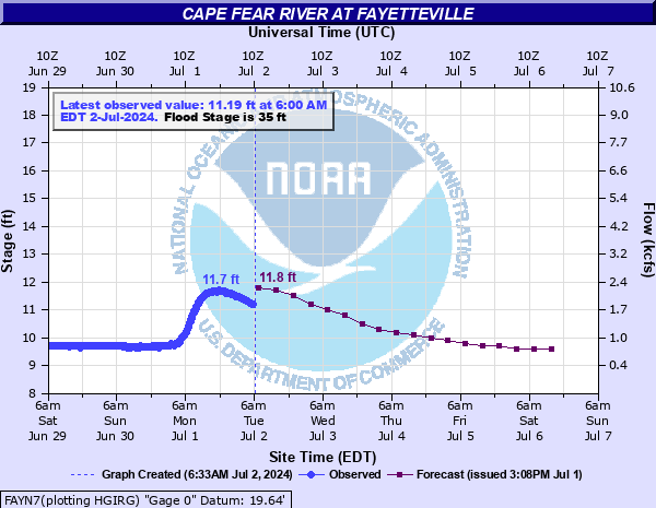
Cape Fear River at Fayetteville
Critical Stages
35' - Action
35' - Flood
48' - Moderate
58' - Major
Latest Observation
Updated: 12:00 PM EST 12/13/25
Status: No Flooding
Stage: 9.96 ft
Flow: 0.928 kcfs
Forecast
| Time | Stage (ft) | Flow (kcfs) |
|---|---|---|
| 7 PM 12/13 | 9.9 | 0.889 |
| 1 AM 12/14 | 9.8 | 0.828 |
| 7 AM 12/14 | 9.8 | 0.828 |
| 1 PM 12/14 | 9.9 | 0.889 |
| 7 PM 12/14 | 9.9 | 0.889 |
| 1 AM 12/15 | 9.9 | 0.889 |
| 7 AM 12/15 | 9.8 | 0.828 |
| 1 PM 12/15 | 9.8 | 0.828 |
| 7 PM 12/15 | 9.8 | 0.828 |
| 1 AM 12/16 | 9.8 | 0.828 |
| 7 AM 12/16 | 9.7 | 0.77 |
| 1 PM 12/16 | 9.7 | 0.77 |
| 7 PM 12/16 | 9.7 | 0.77 |
| 1 AM 12/17 | 9.7 | 0.77 |
| 7 AM 12/17 | 9.7 | 0.77 |
| 1 PM 12/17 | 9.6 | 0.716 |
| 7 PM 12/17 | 9.6 | 0.716 |
| 1 AM 12/18 | 9.6 | 0.716 |
| 7 AM 12/18 | 9.6 | 0.716 |
| Time | Stage (ft) | Flow (kcfs) |
|---|---|---|
| 12:00 PM 12/13 | 9.96 | 0.928 |
| 11:45 AM 12/13 | 9.99 | 0.947 |
| 11:30 AM 12/13 | 9.99 | 0.947 |
| 11:15 AM 12/13 | 9.99 | 0.947 |
| 11:00 AM 12/13 | 9.98 | 0.941 |
| 10:45 AM 12/13 | 9.99 | 0.947 |
| 10:30 AM 12/13 | 9.99 | 0.947 |
| 10:15 AM 12/13 | 9.99 | 0.947 |
| 10:00 AM 12/13 | 9.99 | 0.947 |
| 9:45 AM 12/13 | 10 | 0.954 |
| 9:30 AM 12/13 | 10 | 0.954 |
| 9:15 AM 12/13 | 10 | 0.954 |
| 9:00 AM 12/13 | 10 | 0.954 |
| 8:45 AM 12/13 | 10 | 0.954 |
| 8:30 AM 12/13 | 10.01 | 0.961 |
| 8:15 AM 12/13 | 10.01 | 0.961 |
| 8:00 AM 12/13 | 10.01 | 0.961 |
| 7:45 AM 12/13 | 10.01 | 0.961 |
| 7:30 AM 12/13 | 10.01 | 0.961 |
| 7:15 AM 12/13 | 10.01 | 0.961 |
| 7:00 AM 12/13 | 10.01 | 0.961 |
| 6:45 AM 12/13 | 10.01 | 0.961 |
| 6:30 AM 12/13 | 10.01 | 0.961 |
| 6:15 AM 12/13 | 10.01 | 0.961 |
| 6:00 AM 12/13 | 10.01 | 0.961 |
| 5:45 AM 12/13 | 10.01 | 0.961 |
| 5:30 AM 12/13 | 10.01 | 0.961 |
| 5:15 AM 12/13 | 9.98 | 0.941 |
| 5:00 AM 12/13 | 10.01 | 0.961 |
| 4:45 AM 12/13 | 10.02 | 0.967 |
72' -
The river will spread to a width of up to 2 miles, with several thousand structures threatened.
69' -
The city of Fayetteville begins to flood and up to 150 homes would be threatened. At this stage the river widens to a mile or more in some places.
64' -
Several thousand acres of land and hundreds of structures on both sides of the river will be flooded. Water reaches the under-clearance of the downstream railroad trestle. Downstream about 2 miles, the river will spread to a width of approximately 1 mile.
60' -
Water begins to bypass the left end of the NC-24 bridge for several hundred yards. Two miles downstream, the left bank widens to 1000 feet and to a depth of several feet. Cumberland Tractor lot begins to flood.
59' -
The river will reach the bottom of the railroad bridge just downstream of the Person Street bridge. Debris will get stuck against the railroad bridge.
58' -
Major flooding begins. The right bank widens to several hundred feet and there is significant flooding of downstream structures.
50' -
There is significant overflow on the left bank about 2 miles downstream of the NC24 bridge.
48' -
Moderate flooding begins. The upper parking areas at Riverside Bait and Tackle are flooded. There is significant lowland flooding downstream.
35' -
Minor flooding begins. The boat ramp and lower parking lot at Riverside Bait and Tackle off Person Street are flooded. The stage and lower seating area at the Cape Fear Amphitheater are flooded.
32' -
Action Stage. Banks of the Cape Fear River begin to overflow.
| Date | Stage (ft) |
|---|---|
| Sep 21, 1945 | 68.9 |
| Aug 29, 1908 | 68 |
| Oct 4, 1929 | 65.3 |
| Sep 22, 1928 | 64.7 |
| Sep 19, 2018 | 61.58 |
| Oct 10, 2016 | 58.94 |
| May 24, 1901 | 58.5 |
| Jan 12, 1895 | 58 |
| Sep 8, 1928 | 55.5 |
| Apr 8, 1936 | 55.4 |
| Mar 1, 1888 | 52.3 |
| Jul 24, 1919 | 52 |
| Sep 24, 1945 | 48.3 |
| Jan 24, 1954 | 47.1 |
| Sep 2, 1952 | 47 |
| Sep 7, 1996 | 46.17 |
| Jul 17, 1975 | 45.3 |
| Jul 29, 1965 | 44.2 |
| Nov 16, 2018 | 43.49 |
| Apr 12, 2003 | 43.01 |
Data provided by the National Weather Service.