St. Louis River at Scanlon
Critical Stages
9.5' - Action
10.5' - Flood
11' - Moderate
13' - Major
Latest Observation
Updated: 4:30 PM CST 12/15/25
Status: No Flooding
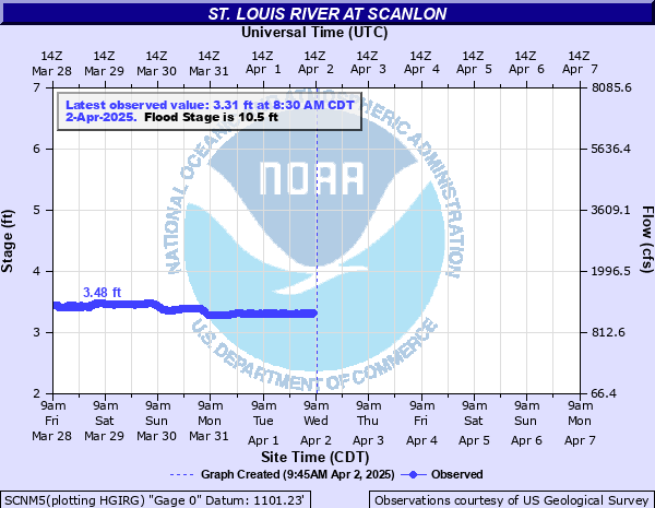
Stage: 2.97 ft
Flow: 0.784 kcfs
Forecast
Forecast not available for this location.
| Time | Stage (ft) | Flow (kcfs) |
|---|---|---|
| 4:30 PM 12/15 | 2.97 | 0.784 |
| 4:15 PM 12/15 | 2.97 | 0.784 |
| 4:00 PM 12/15 | 2.97 | 0.784 |
| 3:45 PM 12/15 | 2.97 | 0.784 |
| 3:30 PM 12/15 | 2.97 | 0.784 |
| 3:15 PM 12/15 | 2.98 | 0.794 |
| 3:00 PM 12/15 | 2.98 | 0.794 |
| 2:45 PM 12/15 | 2.98 | 0.794 |
| 2:30 PM 12/15 | 2.98 | 0.794 |
| 2:15 PM 12/15 | 2.98 | 0.794 |
| 2:00 PM 12/15 | 2.99 | 0.803 |
| 1:45 PM 12/15 | 2.99 | 0.803 |
| 1:30 PM 12/15 | 2.99 | 0.803 |
| 1:15 PM 12/15 | 2.99 | 0.803 |
| 1:00 PM 12/15 | 2.99 | 0.803 |
| 12:45 PM 12/15 | 3 | 0.813 |
| 12:30 PM 12/15 | 3 | 0.813 |
| 12:15 PM 12/15 | 3 | 0.813 |
| 12:00 PM 12/15 | 3 | 0.813 |
| 11:45 AM 12/15 | 3 | 0.813 |
| 11:30 AM 12/15 | 3 | 0.813 |
| 11:15 AM 12/15 | 3.01 | 0.822 |
| 11:00 AM 12/15 | 3.01 | 0.822 |
| 10:45 AM 12/15 | 3.01 | 0.822 |
| 10:30 AM 12/15 | 3.01 | 0.822 |
| 10:15 AM 12/15 | 3.01 | 0.822 |
| 10:00 AM 12/15 | 3.02 | 0.832 |
| 9:45 AM 12/15 | 3.02 | 0.832 |
| 9:30 AM 12/15 | 3.02 | 0.832 |
| 9:15 AM 12/15 | 3.02 | 0.832 |
16' -
Wide spread flooding for areas adjacent to the St. Louis River.
14.5' -
Flood waters enter buildings near River Gate Road if unprotected.
13' -
Water encroaches buildings near River Gate Rd.
11' -
Water encroaches on the lowest sites at the Fond du Lac Campground and Chambers Grove Park.
10.5' -
Minor flooding occurs of low areas adjacent to the river near Cloquet city park and near Scanlon.
| Date | Stage (ft) |
|---|---|
| Jun 21, 2012 | 16.62 |
| May 9, 1950 | 15.8 |
| Apr 23, 1979 | 13.93 |
| Apr 16, 2023 | 13.52 |
| Oct 13, 1973 | 12.76 |
| Apr 19, 1996 | 12.62 |
| Apr 15, 1969 | 12.6 |
| Jul 10, 1999 | 12.45 |
| Apr 18, 1982 | 12.2 |
| Apr 25, 2001 | 12.19 |
| Apr 23, 1975 | 12.09 |
| Apr 18, 1971 | 12.07 |
| Apr 21, 1972 | 11.99 |
| Jun 25, 2002 | 11.87 |
| Apr 16, 1954 | 11.78 |
| Apr 20, 1965 | 11.57 |
| May 14, 2022 | 11.36 |
| Apr 8, 1997 | 11.2 |
| Jun 24, 2024 | 11.06 |
| Apr 30, 1986 | 10.99 |
Data provided by the National Weather Service.