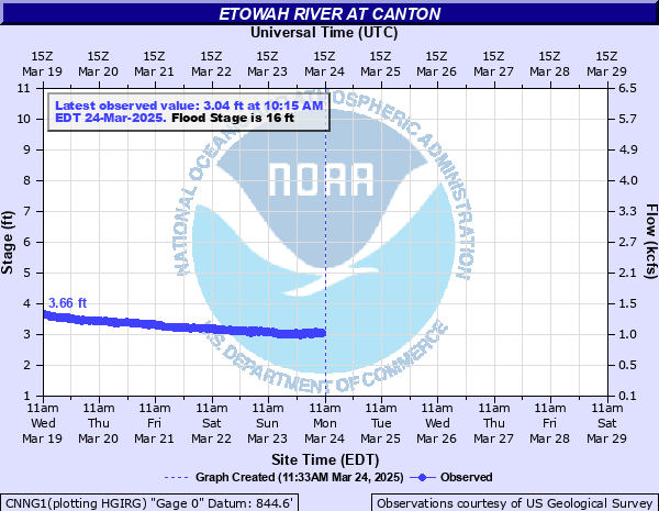
Etowah River at Canton
Critical Stages
15' - Action
16' - Flood
22' - Moderate
26' - Major
Latest Observation
Updated: 1:15 AM EST 12/5/25
Status: No Flooding
Stage: 2.39 ft
Flow: 0.677 kcfs
Forecast
Forecast not available for this location.
| Time | Stage (ft) | Flow (kcfs) |
|---|---|---|
| 1:15 AM 12/5 | 2.39 | 0.677 |
| 1:00 AM 12/5 | 2.38 | 0.672 |
| 12:45 AM 12/5 | 2.37 | 0.668 |
| 12:30 AM 12/5 | 2.33 | 0.649 |
| 12:15 AM 12/5 | 2.33 | 0.649 |
| 12:00 AM 12/5 | 2.31 | 0.64 |
| 11:45 PM 12/4 | 2.29 | 0.63 |
| 11:30 PM 12/4 | 2.25 | 0.612 |
| 11:15 PM 12/4 | 2.27 | 0.621 |
| 11:00 PM 12/4 | 2.28 | 0.626 |
| 10:45 PM 12/4 | 2.27 | 0.621 |
| 10:30 PM 12/4 | 2.26 | 0.617 |
| 10:15 PM 12/4 | 2.26 | 0.617 |
| 10:00 PM 12/4 | 2.27 | 0.621 |
| 9:45 PM 12/4 | 2.28 | 0.626 |
| 9:30 PM 12/4 | 2.28 | 0.626 |
| 9:15 PM 12/4 | 2.28 | 0.626 |
| 9:00 PM 12/4 | 2.29 | 0.63 |
| 8:45 PM 12/4 | 2.29 | 0.63 |
| 8:30 PM 12/4 | 2.29 | 0.63 |
| 8:15 PM 12/4 | 2.29 | 0.63 |
| 8:00 PM 12/4 | 2.3 | 0.635 |
| 7:45 PM 12/4 | 2.3 | 0.635 |
| 7:30 PM 12/4 | 2.3 | 0.635 |
| 7:15 PM 12/4 | 2.3 | 0.635 |
| 7:00 PM 12/4 | 2.31 | 0.64 |
| 6:45 PM 12/4 | 2.31 | 0.64 |
| 6:30 PM 12/4 | 2.31 | 0.64 |
| 6:15 PM 12/4 | 2.31 | 0.64 |
| 6:00 PM 12/4 | 2.31 | 0.64 |
31' -
A catastropic flood never seen before inundates portions of the Canton infrastructure. The water treatment plant at Boling Park will be flooded. Some major and numerous primary roads...industrial buildings...businesses and a few homes will be flooded with 1 to 7 feet of water. The Georgia Power substation and the USGS gage house near the Waleska Street bridge and the railroad tracks in the city will be flooded with several feet of water. Water reaches the USGS gage instrument shelf causing a loss of data.
30' -
Flooding never seen before causes a catastropic flood which inundates portions of the infrastructure of Canton. The water treatment plant near Boling Park will be flooded. Some major and numerous primary roads...industrial buildings and businesses will be flooded with 1 to 5 feet of water. The Georgia Power substation and the USGS gage house near the Waleska Street bridge and the railroad tracks in the city will be flooded with a few feet of water. There may be a data transmission loss at the gage.
28' -
Flooding never seen before inundates all parks near the river in Canton with 7 to 12 feet of water. The flood waters up to 9 feet deep surround the water treatment plant near Boling Park. Numerous primary roads...industrial buildings and businesses including River Place Shopping Center will be flooded with 1 to 3 feet of water. The Georgia Power substation and the USGS gage house near the Waleska Street bridge and the railroad tracks in the city will be flooded.
27' -
Record flooding inundates all recreational areas and parks near the river in Canton with 6 to 11 feet of water. The flood waters up to 8 feet deep surround the water treatment plant near Boling Park. Several primary roads...industrial buildings and numerous businesses including River Place Shopping Center will be flooded with 1 to 2 feet of water. The rock foundation of a Georgia Power substation near the Waleska Street bridge floods. The railroad tracks in the city begin to flood.
26' -
Major flooding begins. Widespread inundation flooding affects all recreational areas and parks near the river in Canton with 5 to 10 feet of water. The flood waters up to 7 feet deep will surround the water treatment plant near Boling Park. Several primary roads...industrial buildings and numerous businesses including River Place Shopping Center will be flooded. The Georgia Power substation near the Waleska Street bridge will begin to flood. Flood waters will approach the railroad tracks in the city.
25' -
Significant flooding expands in Canton. Boling Park behind the Cherokee County High School...the Cherokee County Fairgrounds and the Etowah River Greenway at Heritage Park are flooded with up to 9 feet of water. The flood waters will be up to 6 feet deep around the water treatment plant near Boling Park. Portions of the Mill Industrial Way road are under 8 feet of water. Several buildings near the Canton Textile Plant are flooded with 2 feet of water and buildings along Railroad Street begin to flood.
23' -
Significant flooding occurs along the river in Canton. Boling Park behind the Cherokee County High School...the Cherokee County Fairgrounds and the Etowah River Greenway at Heritage Park are flooded with up to 7 feet of water. The flood waters will be up to 4 feet deep around the water treatment plant near Boling Park. Portions of the Mill Industrial Way road are under 6 feet of water. Several buildings near the Canton Textile Plant 1 begin to flood.
22' -
Moderate flooding begins upstream and downstream from the Walaska Street bridge. Recreation areas such as Boling Park behind the Cherokee County High School...the Cherokee County Fairgrounds and the Etowah River Greenway at Heritage Park will be flooded with up to 6 feet of water. The flood waters will be up to 3 feet deep around the base of the water treatment plant near Boling Park. Portions of the Mill Industrial Way road will be under 5 feet of water. Old Canton Textile Plant Number 1 begins to flood.
20' -
Minor flooding expands further into the woodlands and fields upstream and downstream from the gage by the Walaska Street bridge. Large portions of recreational areas such as Boling Park behind the Cherokee County High School...the Cherokee County Fairgrounds and the Etowah River Greenway at Heritage Park will be flooded with up to 4 feet of water. The flood waters will reach the base of the water treatment plant near Boling Park. Portions of the Mill Industrial Way road will be under 3 feet of water.
18' -
Minor flooding expands into the woodlands and fields along the river upstream and downstream from the gage by the Walaska Street bridge. Large portions of recreational areas such as Boling Park behind the Cherokee County High School...the Cherokee County Fairgrounds and the Etowah River Greenway at Heritage Park will be flooded with up to two feet of water. The parking lot at Boling Park will be under one foot of water. Portions of the Mill Industrial Way Road begin to flood.
17' -
Minor flooding continues in the woodlands and fields along the river upstream and downstream from the gage by the Walaska Street bridge. Portions of recreational areas such as Boling Park behind the Cherokee County High School...the Cherokee County Fairgrounds and the Etowah River Greenway at Heritage Park will be flooded with up to one foot of water. The parking lot at Boling Park will begin to flood.
16' -
Flood Stage is reached. Minor flooding begins in the woodlands and fields along the river upstream and downstream from the gage by the Walaska Street bridge. Low lying portions of recreational areas such as Boling Park behind the Cherokee County High School...the Cherokee County Fairgrounds and the Etowah River Greenway at Heritage Park will begin to flood.
15' -
Bankfull conditions occur in the woodlands and fields along the river in the Canton area. Some flooding will begin in low lying and poor drainage areas.
| Date | Stage (ft) |
|---|---|
| Jan 7, 1946 | 26.7 |
| Dec 10, 1919 | 26.3 |
| Jul 10, 1916 | 25.9 |
| Mar 17, 1990 | 25.33 |
| Dec 12, 1932 | 25.2 |
| Dec 22, 1918 | 25.2 |
| Jan 1, 1892 | 25 |
| Mar 26, 1964 | 24.7 |
| Feb 3, 1982 | 24.45 |
| Apr 30, 1963 | 24.38 |
| Oct 2, 1989 | 24.2 |
| Dec 13, 1961 | 23.8 |
| Apr 14, 1979 | 23.57 |
| Mar 31, 1977 | 23.56 |
| Mar 23, 1952 | 23.3 |
| Feb 9, 1921 | 23.2 |
| Feb 26, 1961 | 23.2 |
| Feb 5, 1936 | 23.2 |
| Mar 31, 1976 | 22.76 |
| Jan 28, 1996 | 22.72 |
Data provided by the National Weather Service.