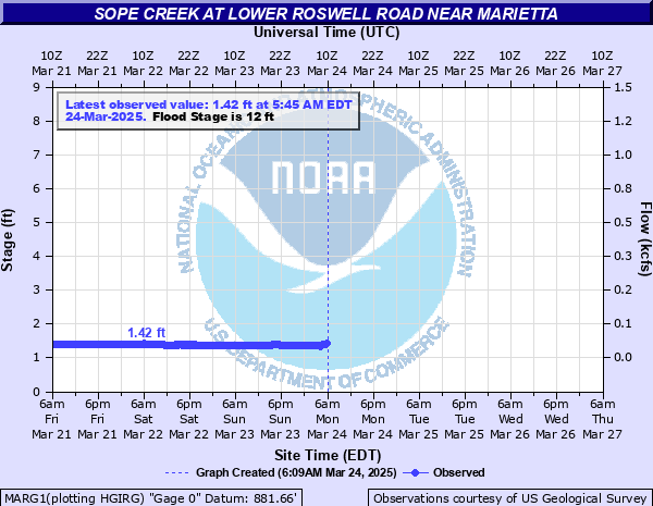
Sope Creek at Lower Roswell Road near Marietta
Critical Stages
10' - Action
12' - Flood
15' - Moderate
18' - Major
Latest Observation
Updated: 1:45 AM EST 12/5/25
Status: No Flooding
Stage: 1.52 ft
Flow: 0.0352 kcfs
Forecast
Forecast not available for this location.
| Time | Stage (ft) | Flow (kcfs) |
|---|---|---|
| 1:45 AM 12/5 | 1.52 | 0.0352 |
| 1:30 AM 12/5 | 1.46 | 0.0319 |
| 1:15 AM 12/5 | 1.39 | 0.0284 |
| 1:00 AM 12/5 | 1.32 | 0.0241 |
| 12:45 AM 12/5 | 1.25 | 0.0209 |
| 12:30 AM 12/5 | 1.21 | 0.0194 |
| 12:15 AM 12/5 | 1.18 | 0.0182 |
| 12:00 AM 12/5 | 1.18 | 0.0182 |
| 11:45 PM 12/4 | 1.18 | 0.0182 |
| 11:30 PM 12/4 | 1.15 | 0.0169 |
| 11:15 PM 12/4 | 1.14 | 0.0165 |
| 11:00 PM 12/4 | 1.12 | 0.0158 |
| 10:45 PM 12/4 | 1.11 | 0.0154 |
| 10:30 PM 12/4 | 1.08 | 0.0141 |
| 10:15 PM 12/4 | 1.11 | 0.0154 |
| 10:00 PM 12/4 | 1.11 | 0.0154 |
| 9:45 PM 12/4 | 1.11 | 0.0154 |
| 9:30 PM 12/4 | 1.11 | 0.0154 |
| 9:15 PM 12/4 | 1.11 | 0.0154 |
| 9:00 PM 12/4 | 1.11 | 0.0154 |
| 8:45 PM 12/4 | 1.11 | 0.0154 |
| 8:30 PM 12/4 | 1.11 | 0.0154 |
| 8:15 PM 12/4 | 1.11 | 0.0154 |
| 8:00 PM 12/4 | 1.11 | 0.0154 |
| 7:45 PM 12/4 | 1.11 | 0.0154 |
| 7:30 PM 12/4 | 1.11 | 0.0154 |
| 7:15 PM 12/4 | 1.11 | 0.0154 |
| 7:00 PM 12/4 | 1.11 | 0.0154 |
| 6:45 PM 12/4 | 1.11 | 0.0154 |
| 6:30 PM 12/4 | 1.11 | 0.0154 |
23' -
Flooding never seen before will cause widespread innundation of yards and extensive damage to homes upstream and downstream from Lower Roswell Road. Portions of Indian Hills Court...Lindsey Road...Cherokee Place...Pheasant Drive...Pheasant Cirle and most of the Indian Hills Golf Course will be flooded. The water will reach the bottom of the Paper Mill Road bridge and will be around 6 feet over the Columns Drive bridge. Many homes and townhouses near the creek will be flooded.
21' -
Record flooding occurs with widespread innundation of yards and damage to homes upstream and downstream from Lower Roswell Road. Portions of Indian Hills Court...Lindsey Road...Cherokee Place...Pheasant Drive and Pheasant Cirle will be flooded. Large portions of the Indian Hills Golf Course will be completely flooded. The water will be around 4 feet deep on Columns Drive near the bridge..and many homes and townhouses near the creek will be flooded.
19' -
Major flooding continues with widespread innundation of yards upstream and downstream from Lower Roswell Road. Many homes on low portions of Indian Hills Court...Cherokee Place...Pheasant Drive and Pheasant Cirle will be flooded. Large portions of the Indian Hills Golf Course will be flooded with up to 9 feet of water. The water will be around 2 feet deep on Columns Drive near the bridge..and water level will reach the foundations of some homes near the creek.
18' -
Major flooding begins with widespread innundation of residential yards upstream and downstream from the gage on Lower Roswell Road. Several homes on the lower portions of Indian Hills Court...Cherokee Place...Pheasant Drive and Pheasant Cirle will be flooded. Large portions of the Indian Hills Golf Course will be flooded with 1 to 8 feet of water. The water will be around one foot deep on Columns Drive near the bridge as the creek enters the Chattahoochee River.
17' -
Significant flooding expands further into residential yards upstream and downstream from the gage on Lower Roswell Road. Several homes on the lower portions of Cherokee Place...Pheasant Drive and Pheasant Cirle will have water in crawl spaces or at their foundations. Large portions of the Indian Hills Golf Course will be flooded with 1 to 7 feet of water. The water will begin to flow over Columns Drive near the bridge as the creek enters the Chattahoochee River.
15' -
Moderate flooding begins and expands further into residential yards upstream and downstream from the gage on Lower Roswell Road. This includes homes on the lower portions of Cherokee Place...Pheasant Drive and Pheasant Cirle. The water will reach foundations and enter crawl spaces of a few homes. Large portions of the Indian Hills Golf Course near the creek will be flooded with 1 to 5 feet of water. The water reaches the bottom of Columns Drive bridge as the creek flows into the Chattahoochee River.
14' -
Minor flooding continues and expands further into residential yards upstream and downstream from the gage on Lower Roswell Road. This includes homes on the lower portions of Cherokee Place...Pheasant Drive and Pheasant Cirle. The water level will begin to reach the foundations and crawl spaces of a few homes. Large portions of the Indian Hills Golf Course near the creek will be flooded with 1 to 4 feet of water.
12' -
Flood Stage is reached. Minor flooding of residential yards occurs upstream and downstream from the gage on Lower Roswell Road. This includes homes on the lower portions of Cherokee Place...Pheasant Drive and Pheasant Cirle. Portions of the Indian Hills Golf Course near the creek will be flooded with 1 to 2 feet of water.
10' -
Bankfull conditions are reached upstream and downstream from the gage on Lower Roswell Road. Water begins to flow into low areas of the flood plain. This will include portions of the Indian Hills Golf Course.
| Date | Stage (ft) |
|---|---|
| Mar 30, 1977 | 21.1 |
| Feb 4, 1982 | 20 |
| Mar 4, 1966 | 19.1 |
| Apr 4, 1966 | 19.1 |
| Sep 21, 2009 | 18.35 |
| Sep 8, 2021 | 18.05 |
| Sep 17, 2004 | 17.47 |
| Sep 30, 1989 | 16.22 |
| Mar 8, 1998 | 15.74 |
| Jul 12, 2012 | 15.7 |
| Feb 16, 1995 | 15.49 |
| Sep 21, 2009 | 15.33 |
| Mar 16, 1990 | 15.27 |
| Apr 30, 1963 | 15.2 |
| Oct 11, 2020 | 15.19 |
| Jan 27, 1996 | 14.32 |
| Apr 16, 2011 | 14.23 |
| Apr 9, 1998 | 14.2 |
| Jan 11, 1993 | 14.14 |
| Jan 27, 1994 | 14.1 |
Data provided by the National Weather Service.