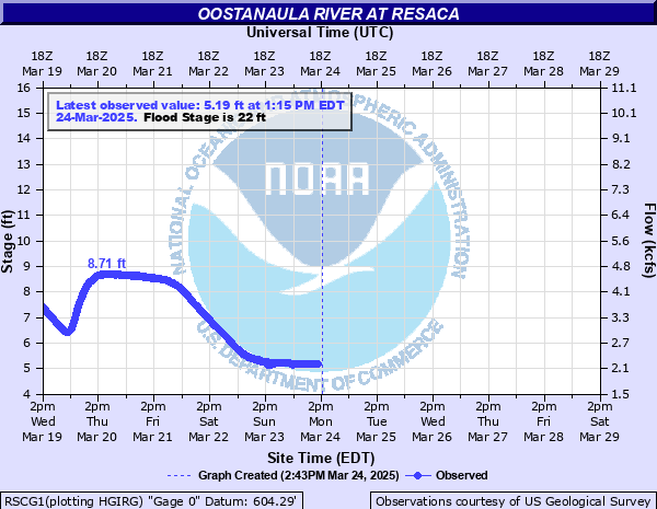
Oostanaula River at Resaca
Critical Stages
19' - Action
22' - Flood
28' - Moderate
33' - Major
Latest Observation
Updated: 1:15 AM EST 12/5/25
Status: No Flooding
Stage: 3.06 ft
Flow: 1.01 kcfs
Forecast
Forecast not available for this location.
| Time | Stage (ft) | Flow (kcfs) |
|---|---|---|
| 1:15 AM 12/5 | 3.06 | 1.01 |
| 1:00 AM 12/5 | 3.05 | 1 |
| 12:45 AM 12/5 | 3.05 | 1 |
| 12:30 AM 12/5 | 3.06 | 1.01 |
| 12:15 AM 12/5 | 3.06 | 1.01 |
| 12:00 AM 12/5 | 3.05 | 1 |
| 11:45 PM 12/4 | 3.02 | 0.99 |
| 11:30 PM 12/4 | 3.04 | 1 |
| 11:15 PM 12/4 | 3.03 | 0.995 |
| 11:00 PM 12/4 | 3.03 | 0.995 |
| 10:45 PM 12/4 | 3.02 | 0.99 |
| 10:30 PM 12/4 | 3 | 0.981 |
| 10:15 PM 12/4 | 3 | 0.981 |
| 10:00 PM 12/4 | 3 | 0.981 |
| 9:45 PM 12/4 | 3.01 | 0.986 |
| 9:30 PM 12/4 | 3.01 | 0.986 |
| 9:15 PM 12/4 | 2.98 | 0.972 |
| 9:00 PM 12/4 | 2.99 | 0.976 |
| 8:45 PM 12/4 | 2.99 | 0.976 |
| 8:30 PM 12/4 | 3 | 0.981 |
| 8:15 PM 12/4 | 3.01 | 0.986 |
| 8:00 PM 12/4 | 3.01 | 0.986 |
| 7:45 PM 12/4 | 3.01 | 0.986 |
| 7:30 PM 12/4 | 3.01 | 0.986 |
| 7:15 PM 12/4 | 3 | 0.981 |
| 7:00 PM 12/4 | 3 | 0.981 |
| 6:45 PM 12/4 | 3 | 0.981 |
| 6:30 PM 12/4 | 3 | 0.981 |
| 6:15 PM 12/4 | 2.99 | 0.976 |
| 6:00 PM 12/4 | 2.99 | 0.976 |
36' -
Near record flooding occurs with widespread inundation flooding of the woodlands...fields and pastures upstream and downstream from the gage on U S Highway 41 or Battlefield Parkway. Downstream in Calhoun...flooding will occur on portions of North and South River Streets. A recreational area on South River Street will flood. Most textile mills in the area will not flood...because these locations have a higher elevation.
33.5' -
Major flooding begins. Widespread inundation flooding occurs of the woodlands...fields and pastures along and near the river upstream and downstream from the gage on U S Highway 41 or Battlefield Parkway. Flooding of a textile mill in Calhoun will develop.
32' -
Significant flooding expands much further into the woodlands...fields and pastures along and near the river upstream and downstream from the gage on U S Highway 41 or Battlefield Parkway. The water level will be approaching the foundation of a textile mill in Calhoun.
30' -
Significant flooding expands further into the woodlands...fields and pastures along the river upstream and downstream from the gage on U S Highway 41 or Battlefield Parkway.
28' -
Moderate flooding begins. Significant flooding will expand further into the woodlands...fields and pastures along the river upstream and downstream from the gage on U S Highway 41 or Battlefield Parkway.
26' -
Minor flooding continues to expand further into the woodlands...fields and pastures along the river upstream and downstream from the gage on U S Highway 41 or Battlefield Parkway.
24' -
Minor flooding continues in the woodlands...fields and pastures along the river upstream and downstream from the gage on U S Highway 41 or Battlefield Parkway.
22' -
Minor flooding begins in the woodlands...fields and pastures along the river upstream and downstream from the gage on U S Highway 41 or Battlefield Parkway.
19' -
Bankfull conditions are reached along the river upstream and downstream from the gage on U S Highway 41 or Battlefield Parkway.
| Date | Stage (ft) |
|---|---|
| Apr 1, 1886 | 36.3 |
| Mar 31, 1951 | 34.5 |
| Jan 21, 1947 | 33.2 |
| Feb 11, 1921 | 32.7 |
| Feb 18, 1990 | 32.59 |
| Feb 12, 1946 | 32.5 |
| Feb 11, 1946 | 32.2 |
| Apr 8, 1892 | 32 |
| Apr 14, 1920 | 32 |
| Jan 22, 1922 | 31.9 |
| Mar 14, 1909 | 31.7 |
| Apr 4, 1920 | 31.7 |
| Apr 7, 1892 | 31.7 |
| Apr 9, 1938 | 31.2 |
| Nov 30, 1948 | 31.1 |
| Dec 29, 1932 | 30.9 |
| Feb 4, 1957 | 30.8 |
| Apr 3, 1936 | 30.6 |
| Jan 18, 1954 | 30.2 |
| Mar 6, 1917 | 30.2 |
Data provided by the National Weather Service.