« Back to Marshall County Rivers
Limestone Creek (AL) near Athens (Capshaw)
Critical Stages
10' - Action
12' - Flood
16' - Moderate
20' - Major
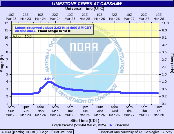
Latest Observation
Updated: 1:00 AM CST 12/15/25
Status: No Flooding
Stage: 1.87 ft
Flow: 0.197 kcfs
Forecast
Forecast not available for this location.
| Time | Stage (ft) | Flow (kcfs) |
|---|---|---|
| 2:00 AM 12/15 | 1.87 | 0.197 |
| 1:45 AM 12/15 | 1.87 | 0.197 |
| 1:30 AM 12/15 | 1.87 | 0.197 |
| 1:15 AM 12/15 | 1.87 | 0.197 |
| 1:00 AM 12/15 | 1.87 | 0.197 |
| 12:45 AM 12/15 | 1.87 | 0.197 |
| 12:30 AM 12/15 | 1.87 | 0.197 |
| 12:15 AM 12/15 | 1.87 | 0.197 |
| 12:00 AM 12/15 | 1.87 | 0.197 |
| 11:45 PM 12/14 | 1.87 | 0.197 |
| 11:30 PM 12/14 | 1.87 | 0.197 |
| 11:15 PM 12/14 | 1.87 | 0.197 |
| 11:00 PM 12/14 | 1.87 | 0.197 |
| 10:45 PM 12/14 | 1.87 | 0.197 |
| 10:30 PM 12/14 | 1.87 | 0.197 |
| 10:15 PM 12/14 | 1.87 | 0.197 |
| 10:00 PM 12/14 | 1.87 | 0.197 |
| 9:45 PM 12/14 | 1.87 | 0.197 |
| 9:30 PM 12/14 | 1.87 | 0.197 |
| 9:15 PM 12/14 | 1.87 | 0.197 |
| 9:00 PM 12/14 | 1.87 | 0.197 |
| 8:45 PM 12/14 | 1.87 | 0.197 |
| 8:30 PM 12/14 | 1.87 | 0.197 |
| 8:15 PM 12/14 | 1.87 | 0.197 |
| 8:00 PM 12/14 | 1.87 | 0.197 |
| 7:45 PM 12/14 | 1.87 | 0.197 |
| 7:30 PM 12/14 | 1.87 | 0.197 |
| 7:15 PM 12/14 | 1.87 | 0.197 |
| 7:00 PM 12/14 | 1.88 | 0.2 |
| 6:45 PM 12/14 | 1.87 | 0.197 |
20' -
Water covers Highway 72 at Limestone Creek.
16' -
Water approaches the underside of the Highway 72 bridges. Significant flooding of farmland and other lowlands near the river is occurring.
12' -
Water spills over the banks of Limestone Creek...flooding lowlands near the river.
| Date | Stage (ft) |
|---|---|
| Mar 16, 1973 | 17.48 |
| Mar 12, 1963 | 15.5 |
| Dec 23, 1991 | 15.2 |
| Apr 28, 2011 | 15.1 |
| Jan 21, 1954 | 14.32 |
| Jan 23, 1999 | 13.56 |
| Feb 1, 1951 | 13.16 |
| Mar 15, 1964 | 13 |
| Feb 6, 2004 | 12.99 |
| Jan 5, 1949 | 12.89 |
| Dec 9, 2009 | 12.82 |
| Jul 5, 2013 | 12.67 |
| Oct 17, 1975 | 12.61 |
| Feb 6, 2020 | 12.56 |
| May 6, 2003 | 12.49 |
| Apr 5, 1977 | 12.38 |
| Mar 13, 1975 | 12.21 |
| Dec 18, 1967 | 12.17 |
| Mar 20, 1980 | 12.12 |
| Dec 26, 2015 | 12.01 |
Data provided by the National Weather Service.