« Back to Marshall County Rivers
Big Wills Creek (AL) near Fort Payne
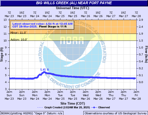
Critical Stages
10' - Action
11' - Flood
13' - Moderate
20' - Major
Latest Observation
Updated: 12:45 AM CST 12/15/25
Status: No Flooding
Stage: 4.03 ft
Flow: 0.0191 kcfs
Forecast
Forecast not available for this location.
| Time | Stage (ft) | Flow (kcfs) |
|---|---|---|
| 1:45 AM 12/15 | 4.04 | 0.0195 |
| 1:30 AM 12/15 | 4.04 | 0.0195 |
| 1:15 AM 12/15 | 4.04 | 0.0195 |
| 1:00 AM 12/15 | 4.04 | 0.0195 |
| 12:45 AM 12/15 | 4.03 | 0.0191 |
| 12:30 AM 12/15 | 4.04 | 0.0195 |
| 12:15 AM 12/15 | 4.03 | 0.0191 |
| 12:00 AM 12/15 | 4.03 | 0.0191 |
| 11:45 PM 12/14 | 4.03 | 0.0191 |
| 11:30 PM 12/14 | 4.02 | 0.0187 |
| 11:15 PM 12/14 | 4.03 | 0.0191 |
| 11:00 PM 12/14 | 4.01 | 0.0184 |
| 10:45 PM 12/14 | 4.02 | 0.0187 |
| 10:30 PM 12/14 | 4.01 | 0.0184 |
| 10:15 PM 12/14 | 4.02 | 0.0187 |
| 10:00 PM 12/14 | 4.02 | 0.0187 |
| 9:45 PM 12/14 | 4.01 | 0.0184 |
| 9:30 PM 12/14 | 4 | 0.018 |
| 9:15 PM 12/14 | 4.01 | 0.0184 |
| 9:00 PM 12/14 | 4.01 | 0.0184 |
| 8:45 PM 12/14 | 4 | 0.018 |
| 8:30 PM 12/14 | 3.99 | 0.0176 |
| 8:15 PM 12/14 | 4 | 0.018 |
| 8:00 PM 12/14 | 3.99 | 0.0176 |
| 7:45 PM 12/14 | 3.98 | 0.0173 |
| 7:30 PM 12/14 | 3.98 | 0.0173 |
| 7:15 PM 12/14 | 3.98 | 0.0173 |
| 7:00 PM 12/14 | 3.97 | 0.017 |
| 6:45 PM 12/14 | 3.97 | 0.017 |
| 6:30 PM 12/14 | 3.97 | 0.017 |
20' -
Widespread flooding is occurring near Fort Payne.
13' -
Flooding of roads and businesses on the North side of Fort Payne...North of Interstate 59...is possible.
11' -
Lowland flooding occurrs near the creek between Fort Payne and Collinsville.
10' -
The River reaches bankfull.
| Date | Stage (ft) |
|---|---|
| Apr 13, 2020 | 17.94 |
| Jun 20, 2021 | 14.43 |
| Jan 7, 2009 | 14.36 |
| May 6, 2003 | 14.19 |
| Feb 6, 2020 | 14.13 |
| Mar 25, 2021 | 14.09 |
| Apr 29, 2014 | 13.93 |
| Dec 26, 2015 | 13.88 |
| Sep 17, 2004 | 13.43 |
| Mar 9, 2011 | 13.12 |
| Feb 24, 2016 | 12.67 |
| Sep 6, 2011 | 12.63 |
| Feb 3, 2016 | 12.57 |
| Jan 2, 2022 | 12.55 |
| Feb 13, 2025 | 12.48 |
| Mar 18, 2021 | 12.48 |
| Jan 15, 2013 | 12.36 |
| Sep 21, 2009 | 12.17 |
| Feb 22, 2003 | 12.16 |
| Jan 25, 2010 | 12.12 |
Data provided by the National Weather Service.