« Back to Marshall County Rivers
Aldridge Creek (AL) at Sherwood Drive in Huntsville
Critical Stages
11' - Action
12' - Flood
14' - Moderate
15' - Major
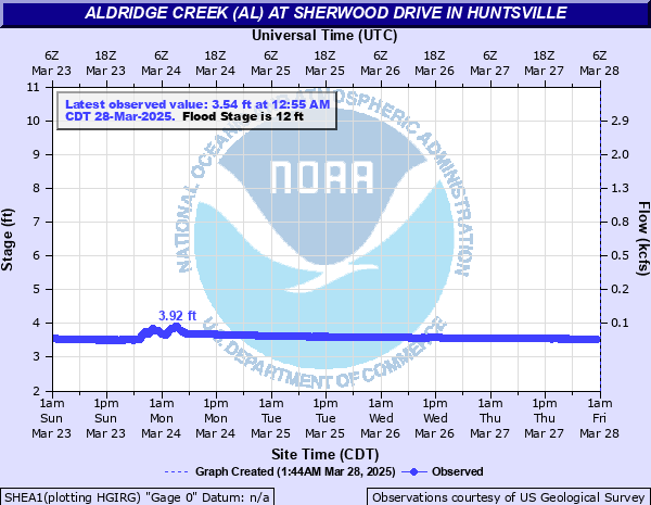
Latest Observation
Updated: 12:55 AM CST 12/15/25
Status: No Flooding
Stage: 3.53 ft
Flow: -999 kcfs
Forecast
Forecast not available for this location.
| Time | Stage (ft) | Flow (kcfs) |
|---|---|---|
| 1:55 AM 12/15 | 3.53 | -999 |
| 1:50 AM 12/15 | 3.53 | -999 |
| 1:45 AM 12/15 | 3.53 | -999 |
| 1:40 AM 12/15 | 3.53 | -999 |
| 1:35 AM 12/15 | 3.53 | -999 |
| 1:30 AM 12/15 | 3.53 | -999 |
| 1:25 AM 12/15 | 3.53 | -999 |
| 1:20 AM 12/15 | 3.53 | -999 |
| 1:15 AM 12/15 | 3.53 | -999 |
| 1:10 AM 12/15 | 3.53 | -999 |
| 1:05 AM 12/15 | 3.53 | -999 |
| 1:00 AM 12/15 | 3.53 | -999 |
| 12:55 AM 12/15 | 3.53 | -999 |
| 12:50 AM 12/15 | 3.53 | -999 |
| 12:45 AM 12/15 | 3.53 | -999 |
| 12:40 AM 12/15 | 3.53 | -999 |
| 12:35 AM 12/15 | 3.53 | -999 |
| 12:30 AM 12/15 | 3.53 | -999 |
| 12:25 AM 12/15 | 3.53 | -999 |
| 12:20 AM 12/15 | 3.53 | -999 |
| 12:15 AM 12/15 | 3.53 | -999 |
| 12:10 AM 12/15 | 3.53 | -999 |
| 12:05 AM 12/15 | 3.53 | -999 |
| 12:00 AM 12/15 | 3.53 | -999 |
| 11:55 PM 12/14 | 3.53 | -999 |
| 11:50 PM 12/14 | 3.53 | -999 |
| 11:45 PM 12/14 | 3.53 | -999 |
| 11:40 PM 12/14 | 3.52 | -999 |
| 11:35 PM 12/14 | 3.53 | -999 |
| 11:30 PM 12/14 | 3.53 | -999 |
16' -
The creek overtops the bridge at Sherwood Drive. Floodwaters may be affecting nearby homes.
15' -
Water is covering numerous roads on the left bank of Aldridge Creek...including Atwood Street...and is approaching homes near the right bank.
14' -
Water is covering several roads near the creek...including Atwood Street...Sherwood Drive...and Harrisburg Drive.
12' -
Water is covering large portions of the Greenway between Atwood Street and Aldridge Creek...and is approaching Atwood Street on the left bank.
11' -
Water begins to cover the Greenway between Aldridge Creek and Atwood Street.
| Date | Stage (ft) |
|---|---|
| Jun 28, 1999 | 14.55 |
| May 6, 2003 | 10.4 |
| Apr 13, 2020 | 9.31 |
| May 4, 2002 | 9.01 |
| Apr 3, 2000 | 8.76 |
| Mar 6, 2004 | 8.47 |
| Dec 9, 2004 | 7.51 |
| Sep 17, 2004 | 7.26 |
| Feb 6, 2004 | 7.13 |
Data provided by the National Weather Service.