« Back to Marshall County Rivers
Aldridge Creek (AL) at Toney Drive in Huntsville
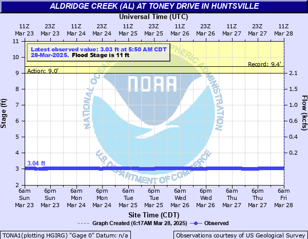
Critical Stages
9' - Action
11' - Flood
12' - Moderate
14' - Major
Latest Observation
Updated: 12:50 AM CST 12/15/25
Status: No Flooding
Stage: 3.08 ft
Flow: -999 kcfs
Forecast
Forecast not available for this location.
| Time | Stage (ft) | Flow (kcfs) |
|---|---|---|
| 1:50 AM 12/15 | 3.08 | -999 |
| 1:45 AM 12/15 | 3.08 | -999 |
| 1:40 AM 12/15 | 3.08 | -999 |
| 1:35 AM 12/15 | 3.08 | -999 |
| 1:30 AM 12/15 | 3.08 | -999 |
| 1:25 AM 12/15 | 3.08 | -999 |
| 1:20 AM 12/15 | 3.08 | -999 |
| 1:15 AM 12/15 | 3.08 | -999 |
| 1:10 AM 12/15 | 3.08 | -999 |
| 1:05 AM 12/15 | 3.08 | -999 |
| 1:00 AM 12/15 | 3.08 | -999 |
| 12:55 AM 12/15 | 3.08 | -999 |
| 12:50 AM 12/15 | 3.08 | -999 |
| 12:45 AM 12/15 | 3.08 | -999 |
| 12:40 AM 12/15 | 3.08 | -999 |
| 12:35 AM 12/15 | 3.08 | -999 |
| 12:30 AM 12/15 | 3.08 | -999 |
| 12:25 AM 12/15 | 3.08 | -999 |
| 12:20 AM 12/15 | 3.08 | -999 |
| 12:15 AM 12/15 | 3.08 | -999 |
| 12:10 AM 12/15 | 3.08 | -999 |
| 12:05 AM 12/15 | 3.08 | -999 |
| 12:00 AM 12/15 | 3.08 | -999 |
| 11:55 PM 12/14 | 3.08 | -999 |
| 11:50 PM 12/14 | 3.08 | -999 |
| 11:45 PM 12/14 | 3.08 | -999 |
| 11:40 PM 12/14 | 3.08 | -999 |
| 11:35 PM 12/14 | 3.08 | -999 |
| 11:30 PM 12/14 | 3.08 | -999 |
| 11:25 PM 12/14 | 3.08 | -999 |
14' -
Water overtops the bridge on Toney Drive and is likely also approaching nearby homes.
12' -
Water floods ballfields near the creek...and farmland both along the creek and along nearby tributaries on Jones Farm.
11' -
The creek spills over its banks...and into nearby lowlands...including a baseball field.
9' -
The creek reaches the top of the concrete channel on the left bank.
| Date | Stage (ft) |
|---|---|
| Jun 28, 1999 | 9.4 |
| May 6, 2003 | 9.32 |
| Jul 31, 1996 | 7.89 |
| Apr 3, 2000 | 6.73 |
| Mar 5, 2004 | 6.47 |
| Jun 4, 2001 | 6.39 |
Data provided by the National Weather Service.