« Back to Marshall County Rivers
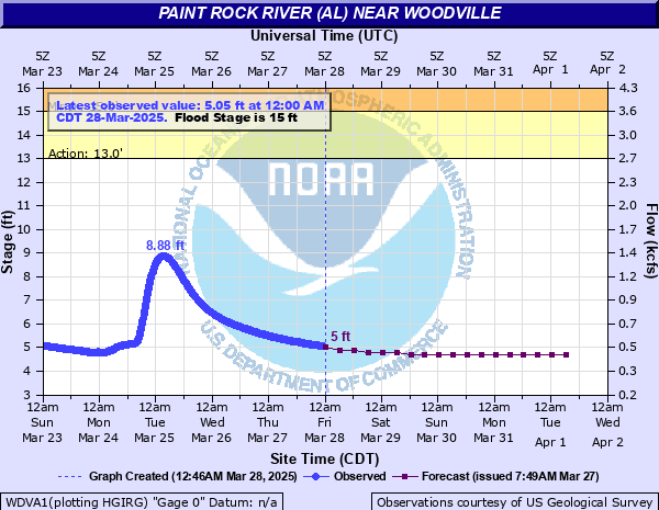
Paint Rock River (AL) near Woodville
Critical Stages
13' - Action
15' - Flood
19' - Moderate
22' - Major
Latest Observation
Updated: 3:00 AM CST 12/15/25
Status: No Flooding
Stage: 2.99 ft
Flow: 0.174 kcfs
Forecast
| Time | Stage (ft) | Flow (kcfs) |
|---|---|---|
| 6 AM 12/15 | 3 | 0.175 |
| 12 PM 12/15 | 3 | 0.175 |
| 6 PM 12/15 | 3 | 0.175 |
| 12 AM 12/16 | 3 | 0.175 |
| 6 AM 12/16 | 3 | 0.175 |
| 12 PM 12/16 | 3 | 0.175 |
| 6 PM 12/16 | 3 | 0.175 |
| 12 AM 12/17 | 3 | 0.175 |
| 6 AM 12/17 | 2.9 | 0.161 |
| 12 PM 12/17 | 2.9 | 0.161 |
| 6 PM 12/17 | 2.9 | 0.161 |
| 12 AM 12/18 | 2.9 | 0.161 |
| 6 AM 12/18 | 2.9 | 0.161 |
| 12 PM 12/18 | 2.9 | 0.161 |
| 6 PM 12/18 | 2.9 | 0.161 |
| 12 AM 12/19 | 2.9 | 0.161 |
| 6 AM 12/19 | 2.9 | 0.161 |
| Time | Stage (ft) | Flow (kcfs) |
|---|---|---|
| 3:00 AM 12/15 | 2.99 | 0.174 |
| 2:45 AM 12/15 | 3 | 0.175 |
| 2:30 AM 12/15 | 3 | 0.175 |
| 2:15 AM 12/15 | 3 | 0.175 |
| 2:00 AM 12/15 | 3 | 0.175 |
| 1:45 AM 12/15 | 3 | 0.175 |
| 1:30 AM 12/15 | 3 | 0.175 |
| 1:15 AM 12/15 | 3.01 | 0.176 |
| 1:00 AM 12/15 | 3.01 | 0.176 |
| 12:45 AM 12/15 | 3.01 | 0.176 |
| 12:30 AM 12/15 | 3 | 0.175 |
| 12:15 AM 12/15 | 3.01 | 0.176 |
| 12:00 AM 12/15 | 3 | 0.175 |
| 11:45 PM 12/14 | 3.01 | 0.176 |
| 11:30 PM 12/14 | 3.01 | 0.176 |
| 11:15 PM 12/14 | 3.01 | 0.176 |
| 11:00 PM 12/14 | 3.02 | 0.178 |
| 10:45 PM 12/14 | 3.01 | 0.176 |
| 10:30 PM 12/14 | 3.01 | 0.176 |
| 10:15 PM 12/14 | 3.02 | 0.178 |
| 10:00 PM 12/14 | 3.02 | 0.178 |
| 9:45 PM 12/14 | 3.02 | 0.178 |
| 9:30 PM 12/14 | 3.02 | 0.178 |
| 9:15 PM 12/14 | 3.02 | 0.178 |
| 9:00 PM 12/14 | 3.02 | 0.178 |
| 8:45 PM 12/14 | 3.03 | 0.179 |
| 8:30 PM 12/14 | 3.02 | 0.178 |
| 8:15 PM 12/14 | 3.03 | 0.179 |
| 8:00 PM 12/14 | 3.03 | 0.179 |
| 7:45 PM 12/14 | 3.03 | 0.179 |
30' -
Water reaches and overtops the bridge at the gage site on Highway 72. Large portions of Highway 72 and surrounding local roads will be flooded and homes will be threatened.
23' -
Flood waters cover U.S. Highway 72 near Woodville and Paint Rock. Some evacuations may become necessary as water approaches residences.
20' -
Portions of Alabama State Highway 65 are closed due to high water.
19' -
Water is covering Alabama State Route 65 about two miles north of U.S. Highway 72. Several County Roads in Paint Rock Valley are flooded...including Jackson County Road 20.
15' -
Flood waters affect mostly bottomland along the river...including low lying farm and pasturelands.
14' -
The Butler Bottom Lowlands near the river are flooded. High waters are approaching County Road 20 north of the town of Paint Rock.
12' -
Some minor overflow of lowlands begins.
| Date | Stage (ft) |
|---|---|
| Mar 16, 1973 | 24.4 |
| Dec 23, 1990 | 23.42 |
| Mar 12, 1963 | 22.6 |
| Dec 2, 1991 | 21.36 |
| Feb 11, 1994 | 21.08 |
| Dec 27, 1973 | 21.06 |
| Mar 21, 1980 | 21 |
| Jan 8, 1998 | 20.87 |
| Jan 5, 1949 | 20.84 |
| Mar 24, 1993 | 20.64 |
| Dec 31, 1969 | 20.6 |
| Dec 28, 1942 | 20.5 |
| Dec 8, 2004 | 20.46 |
| Mar 14, 1975 | 20.4 |
| Feb 4, 1939 | 20.35 |
| Mar 19, 2021 | 20.35 |
| Mar 29, 1951 | 20.32 |
| Dec 27, 2015 | 20.21 |
| Feb 17, 2003 | 20.2 |
| Feb 1, 1957 | 20.16 |
Data provided by the National Weather Service.