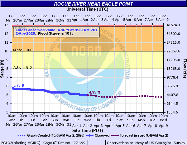
Rogue River near Eagle Point
Critical Stages
8' - Action
10' - Flood
12.8' - Moderate
15' - Major
Latest Observation
Updated: 5:00 AM PST 12/5/25
Status: No Flooding
Stage: 3.06 ft
Flow: 1.27 kcfs
Forecast
| Time | Stage (ft) | Flow (kcfs) |
|---|---|---|
| 10 AM 12/5 | 3.09 | 1.3 |
| 4 PM 12/5 | 3.19 | 1.41 |
| 10 PM 12/5 | 3.33 | 1.57 |
| 4 AM 12/6 | 3.39 | 1.64 |
| 10 AM 12/6 | 3.35 | 1.6 |
| 4 PM 12/6 | 3.28 | 1.51 |
| 10 PM 12/6 | 3.23 | 1.46 |
| 4 AM 12/7 | 3.2 | 1.42 |
| 10 AM 12/7 | 3.17 | 1.39 |
| 4 PM 12/7 | 3.16 | 1.38 |
| 10 PM 12/7 | 3.15 | 1.37 |
| 4 AM 12/8 | 3.15 | 1.37 |
| 10 AM 12/8 | 3.14 | 1.36 |
| 4 PM 12/8 | 3.13 | 1.34 |
| 10 PM 12/8 | 3.12 | 1.33 |
| 4 AM 12/9 | 3.12 | 1.33 |
| 10 AM 12/9 | 3.13 | 1.34 |
| 4 PM 12/9 | 3.17 | 1.39 |
| 10 PM 12/9 | 3.21 | 1.43 |
| 4 AM 12/10 | 3.23 | 1.46 |
| 10 AM 12/10 | 3.24 | 1.47 |
| 4 PM 12/10 | 3.23 | 1.46 |
| 10 PM 12/10 | 3.24 | 1.47 |
| 4 AM 12/11 | 3.24 | 1.47 |
| 10 AM 12/11 | 3.23 | 1.46 |
| 4 PM 12/11 | 3.2 | 1.42 |
| 10 PM 12/11 | 3.18 | 1.4 |
| 4 AM 12/12 | 3.16 | 1.38 |
| 10 AM 12/12 | 3.16 | 1.38 |
| 4 PM 12/12 | 3.16 | 1.38 |
| 10 PM 12/12 | 3.17 | 1.39 |
| 4 AM 12/13 | 3.19 | 1.41 |
| 10 AM 12/13 | 3.23 | 1.46 |
| 4 PM 12/13 | 3.24 | 1.47 |
| 10 PM 12/13 | 3.22 | 1.45 |
| 4 AM 12/14 | 3.2 | 1.42 |
| Time | Stage (ft) | Flow (kcfs) |
|---|---|---|
| 5:00 AM 12/5 | 3.06 | 1.27 |
| 4:45 AM 12/5 | 3.06 | 1.27 |
| 4:30 AM 12/5 | 3.06 | 1.27 |
| 4:15 AM 12/5 | 3.06 | 1.27 |
| 4:00 AM 12/5 | 3.06 | 1.27 |
| 3:45 AM 12/5 | 3.06 | 1.27 |
| 3:30 AM 12/5 | 3.06 | 1.27 |
| 3:15 AM 12/5 | 3.06 | 1.27 |
| 3:00 AM 12/5 | 3.06 | 1.27 |
| 2:45 AM 12/5 | 3.06 | 1.27 |
| 2:30 AM 12/5 | 3.06 | 1.27 |
| 2:15 AM 12/5 | 3.07 | 1.28 |
| 2:00 AM 12/5 | 3.07 | 1.28 |
| 1:45 AM 12/5 | 3.07 | 1.28 |
| 1:30 AM 12/5 | 3.07 | 1.28 |
| 1:15 AM 12/5 | 3.07 | 1.28 |
| 1:00 AM 12/5 | 3.07 | 1.28 |
| 12:45 AM 12/5 | 3.07 | 1.28 |
| 12:30 AM 12/5 | 3.07 | 1.28 |
| 12:15 AM 12/5 | 3.07 | 1.28 |
| 12:00 AM 12/5 | 3.07 | 1.28 |
| 11:45 PM 12/4 | 3.07 | 1.28 |
| 11:30 PM 12/4 | 3.07 | 1.28 |
| 11:15 PM 12/4 | 3.07 | 1.28 |
| 11:00 PM 12/4 | 3.07 | 1.28 |
| 10:45 PM 12/4 | 3.07 | 1.28 |
| 10:30 PM 12/4 | 3.07 | 1.28 |
| 10:15 PM 12/4 | 3.07 | 1.28 |
| 10:00 PM 12/4 | 3.07 | 1.28 |
| 9:45 PM 12/4 | 3.07 | 1.28 |
15.2' -
Expect widespread flooding in the town of Shady Cove. Also expect flooding of businesses, homes, and the Dodge Bridge County Park both upstream and downstream of the gage at Dodge Bridge.
15.2' -
Expect widespread flooding in the town of Shady Cove. Also expect flooding of businesses, homes, and the Dodge Bridge County Park both upstream and downstream of the gage at Dodge Bridge.
12.8' -
Expect considerable flooding throughout the town of Shady Cove.
12' -
Flooding begins in the southern portions of the town of Shady Cove.
11' -
Expect flooding of structures on the left bank of the Rogue River downstream from the river gage at Dodge Bridge. Widespread low-land flooding likely up and down stream from Dodge Bridge.
10' -
Expect flooding of low-lying farm and pasture land.
| Date | Stage (ft) |
|---|---|
| Dec 22, 1955 | 15.17 |
| Dec 28, 1945 | 13.19 |
| Mar 2, 1972 | 12.84 |
| Dec 22, 1964 | 12.78 |
| Jan 11, 1974 | 12.67 |
| Jan 17, 1971 | 11.96 |
| Jan 6, 1974 | 11.67 |
| Dec 2, 1962 | 11.48 |
| Jan 22, 1970 | 10.67 |
| Mar 17, 2025 | 10.29 |
| Jan 29, 1958 | 10.27 |
| Jan 26, 1970 | 10.26 |
| Jan 1, 1997 | 10.2 |
| Dec 15, 1977 | 10.16 |
| Dec 30, 1996 | 10 |
Data provided by the National Weather Service.