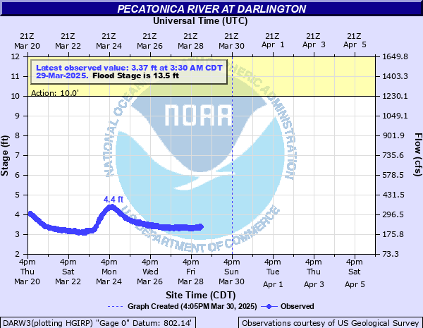
Pecatonica River at Darlington
Critical Stages
10' - Action
13.5' - Flood
15' - Moderate
16' - Major
Latest Observation
Updated: 3:00 AM CST 12/7/25
Status: No Flooding
Stage: 2.91 ft
Flow: 0.186 kcfs
Forecast
Forecast not available for this location.
| Time | Stage (ft) | Flow (kcfs) |
|---|---|---|
| 3:00 AM 12/7 | 2.91 | 0.186 |
| 2:45 AM 12/7 | 2.91 | 0.186 |
| 2:30 AM 12/7 | 2.92 | 0.187 |
| 2:15 AM 12/7 | 2.92 | 0.187 |
| 2:00 AM 12/7 | 2.92 | 0.187 |
| 1:45 AM 12/7 | 2.92 | 0.187 |
| 1:30 AM 12/7 | 2.93 | 0.188 |
| 1:15 AM 12/7 | 2.93 | 0.188 |
| 1:00 AM 12/7 | 2.93 | 0.188 |
| 12:45 AM 12/7 | 2.93 | 0.188 |
| 12:30 AM 12/7 | 2.93 | 0.188 |
| 12:15 AM 12/7 | 2.93 | 0.188 |
| 12:00 AM 12/7 | 2.92 | 0.187 |
| 11:45 PM 12/6 | 2.92 | 0.187 |
| 11:30 PM 12/6 | 2.92 | 0.187 |
| 11:15 PM 12/6 | 2.92 | 0.187 |
| 11:00 PM 12/6 | 2.92 | 0.187 |
| 10:45 PM 12/6 | 2.92 | 0.187 |
| 10:30 PM 12/6 | 2.92 | 0.187 |
| 10:15 PM 12/6 | 2.92 | 0.187 |
| 10:00 PM 12/6 | 2.92 | 0.187 |
| 9:45 PM 12/6 | 2.92 | 0.187 |
| 9:30 PM 12/6 | 2.92 | 0.187 |
| 9:15 PM 12/6 | 2.92 | 0.187 |
| 9:00 PM 12/6 | 2.91 | 0.186 |
| 8:45 PM 12/6 | 2.91 | 0.186 |
| 8:30 PM 12/6 | 2.92 | 0.187 |
| 8:15 PM 12/6 | 2.91 | 0.186 |
| 8:00 PM 12/6 | 2.92 | 0.187 |
| 7:45 PM 12/6 | 2.92 | 0.187 |
20.8' -
There is major urban flooding in Darlington. The Wisconsin Power and Light substation in Darlington is flooded.
19.4' -
There is major urban flooding in darlington. Highways 23 and 81 are flooded and closed as are some other streets in downtown Darlington. The Wisconsin Power and Light substation in Darlington is flooded.
19' -
There is major urban flooding in Darlington. The Wisconsin Power and Light substation in Darlington is flooded.
18' -
There is major urban flooding in Darlington.
17' -
There is major urban flooding in Darlington.
16' -
There is major urban flooding in Darlington. Highways 23 and 81 are flooded and closed as are some streets in downtown Darlington.
15.8' -
Highways 23 and 81 in Darlington are flooded and closed as is Main Street. The Lafayette County Fairgrounds are flooded.
15.5' -
There is flooding in Calamine, Wisconsin, about 5 miles upstream of Darlington. Highways 23 and 81 are flooded and closed in Darlington as is a good part of Main Street. The Lafayette County Fairgrounds are flooded.
15' -
Highways 23 (Main St bridge) and 81 are flooded and closed in Darlington. A portion of Main Street in Darlington is flooded. A good part of the Lafayette County Fairgrounds is flooded.
13.9' -
Floodwaters cover a portion of Main Street in Darlington. A part of the Lafayette County Fairgrounds is flooded.
13.5' -
Floodwaters touch Main Street in Darlington. A part of the Lafayette County Fairgrounds has 2 to 3 feet of water over it.
13' -
There is minor urban flooding in Darlington.
12' -
There is flooding of agricultural land in the Darlington area.
11' -
There is flooding of agricultural land and lowland.
10' -
There is minor lowland flooding in the Darlington area.
| Date | Stage (ft) |
|---|---|
| Jul 16, 1950 | 20.71 |
| Jun 29, 1990 | 19.8 |
| Jun 30, 1969 | 19.16 |
| Jul 6, 1993 | 18.22 |
| Feb 28, 1948 | 17.65 |
| Mar 14, 2019 | 17.6 |
| Feb 21, 1937 | 17.6 |
| Feb 20, 1953 | 17.47 |
| Jan 6, 1946 | 17.18 |
| Apr 1, 1959 | 17.16 |
| Jul 8, 1951 | 16.61 |
| Jan 25, 1967 | 16.47 |
| Mar 30, 1960 | 16.06 |
| Feb 9, 1966 | 16 |
| Oct 3, 2019 | 15.84 |
| Jan 22, 1954 | 15.79 |
| Jun 22, 1954 | 15.79 |
| Jun 1, 2000 | 15.77 |
| Feb 20, 1994 | 15.75 |
| Jun 9, 2008 | 15.75 |
Data provided by the National Weather Service.