Pecatonica River near Shirland
Critical Stages
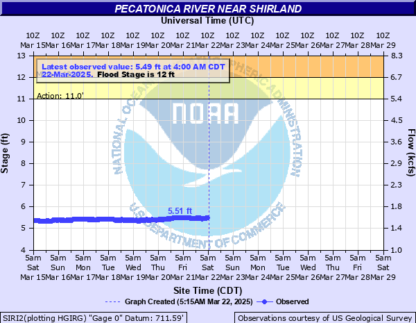
11' - Action
12' - Flood
14' - Moderate
15.5' - Major
Latest Observation
Updated: 3:00 AM CST 12/7/25
Status: No Flooding
Stage: 4.82 ft
Flow: 1.3 kcfs
Forecast
Forecast not available for this location.
| Time | Stage (ft) | Flow (kcfs) |
|---|---|---|
| 3:00 AM 12/7 | 4.82 | 1.3 |
| 2:45 AM 12/7 | 4.81 | 1.3 |
| 2:30 AM 12/7 | 4.24 | 1.07 |
| 2:15 AM 12/7 | 4.24 | 1.07 |
| 2:00 AM 12/7 | 4.24 | 1.07 |
| 1:45 AM 12/7 | 4.74 | 1.27 |
| 1:30 AM 12/7 | 4.72 | 1.26 |
| 1:15 AM 12/7 | 4.69 | 1.24 |
| 1:00 AM 12/7 | 4.64 | 1.22 |
| 12:45 AM 12/7 | 4.65 | 1.23 |
| 12:30 AM 12/7 | 4.64 | 1.22 |
| 12:15 AM 12/7 | 4.63 | 1.22 |
| 12:00 AM 12/7 | 4.64 | 1.22 |
| 11:45 PM 12/6 | 4.63 | 1.22 |
| 11:30 PM 12/6 | 4.63 | 1.22 |
| 11:15 PM 12/6 | 4.63 | 1.22 |
| 11:00 PM 12/6 | 4.63 | 1.22 |
| 10:45 PM 12/6 | 4.63 | 1.22 |
| 10:30 PM 12/6 | 4.62 | 1.22 |
| 10:15 PM 12/6 | 4.62 | 1.22 |
| 10:00 PM 12/6 | 4.62 | 1.22 |
| 9:45 PM 12/6 | 4.62 | 1.22 |
| 9:30 PM 12/6 | 4.61 | 1.21 |
| 9:15 PM 12/6 | 4.61 | 1.21 |
| 9:00 PM 12/6 | 4.61 | 1.21 |
| 8:45 PM 12/6 | 4.61 | 1.21 |
| 8:30 PM 12/6 | 4.61 | 1.21 |
| 8:15 PM 12/6 | 4.61 | 1.21 |
| 8:00 PM 12/6 | 4.6 | 1.21 |
| 7:45 PM 12/6 | 4.6 | 1.21 |
19.5' -
Shirland Community School and other municipal buildings are threatened in Shirland.
19' -
IL-70 (Trask Bridge Road) is threatened east of the river between Pecatonica and Harrison.
18.5' -
Structures threatened near the river in Pecatonica.
17.5' -
Residences are threatened along Harrison Road in Harrison. Meridian Road is threatened south of the river east of Shirland.
17' -
Telegraph Road is threatened east of Pecatonica. IL-75 is threatened west of Harrison. Harrison Road is threatened in Harrison.
16.5' -
Residences are threatened along Hartlien Road in Shirland.
16' -
Water treatment plant property in Pecatonica is threatened.
15' -
Harrison Road (Mitchell Street) threatened between Shirland and Harrison. Widespread inundation of the floodplain reaches up to half mile from the river near Shirland.
14.5' -
Pecatonica Road and Blair Road are threatened north of Pecatonica.
14' -
Structures threatened at Rivers Edge Campground east of Shirland.
12' -
Low-lying sections of the Winnebago County Fairgrounds are inundated. Low-lying sections of Rivers Edge Campground are inundated east of Shirland.
| Date | Stage (ft) |
|---|---|
| Mar 25, 1975 | 18.08 |
| Apr 4, 1959 | 17.45 |
| Apr 3, 1960 | 17.08 |
| Mar 21, 1948 | 16.73 |
| Feb 19, 1971 | 16.5 |
| Mar 17, 2019 | 16.46 |
| Jul 6, 1969 | 15.93 |
| Jul 28, 2010 | 15.89 |
| May 11, 1973 | 15.7 |
| Feb 24, 2018 | 15.58 |
| Oct 7, 2019 | 15.52 |
| Jul 8, 1969 | 15.4 |
| Mar 18, 1943 | 15.38 |
| Oct 11, 2018 | 15.27 |
| Mar 30, 1962 | 15.09 |
| Jun 17, 2008 | 15.09 |
| Mar 8, 1949 | 15.04 |
| Mar 21, 1952 | 14.91 |
| Feb 28, 1985 | 14.9 |
| Mar 17, 1944 | 14.88 |
Data provided by the National Weather Service.