« Back to Miller Cemetery Rivers
Leaf River at Hattiesburg
Critical Stages
16' - Action
22' - Flood
24' - Moderate
29.3' - Major
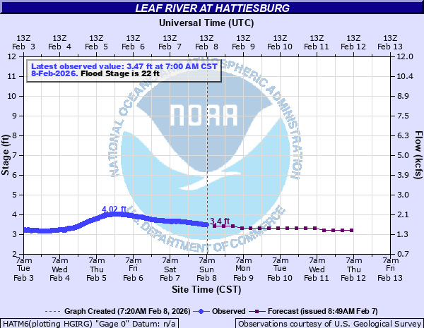
Latest Observation
Updated: 9:00 AM CST 12/14/25
Status: No Flooding
Stage: 2.19 ft
Flow: 0.786 kcfs
Forecast
| Time | Stage (ft) | Flow (kcfs) |
|---|---|---|
| 12 PM 12/14 | 2.2 | 0.792 |
| 6 PM 12/14 | 2.2 | 0.792 |
| 12 AM 12/15 | 2.3 | 0.85 |
| 6 AM 12/15 | 2.4 | 0.91 |
| 12 PM 12/15 | 2.3 | 0.85 |
| 6 PM 12/15 | 2.3 | 0.85 |
| 12 AM 12/16 | 2.3 | 0.85 |
| 6 AM 12/16 | 2.2 | 0.792 |
| 12 PM 12/16 | 2.2 | 0.792 |
| 6 PM 12/16 | 2.2 | 0.792 |
| 12 AM 12/17 | 2.2 | 0.792 |
| 6 AM 12/17 | 2.2 | 0.792 |
| 12 PM 12/17 | 2.2 | 0.792 |
| 6 PM 12/17 | 2.2 | 0.792 |
| 12 AM 12/18 | 2.2 | 0.792 |
| 6 AM 12/18 | 2.2 | 0.792 |
| 12 PM 12/18 | 2.2 | 0.792 |
| 6 PM 12/18 | 2.2 | 0.792 |
| 12 AM 12/19 | 2.2 | 0.792 |
| 6 AM 12/19 | 2.2 | 0.792 |
| Time | Stage (ft) | Flow (kcfs) |
|---|---|---|
| 9:00 AM 12/14 | 2.19 | 0.786 |
| 8:45 AM 12/14 | 2.19 | 0.786 |
| 8:30 AM 12/14 | 2.18 | 0.781 |
| 8:15 AM 12/14 | 2.16 | 0.769 |
| 8:00 AM 12/14 | 2.2 | 0.792 |
| 7:45 AM 12/14 | 2.19 | 0.786 |
| 7:30 AM 12/14 | 2.2 | 0.792 |
| 7:15 AM 12/14 | 2.19 | 0.786 |
| 7:00 AM 12/14 | 2.19 | 0.786 |
| 6:45 AM 12/14 | 2.17 | 0.775 |
| 6:30 AM 12/14 | 2.18 | 0.781 |
| 6:15 AM 12/14 | 2.19 | 0.786 |
| 6:00 AM 12/14 | 2.17 | 0.775 |
| 5:45 AM 12/14 | 2.18 | 0.781 |
| 5:30 AM 12/14 | 2.19 | 0.786 |
| 5:15 AM 12/14 | 2.19 | 0.786 |
| 5:00 AM 12/14 | 2.19 | 0.786 |
| 4:45 AM 12/14 | 2.19 | 0.786 |
| 4:30 AM 12/14 | 2.19 | 0.786 |
| 4:15 AM 12/14 | 2.19 | 0.786 |
| 4:00 AM 12/14 | 2.19 | 0.786 |
| 3:45 AM 12/14 | 2.19 | 0.786 |
| 3:30 AM 12/14 | 2.18 | 0.781 |
| 3:15 AM 12/14 | 2.19 | 0.786 |
| 3:00 AM 12/14 | 2.18 | 0.781 |
| 2:45 AM 12/14 | 2.19 | 0.786 |
| 2:30 AM 12/14 | 2.18 | 0.781 |
| 2:15 AM 12/14 | 2.18 | 0.781 |
| 2:00 AM 12/14 | 2.18 | 0.781 |
| 1:45 AM 12/14 | 2.18 | 0.781 |
34' -
East Hattiesburg is inundated. Serious flooding in the cities of Hattiesburg and Petal, with approximately 350 businesses and 2900 other structures affected by high water.
30.5' -
Flooding begins to occur on Highway 11 about 1/2 mile north of bridge.
29.3' -
Water in is the Briarfield Homes Apartments off Second Street.
27.3' -
The turn ramp on the bypass becomes flooded.
26' -
Sections of east Hattiesburg close to the river begin to flood.
25.5' -
The stockyard area on Highway 11 begins to flood.
25.3' -
Water is beginning to cover east side of Hardy Street.
23.5' -
Water is beginning to enter homes on Curie Street.
23' -
Water begins to cover streets and highways in low lying areas along the river.
22' -
Water begins to cover road at a trailer park about 3 miles downstream of the Highway 11 bridge.
20' -
Portable restrooms in Chain Park on the river at Highway 11 are removed.
17' -
Power to Chain Park on the river at Highway 11 is turned off.
16' -
Chain Park on the river at Highway 11 begins to flood in Hattiesburg.
| Date | Stage (ft) |
|---|---|
| Apr 15, 1974 | 34.03 |
| Feb 23, 1961 | 31.53 |
| Apr 9, 1983 | 29.19 |
| Apr 14, 1980 | 29.13 |
| Mar 22, 1943 | 28.91 |
| Mar 22, 1944 | 28.91 |
| Mar 12, 2016 | 27.51 |
| Mar 31, 1980 | 27.44 |
| Jan 10, 1950 | 27.42 |
| May 14, 1990 | 27.31 |
| Feb 19, 1990 | 27.09 |
| Jan 22, 1947 | 26.66 |
| Dec 20, 1961 | 25.92 |
| Apr 3, 1949 | 25.72 |
| Feb 18, 1966 | 25.24 |
| Mar 5, 2001 | 25.13 |
| Mar 7, 1948 | 24.98 |
| May 3, 1940 | 24.88 |
| Mar 2, 1987 | 24.85 |
| Jan 27, 1990 | 24.8 |
Data provided by the National Weather Service.