« Back to Mineral Wells Rivers
Brazos River near Glen Rose
Critical Stages
22' - Action
29' - Flood
30' - Moderate
34' - Major
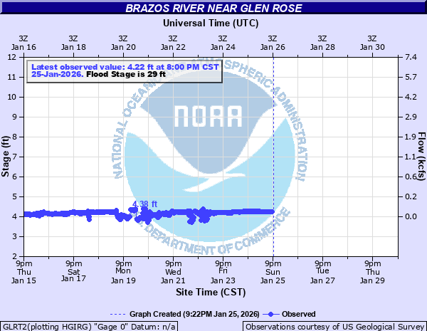
Latest Observation
Updated: 12:00 PM CST 12/15/25
Status: No Flooding
Stage: 4.2 ft
Flow: 0.038 kcfs
Forecast
Forecast not available for this location.
| Time | Stage (ft) | Flow (kcfs) |
|---|---|---|
| 12:00 PM 12/15 | 4.2 | 0.038 |
| 11:45 AM 12/15 | 4.19 | 0.0362 |
| 11:30 AM 12/15 | 4.19 | 0.0362 |
| 11:15 AM 12/15 | 4.19 | 0.0362 |
| 11:00 AM 12/15 | 4.19 | 0.0362 |
| 10:45 AM 12/15 | 4.19 | 0.0362 |
| 10:30 AM 12/15 | 4.18 | 0.0344 |
| 10:15 AM 12/15 | 4.17 | 0.0327 |
| 10:00 AM 12/15 | 4.18 | 0.0344 |
| 9:45 AM 12/15 | 4.18 | 0.0344 |
| 9:30 AM 12/15 | 4.17 | 0.0327 |
| 9:15 AM 12/15 | 4.19 | 0.0362 |
| 9:00 AM 12/15 | 4.18 | 0.0344 |
| 8:45 AM 12/15 | 4.18 | 0.0344 |
| 8:30 AM 12/15 | 4.18 | 0.0344 |
| 8:15 AM 12/15 | 4.18 | 0.0344 |
| 8:00 AM 12/15 | 4.18 | 0.0344 |
| 7:45 AM 12/15 | 4.18 | 0.0344 |
| 7:30 AM 12/15 | 4.18 | 0.0344 |
| 7:15 AM 12/15 | 4.18 | 0.0344 |
| 7:00 AM 12/15 | 4.18 | 0.0344 |
| 6:45 AM 12/15 | 4.18 | 0.0344 |
| 6:30 AM 12/15 | 4.18 | 0.0344 |
| 6:15 AM 12/15 | 4.18 | 0.0344 |
| 6:00 AM 12/15 | 4.19 | 0.0362 |
| 5:45 AM 12/15 | 4.18 | 0.0344 |
| 5:30 AM 12/15 | 4.18 | 0.0344 |
| 5:15 AM 12/15 | 4.18 | 0.0344 |
| 5:00 AM 12/15 | 4.18 | 0.0344 |
| 4:45 AM 12/15 | 4.18 | 0.0344 |
36' -
Major flooding will occur both upstream and downstream from the gage. Rural roads and access roads will be underwater. Farm and ranch lands along the river will be underwater. Recreational facilities will flood.
34' -
Major flooding will occur both upstream and downstream from the gage. Farm and ranch land near the river will be underwater. Rural roads along the river reach will flood. Several houses near the river will flood. Recreational establishments along the river reach will also flood.
32' -
Moderate flooding will occur both upstream and downstream from the gage. Farm and ranch land, as well as several access and rural roads near the river, will be under water.
30' -
Moderate flooding is expected. Houses along the right bank will be flooded, along with access and rural roads. Some farm and ranch land near the river will flood.
29' -
Minor flooding can be expected. Recreational areas near the river will be affected. Several rural roads will begin to flood. Farm and ranch lands near the river will begin to flood.
28' -
No significant flooding is expected, but the right bank will overflow into the lowlands. Private recreational areas near the river on the right bank will be affected.
22' -
Overflow will occur on the low bank. Several private recreational areas near the river will be affected.
| Date | Stage (ft) |
|---|---|
| Apr 28, 1990 | 35.76 |
| Oct 15, 1981 | 35.19 |
| Jun 3, 2016 | 35.17 |
| Dec 21, 1991 | 34 |
| May 27, 1957 | 30 |
| Jun 30, 2007 | 29.98 |
| Jun 27, 2007 | 29.87 |
| May 1, 1922 | 29.5 |
| Feb 22, 1997 | 28.99 |
| Oct 5, 1959 | 28.1 |
| May 4, 1979 | 27.6 |
| May 18, 1989 | 27.08 |
| May 1, 1908 | 27 |
| May 17, 1949 | 26.7 |
| May 3, 1966 | 25.9 |
| Mar 27, 1977 | 25.88 |
| Nov 1, 1974 | 25.42 |
| Jul 29, 1962 | 25.32 |
| Aug 11, 1978 | 24.7 |
| May 18, 1935 | 23.68 |
Data provided by the National Weather Service.