« Back to Monongalia County Rivers
Cheat River at Rowlesburg
Critical Stages
12.5' - Action
16' - Flood
18' - Moderate
22' - Major
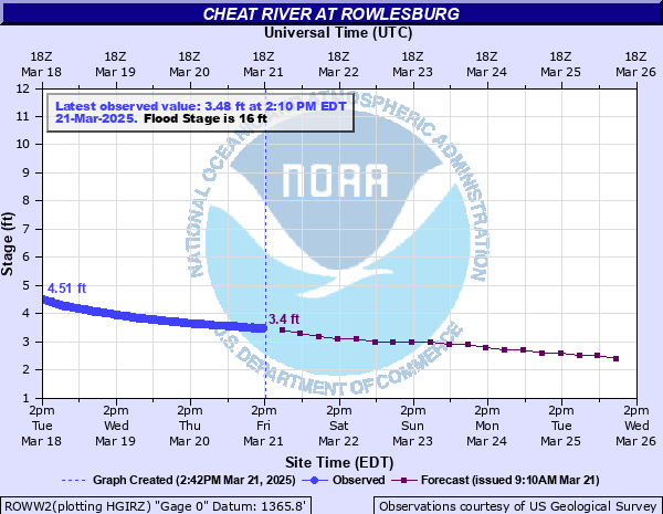
Latest Observation
Updated: 6:55 PM EST 12/15/25
Status: No Flooding
Stage: 2.1 ft
Flow: 0.59 kcfs
Forecast
| Time | Stage (ft) | Flow (kcfs) |
|---|---|---|
| 1 AM 12/16 | 2 | 0.533 |
| 7 AM 12/16 | 1.9 | 0.479 |
| 1 PM 12/16 | 1.9 | 0.479 |
| 7 PM 12/16 | 1.9 | 0.479 |
| 1 AM 12/17 | 1.9 | 0.479 |
| 7 AM 12/17 | 1.9 | 0.479 |
| 1 PM 12/17 | 1.9 | 0.479 |
| 7 PM 12/17 | 1.9 | 0.479 |
| 1 AM 12/18 | 2 | 0.533 |
| 7 AM 12/18 | 2.1 | 0.59 |
| 1 PM 12/18 | 2.2 | 0.649 |
| 7 PM 12/18 | 2.3 | 0.712 |
| 1 AM 12/19 | 2.6 | 0.919 |
| 7 AM 12/19 | 2.8 | 1.07 |
| 1 PM 12/19 | 3 | 1.25 |
| 7 PM 12/19 | 3 | 1.25 |
| 1 AM 12/20 | 3.1 | 1.35 |
| 7 AM 12/20 | 3.1 | 1.35 |
| Time | Stage (ft) | Flow (kcfs) |
|---|---|---|
| 7:10 PM 12/15 | 2.1 | 0.59 |
| 7:05 PM 12/15 | 2.11 | 0.595 |
| 7:00 PM 12/15 | 2.11 | 0.595 |
| 6:55 PM 12/15 | 2.1 | 0.59 |
| 6:50 PM 12/15 | 2.12 | 0.601 |
| 6:45 PM 12/15 | 2.13 | 0.607 |
| 6:40 PM 12/15 | 2.1 | 0.59 |
| 6:35 PM 12/15 | 2.12 | 0.601 |
| 6:30 PM 12/15 | 2.12 | 0.601 |
| 6:25 PM 12/15 | 2.1 | 0.59 |
| 6:20 PM 12/15 | 2.09 | 0.584 |
| 6:15 PM 12/15 | 2.11 | 0.595 |
| 6:10 PM 12/15 | 2.12 | 0.601 |
| 6:05 PM 12/15 | 2.11 | 0.595 |
| 6:00 PM 12/15 | 2.09 | 0.584 |
| 5:55 PM 12/15 | 2.1 | 0.59 |
| 5:50 PM 12/15 | 2.09 | 0.584 |
| 5:45 PM 12/15 | 2.1 | 0.59 |
| 5:40 PM 12/15 | 2.08 | 0.578 |
| 5:35 PM 12/15 | 2.11 | 0.595 |
| 5:30 PM 12/15 | 2.1 | 0.59 |
| 5:25 PM 12/15 | 2.11 | 0.595 |
| 5:20 PM 12/15 | 2.1 | 0.59 |
| 5:10 PM 12/15 | 2.1 | 0.59 |
| 5:05 PM 12/15 | 2.12 | 0.601 |
| 5:00 PM 12/15 | 2.08 | 0.578 |
| 4:55 PM 12/15 | 2.11 | 0.595 |
| 4:50 PM 12/15 | 2.11 | 0.595 |
| 4:45 PM 12/15 | 2.12 | 0.601 |
| 4:40 PM 12/15 | 2.11 | 0.595 |
36.9' -
Water levels reach the historic Election Day Flood of November 5, 1985.
36' -
With the exception of areas like Oak, Maple and Wilson Streets, the entire town of Rowlesburg is under water. Areas closest to the Cheat River are inundated by up to 20 feet of water.
33' -
Water reaches the road deck of the Maple Avenue Bridge (Route 51). Backwater flooding occurs on Saltlick Creek upstream from the confluence of the Cheat River.
30' -
Water surrounds buildings on Maple Avenue (Route 51) east the Maple Avenue Bridge along Saltlick Creek. Parts of East Main Street and Elm Street are covered with 13 feet of water.
28' -
Water covers the intersection at the east end of the Maple Avenue Bridge with County Route 80/8 and Maple Avenue flooded.
25' -
Water reaches the lowest bridge girders on both the railroad bridge and the Maple Avenue Bridge (Route 51). Approximately 3 feet of water covers the east end of Main Street and 8 feet of water on Catherine Street (Route 72) near town park.
24.2' -
Water levels reach the flood levels of the flood of January 19, 1996.
24' -
Water covers portions of Elm, East Main and Catherine Streets in Rowlesburg and Route 72 both South and North of Rowlesburg. Water covers parts of the intersection of Maple Avenue and County Road 80/8 at the east end of the Maple Avenue Bridge. Downstream in Manheim, Center Avenue floods.
23.58' -
Water levels reach the flood levels of the flood of February 9, 1994.
22' -
Route 72 (Buffalo Street) is closed near Feltys Hill at the south end of Rowlesburg. Water approaches the intersection of Maple Street and County Road 80/8 at the east end of the Maple Avenue Bridge.
20' -
Water flows under houses in low lying areas of Rowlesburg. Water affects homes along Poplar, Elm, Catherine, Diamond, Church, Buffalo and Main Streets. Nearly 3 feet of water covers Rowlesburg Town Park ball fields.
18' -
State route 72 is closed at the north end of Rowlesburg, and water surrounds houses near Rowlesburg town park.
16' -
Flooding reaches pavilions in Rowlesburg town park.
15' -
Flooding begins in the Rowlesburg town park.
| Date | Stage (ft) |
|---|---|
| Nov 5, 1985 | 36.9 |
| Jan 19, 1996 | 24.2 |
| Feb 9, 1994 | 23.58 |
| May 8, 1994 | 20.94 |
| Feb 19, 2000 | 20.9 |
| Jul 29, 2017 | 19.75 |
| Jul 19, 1996 | 19.5 |
| Mar 20, 2002 | 19 |
| Jul 31, 1996 | 18.72 |
| Mar 6, 1989 | 18.71 |
| May 27, 1990 | 18.65 |
| May 17, 1996 | 17.5 |
| Jan 26, 2010 | 17.3 |
| Sep 7, 1996 | 17.15 |
| Sep 19, 2003 | 16.8 |
| Feb 1, 2025 | 16.7 |
| Mar 1, 2021 | 16.12 |
| May 16, 2014 | 16.1 |
| Apr 16, 2007 | 16 |
| Oct 16, 1954 | 15.67 |
Data provided by the National Weather Service.