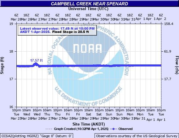
Campbell Creek near Spenard
Critical Stages
19.5' - Action
20.5' - Flood
22.5' - Moderate
Major
Latest Observation
Updated: 10:30 AM AKST 12/9/25
Status: No Flooding
Stage: 19.37 ft
Flow: 0.258 kcfs
Forecast
Forecast not available for this location.
| Time | Stage (ft) | Flow (kcfs) |
|---|---|---|
| 10:45 AM 12/9 | 19.36 | 0.257 |
| 10:30 AM 12/9 | 19.37 | 0.258 |
| 10:15 AM 12/9 | 19.37 | 0.258 |
| 10:00 AM 12/9 | 19.37 | 0.258 |
| 9:45 AM 12/9 | 19.37 | 0.258 |
| 9:30 AM 12/9 | 19.37 | 0.258 |
| 9:15 AM 12/9 | 19.37 | 0.258 |
| 9:00 AM 12/9 | -9999 | -999 |
| 8:45 AM 12/9 | -9999 | -999 |
| 8:30 AM 12/9 | -9999 | -999 |
| 8:15 AM 12/9 | -9999 | -999 |
| 8:00 AM 12/9 | -9999 | -999 |
| 7:45 AM 12/9 | -9999 | -999 |
| 7:30 AM 12/9 | -9999 | -999 |
| 7:15 AM 12/9 | -9999 | -999 |
| 7:00 AM 12/9 | -9999 | -999 |
| 6:45 AM 12/9 | -9999 | -999 |
| 6:30 AM 12/9 | -9999 | -999 |
| 6:15 AM 12/9 | -9999 | -999 |
| 6:00 AM 12/9 | -9999 | -999 |
| 5:45 AM 12/9 | -9999 | -999 |
| 5:30 AM 12/9 | -9999 | -999 |
| 5:15 AM 12/9 | -9999 | -999 |
| 4:45 AM 12/9 | -9999 | -999 |
| 4:30 AM 12/9 | -9999 | -999 |
| 4:15 AM 12/9 | -9999 | -999 |
| 4:00 AM 12/9 | -9999 | -999 |
| 3:45 AM 12/9 | -9999 | -999 |
| 3:30 AM 12/9 | -9999 | -999 |
| 3:15 AM 12/9 | -9999 | -999 |
25' -
Water flows into the crawl space of the house located just upstream of Campbell Ck. and Dowling.
24' -
Bike paths become impassable, parts of trail system close and significant erosion of the bike path. Water encroaches on property owners, including the houses near Dowling, Jim's Burgers, and The Peanut Farm.
22' -
Flooding of bike path along Campbell Creek from Lake Otis to Victor/Dimond. Jim's Burgers floods. Water in the yard of residence just upstream of Campbell Campbell Creek and Dowling.
| Date | Stage (ft) |
|---|---|
| Aug 26, 1989 | 23.04 |
| Sep 21, 2012 | 21.68 |
| Aug 19, 2006 | 21.42 |
| Oct 11, 1986 | 20.89 |
| Oct 6, 2012 | 20.88 |
| Sep 29, 2015 | 20.85 |
| Aug 13, 1981 | 20.58 |
| Aug 9, 1971 | 20.47 |
| Sep 28, 1977 | 20.39 |
| Sep 21, 1976 | 20.33 |
| Jul 13, 1980 | 20.31 |
| Jun 26, 1979 | 20.28 |
| Sep 16, 1982 | 20.21 |
| Jun 16, 2018 | 20.19 |
| Oct 8, 2013 | 20.18 |
| Sep 11, 1975 | 20.18 |
| Sep 21, 2019 | 20.16 |
| Aug 13, 2017 | 20.01 |
| Aug 25, 1984 | 19.99 |
| Jul 24, 2008 | 19.96 |
Data provided by the National Weather Service.