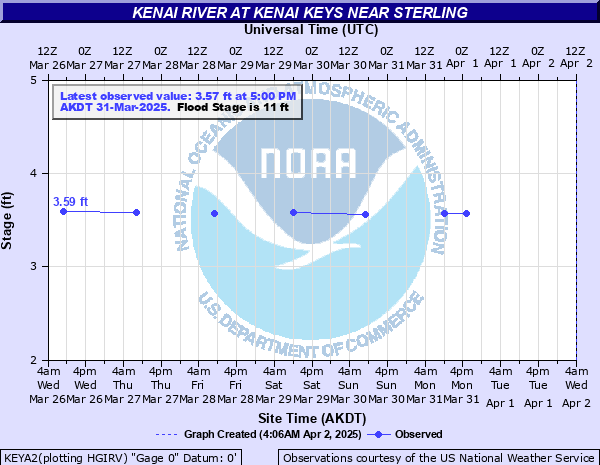
Kenai River at Kenai Keys near Sterling
Critical Stages
10' - Action
11' - Flood
12.5' - Moderate
14' - Major
Latest Observation
Updated: 10:00 AM AKST 12/9/25
Status: No Flooding
Stage: 4.27 ft
Flow: 2.53 kcfs
Forecast
Forecast not available for this location.
| Time | Stage (ft) | Flow (kcfs) |
|---|---|---|
| 10:00 AM 12/9 | 4.27 | 2.53 |
| 8:00 AM 12/8 | 4.48 | 2.82 |
| 9:40 AM 12/7 | 4.48 | 2.82 |
| 8:00 AM 12/5 | 4.49 | 2.83 |
| 9:00 AM 12/4 | 4.5 | 2.85 |
| 9:00 AM 12/3 | 4.56 | 2.93 |
| 9:00 AM 12/2 | 4.57 | 2.94 |
| 8:00 AM 12/1 | 4.59 | 2.97 |
| 8:00 AM 11/30 | 4.59 | 2.97 |
| 8:00 AM 11/29 | 4.62 | 3 |
| 8:00 AM 11/28 | 4.61 | 2.99 |
| 8:00 AM 11/27 | 4.61 | 2.99 |
| 8:00 AM 11/26 | 4.62 | 3 |
| 8:00 AM 11/25 | 4.9 | 3.36 |
| 10:16 AM 11/24 | 4.72 | 3.12 |
| 8:00 AM 11/23 | 4.9 | 3.36 |
| 8:00 AM 11/22 | 4.91 | 3.38 |
| 8:00 AM 11/21 | 5.04 | 3.58 |
| 8:00 AM 11/20 | 5.13 | 3.73 |
| 8:00 AM 11/19 | 5.3 | 3.99 |
| 8:00 AM 11/18 | 5.39 | 4.11 |
| 8:00 AM 11/17 | 5.55 | 4.38 |
| 8:00 AM 11/16 | 5.72 | 4.65 |
| 10:28 AM 11/15 | 5.79 | 4.73 |
| 10:45 AM 11/14 | 6.69 | 6.01 |
| 10:30 AM 11/13 | 6.92 | 6.81 |
| 11:46 AM 11/12 | 7.2 | 7.25 |
| 9:40 AM 11/11 | 7.35 | 7.59 |
| 8:00 AM 11/10 | 7.58 | 8.17 |
13.5' -
Water starts to flow into garages and cabins in the Kenai Keys subdivision; and likely flooding downstream.
13.2' -
In 2012, water was 2 feet deep over Kenai Keys Road, near the entrance to the subdivison.
12' -
Water starts to flow over some of the roads in the Kenai Keys subdivision.
10.75' -
In October of 2020, water was in the lowest lying garages of the Kenai Keys subdivision.
| Date | Stage (ft) |
|---|---|
| Sep 24, 1995 | 15.52 |
| Sep 9, 1977 | 14.909999847412 |
| Sep 3, 1989 | 13.64999961853 |
| Sep 26, 2012 | 13.2 |
| Aug 17, 1979 | 12.939999580383 |
| Oct 24, 2002 | 12.52 |
| Sep 13, 2023 | 11.98 |
| Nov 27, 2002 | 11.98 |
| Aug 13, 1981 | 11.960000038147 |
| Aug 16, 2014 | 11.9 |
| Oct 1, 2012 | 11.82 |
| Aug 1, 2009 | 11.69 |
| Jul 11, 2019 | 11.27 |
| Oct 6, 2020 | 10.75 |
| Jun 22, 2018 | 10.74 |
| Aug 10, 2016 | 10.56 |
| Sep 11, 2011 | 10.51 |
| Jul 30, 2004 | 10.48 |
| Oct 20, 1995 | 10.47 |
| Sep 26, 2017 | 10.42 |
Data provided by the National Weather Service.