« Back to Mount Pleasant Rivers
Tittabawassee River at Midland
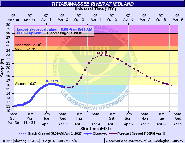
Critical Stages
16' - Action
24' - Flood
25' - Moderate
28' - Major
Latest Observation
Updated: 3:00 PM EST 12/10/25
Status: No Flooding
Stage: 9.43 ft
Flow: 0.616 kcfs
Forecast
Forecast not available for this location.
| Time | Stage (ft) | Flow (kcfs) |
|---|---|---|
| 3:15 PM 12/10 | 9.44 | 0.62 |
| 3:00 PM 12/10 | 9.43 | 0.616 |
| 2:45 PM 12/10 | 9.44 | 0.62 |
| 2:30 PM 12/10 | 9.44 | 0.62 |
| 2:15 PM 12/10 | 9.44 | 0.62 |
| 2:00 PM 12/10 | 9.45 | 0.625 |
| 1:45 PM 12/10 | 9.45 | 0.625 |
| 1:30 PM 12/10 | 9.45 | 0.625 |
| 1:15 PM 12/10 | 9.46 | 0.63 |
| 1:00 PM 12/10 | 9.46 | 0.63 |
| 12:45 PM 12/10 | 9.47 | 0.635 |
| 12:30 PM 12/10 | 9.47 | 0.635 |
| 12:15 PM 12/10 | 9.47 | 0.635 |
| 12:00 PM 12/10 | 9.47 | 0.635 |
| 11:45 AM 12/10 | 9.48 | 0.639 |
| 11:30 AM 12/10 | 9.48 | 0.639 |
| 11:15 AM 12/10 | 9.49 | 0.644 |
| 11:00 AM 12/10 | 9.49 | 0.644 |
| 10:45 AM 12/10 | 9.49 | 0.644 |
| 10:30 AM 12/10 | 9.5 | 0.649 |
| 10:15 AM 12/10 | 9.5 | 0.649 |
| 10:00 AM 12/10 | 9.51 | 0.654 |
| 9:45 AM 12/10 | 9.51 | 0.654 |
| 9:30 AM 12/10 | 9.51 | 0.654 |
| 9:15 AM 12/10 | 9.51 | 0.654 |
| 9:00 AM 12/10 | 9.51 | 0.654 |
| 8:45 AM 12/10 | 9.51 | 0.654 |
| 8:30 AM 12/10 | 9.51 | 0.654 |
| 8:15 AM 12/10 | 9.51 | 0.654 |
| 8:00 AM 12/10 | 9.51 | 0.654 |
33.9' -
Many homes experience overland flooding. Saginaw Road will flood from east of Sturgeon Creek Drive to west of West Main Street. Moorland Drive will flood at Inman Drain.
33' -
West Main Street floods from Main Street to Saginaw Road. Streets north of Isabella and east of Vance Roads will flood. South Saginaw Road floods at Gordonville Road.
32' -
Perrine Road, Gibson, Joanne, Valorie and Belmont Streets flood. Haskin and Emerson Park Drive flood on the west end. West Sugnet Road floods at Snake Creek. Pfeiffer Court floods at the east end. Numri Drive floods at the south end.
31' -
Sturgeon Creek Parkway and Sturgeon Road flood north of Saginaw Road. St. Marys Drive and Marvo Court flood. Sugnet Road floods from east of Valley Drive to West Main Street.
30' -
Valley drive, West Main Street and Tittabawassee Drive at Northwood University floods. West Main Street floods from Main to Sugnet and at Dow High School. Homes in this area begin to flood.
29' -
Sugnet Road and part of West Main Street flood at Sturgeon Creek.
28' -
Several homes along Sturgeon Creek (Valley Drive) begin to flood.
27' -
Sturgeon Creek begins to flood. The parking lot at the foot of Ashman Street floods.
26.5' -
A home on Valley Drive experiences flooding from backup through a footing drain.
26' -
Poseyville Road floods.
25' -
West St. Andrews road floods at Snake Creek.
24.5' -
St. Charles Drive floods.
24' -
Emerson Park, Currie Golf Course, Currie Parkway, Towsley, Benson and River Streets flood. Currie Parkway bridge will likely be closed.
22' -
The river begins to overflow in 4D Incorporated storage yard.
21' -
Emerson Park Drive floods at the east end. Three homes on Bark Lane flood.
20' -
Some river bank overflow begins in isolated areas.
| Date | Stage (ft) |
|---|---|
| May 20, 2020 | 35.05 |
| Sep 13, 1986 | 33.89 |
| Jun 24, 2017 | 32.15 |
| Mar 28, 1916 | 29.7 |
| Mar 21, 1948 | 29.5 |
| Mar 8, 1946 | 28.8 |
| Apr 20, 2013 | 28.37 |
| Apr 15, 2014 | 28.26 |
| Jun 3, 1945 | 28 |
| Apr 4, 1959 | 27.82 |
| Apr 29, 2011 | 27.75 |
| Mar 22, 1976 | 27.6 |
| Feb 22, 2018 | 27.52 |
| Mar 7, 2004 | 27.45 |
| Sep 2, 1975 | 27.08 |
| Apr 1, 1960 | 27.08 |
| Apr 13, 1965 | 26.98 |
| Mar 15, 2006 | 26.97 |
| Apr 13, 2013 | 26.8 |
| Jul 10, 1957 | 26.34 |
Data provided by the National Weather Service.