« Back to Mount Sterling Rivers
Great Miami River at Dayton
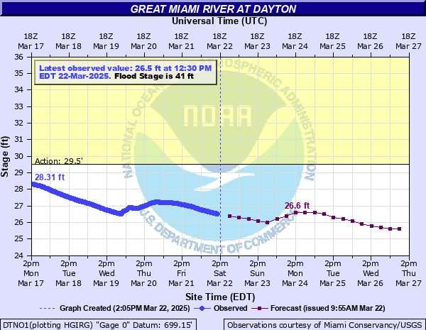
Critical Stages
29.5' - Action
41' - Flood
44' - Moderate
48' - Major
Latest Observation
Updated: 11:30 PM EST 12/4/25
Status: No Flooding
Stage: 23.59 ft
Flow: 0.521 kcfs
Forecast
| Time | Stage (ft) | Flow (kcfs) |
|---|---|---|
| 1 AM 12/5 | 23.5 | 0.486 |
| 7 AM 12/5 | 23.5 | 0.486 |
| 1 PM 12/5 | 23.5 | 0.486 |
| 7 PM 12/5 | 23.4 | 0.448 |
| 1 AM 12/6 | 23.4 | 0.448 |
| 7 AM 12/6 | 23.4 | 0.448 |
| 1 PM 12/6 | 23.4 | 0.448 |
| 7 PM 12/6 | 23.4 | 0.448 |
| 1 AM 12/7 | 23.4 | 0.448 |
| 7 AM 12/7 | 23.4 | 0.448 |
| 1 PM 12/7 | 23.4 | 0.448 |
| 7 PM 12/7 | 23.4 | 0.448 |
| 1 AM 12/8 | 23.4 | 0.448 |
| 7 AM 12/8 | 23.4 | 0.448 |
| 1 PM 12/8 | 23.4 | 0.448 |
| 7 PM 12/8 | 23.4 | 0.448 |
| 1 AM 12/9 | 23.4 | 0.448 |
| 7 AM 12/9 | 23.4 | 0.448 |
| Time | Stage (ft) | Flow (kcfs) |
|---|---|---|
| 11:30 PM 12/4 | 23.59 | 0.521 |
| 11:15 PM 12/4 | 23.59 | 0.521 |
| 11:00 PM 12/4 | 23.59 | 0.521 |
| 10:45 PM 12/4 | 23.59 | 0.521 |
| 10:30 PM 12/4 | 23.59 | 0.521 |
| 10:15 PM 12/4 | 23.6 | 0.525 |
| 10:00 PM 12/4 | 23.6 | 0.525 |
| 9:45 PM 12/4 | 23.6 | 0.525 |
| 9:30 PM 12/4 | 23.6 | 0.525 |
| 9:15 PM 12/4 | 23.6 | 0.525 |
| 9:00 PM 12/4 | 23.6 | 0.525 |
| 8:45 PM 12/4 | 23.6 | 0.525 |
| 8:30 PM 12/4 | 23.6 | 0.525 |
| 8:15 PM 12/4 | 23.6 | 0.525 |
| 8:00 PM 12/4 | 23.6 | 0.525 |
| 7:45 PM 12/4 | 23.6 | 0.525 |
| 7:30 PM 12/4 | 23.6 | 0.525 |
| 7:15 PM 12/4 | 23.6 | 0.525 |
| 7:00 PM 12/4 | 23.6 | 0.525 |
| 6:45 PM 12/4 | 23.6 | 0.525 |
| 6:30 PM 12/4 | 23.6 | 0.525 |
| 6:15 PM 12/4 | 23.6 | 0.525 |
| 6:00 PM 12/4 | 23.6 | 0.525 |
| 5:45 PM 12/4 | 23.6 | 0.525 |
| 5:30 PM 12/4 | 23.6 | 0.525 |
| 5:15 PM 12/4 | 23.6 | 0.525 |
| 5:00 PM 12/4 | 23.6 | 0.525 |
| 4:45 PM 12/4 | 23.6 | 0.525 |
| 4:30 PM 12/4 | 23.6 | 0.525 |
| 4:15 PM 12/4 | 23.6 | 0.525 |
42' -
This is equivalent of the FEMA 0.20r 500 year flood. Flood protection by MCD protects to a stage of 47.4 feet. Low-lying areas in communities south of Dayton along tributaries of the Great Miami River experience flooding, especially from Moraine to near Miamisburg.
41' -
Low lying areas outside of the floodwall experience flooding. Several feet of water now flood Island Metropark at east Helena Street as well as sections of Rip Rap Road near Huber Heights. University of Dayton operates pumps to keep Arena floor from flooding. Much of the city is protected by levees to a stage of 47.4 feet.
40' -
A stop log wall must be installed at Riverscape to prevent the levee in the Riverscape area from being overtopped. The Miami Conservancy District flood protection system provides protection to the City of Dayton up to a river stage of 47.4 feet. There is some flooding outside of flood protected areas such as along Rip Rap Road in Huber Heights.
39.4' -
This is the FEMA 1 percent flood elevation level. The Miami Conservancy District flood protection system provides protection to the City of Dayton up to a river stage of 47.4 feet. This system includes dams and levees on the Great Miami and tributaries. There is flooding outside of flood protected areas along Rip Rap Road in Huber Heights.
34' -
Island Metro Park becomes inundated as well as Helena Street. Several inches of water cover sections of Rip Rap Road near Huber Heights. While there is some groundwater flooding problems near University of Dayton due to the high river level the city of Dayton is protected by a flood wall up to 47.4 feet.
33' -
Island Metro Park and Helena Street experience some flooding as well as portions of Rip Rap Road near Huber Heights. The MCD flood protection system provides protection to the City of Dayton up to a river stage of 47.4 feet. This system includes dams and levees along the Miami River and tributaries in the Dayton area. In addition, some groundwater flooding may occur due to the high river near the University of Dayton.
30' -
Flooding occurs near Rip Rap Road between Bridgewater and Little York Roads near Huber Heights. The MCD flood protection system provides protection to selected areas in the City of Dayton up to a river stage of 47.4 feet. This system provides flood reduction from four dams and reduced risk in leveed areas.
26.5' -
Flooding begins along the bike trail along river in the city.
| Date | Stage (ft) |
|---|---|
| Jan 22, 1959 | 36 |
| Feb 27, 1929 | 35.4 |
| Dec 23, 2013 | 35.21 |
| Jan 7, 2005 | 34.33 |
| Jan 22, 1937 | 34.2 |
| May 14, 1933 | 34 |
| Mar 6, 1963 | 33.7 |
| Apr 6, 2025 | 33.24 |
| Dec 31, 1990 | 33.1 |
| Jun 14, 1958 | 33 |
| Jul 10, 2003 | 32.71 |
| Feb 24, 1975 | 32.5 |
| Feb 22, 1951 | 32 |
| May 27, 1989 | 31.5 |
| Feb 24, 1985 | 31 |
| Jan 24, 1996 | 30.35 |
| May 19, 1995 | 29.8 |
Data provided by the National Weather Service.