« Back to Mount Sterling Rivers
Little Miami River near Spring Valley
Critical Stages
9' - Action
11' - Flood
14' - Moderate
17' - Major
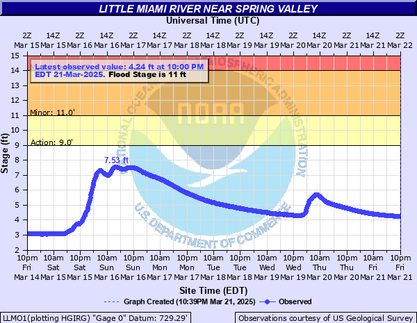
Latest Observation
Updated: 11:00 PM EST 12/4/25
Status: No Flooding
Stage: 2.81 ft
Flow: 0.151 kcfs
Forecast
Forecast not available for this location.
| Time | Stage (ft) | Flow (kcfs) |
|---|---|---|
| 11:00 PM 12/4 | 2.81 | 0.151 |
| 10:45 PM 12/4 | 2.81 | 0.151 |
| 10:30 PM 12/4 | 2.81 | 0.151 |
| 10:15 PM 12/4 | 2.81 | 0.151 |
| 10:00 PM 12/4 | 2.81 | 0.151 |
| 9:45 PM 12/4 | 2.81 | 0.151 |
| 9:30 PM 12/4 | 2.81 | 0.151 |
| 9:15 PM 12/4 | 2.81 | 0.151 |
| 9:00 PM 12/4 | 2.8 | 0.15 |
| 8:45 PM 12/4 | 2.81 | 0.151 |
| 8:30 PM 12/4 | 2.81 | 0.151 |
| 8:15 PM 12/4 | 2.8 | 0.15 |
| 8:00 PM 12/4 | 2.81 | 0.151 |
| 7:45 PM 12/4 | 2.81 | 0.151 |
| 7:30 PM 12/4 | 2.8 | 0.15 |
| 7:15 PM 12/4 | 2.81 | 0.151 |
| 7:00 PM 12/4 | 2.8 | 0.15 |
| 6:45 PM 12/4 | 2.81 | 0.151 |
| 6:30 PM 12/4 | 2.8 | 0.15 |
| 6:15 PM 12/4 | 2.81 | 0.151 |
| 6:00 PM 12/4 | 2.8 | 0.15 |
| 5:45 PM 12/4 | 2.8 | 0.15 |
| 5:30 PM 12/4 | 2.8 | 0.15 |
| 5:15 PM 12/4 | 2.81 | 0.151 |
| 5:00 PM 12/4 | 2.81 | 0.151 |
| 4:45 PM 12/4 | 2.81 | 0.151 |
| 4:30 PM 12/4 | 2.81 | 0.151 |
| 4:15 PM 12/4 | 2.81 | 0.151 |
| 4:00 PM 12/4 | 2.8 | 0.15 |
| 3:45 PM 12/4 | 2.8 | 0.15 |
19' -
This stage is approximate the FEMA 1 percent flood level. Numerous homes are flooded near Corwin Road from Corwin to Oregonia, with areas of Spring Valley flooded between the Little Miami trail and the river, as well as areas of Beavercreek Township. Areas of Bellbrook south of Franklin Street may flood due to backwater along Sugar Creek. The Sugar Creek Waste Water Treatment facility begin incurs partial flooding. A flood of this level is close to the record flood for the region, which occurred in 1959.
17' -
Flooding impacts numerous homes and businesses along the river, as well as backwater flooding along Sugar Creek. Structures near Corwin road from Spring Valley to Corwin are impacted, as well as areas of Beavercreek township close to the river.
15' -
Some homes and businesses near Spring Valley, Roxanna, Oregonia and Corwin are impacted by flooding, possibly first floor level flooding. High water covers long stretches of Corwin Road near the river, as well as Waynesville, New Burlington and Middletown Roads.
14' -
Flood waters approach businesses and some homes near Spring Valley, Roxanna, Oregonia, Corwin and east of Waynesville. Flooding continues along portions of Corwin Road near the river, as well as Waynesville, New Burlington and Middletown Roads. Much of Wayne Township in Warren County is flooded along the river.
13' -
High water impacts low areas near Spring Valley, Roxanna, Corwin and east of Waynesville. Flood waters approach homes very close to the river, and widespread bottom land flooding occurs. Water floods Corwin Road, Waynesville Road and Middletown Road near the river.
12' -
Water rises into low-lying areas close to the river near Spring Valley, Roxanna and east of Waynesville. Water floods Corwin Road, as well as Waynesville and Middletown Roads, along with flooding of Bellbrook golf driving range and portions of Washington Mill Park.
11' -
Flooding impacts short areas of Middletown and Waynesville Roads, in addition to Corwin Road and Corwin Park. Backwater flooding may impact Route 725 in Sugarcreek Township.
10' -
Corwin Road and Corwin Park are flooded.
| Date | Stage (ft) |
|---|---|
| Jan 21, 1959 | 19.2 |
| Mar 5, 1963 | 19.14 |
| Feb 6, 1929 | 16.8 |
| Jan 27, 1952 | 16.75 |
| Feb 14, 1948 | 16.47 |
| Jan 5, 1949 | 16.12 |
| Mar 10, 1964 | 15.79 |
| Mar 6, 1945 | 15.65 |
| Mar 20, 1943 | 15.5 |
| Dec 3, 1950 | 15.34 |
| Jun 2, 1947 | 14.71 |
| Jun 6, 1981 | 14.53 |
| Jun 29, 1980 | 14.51 |
| Jan 5, 2004 | 14.47 |
| Mar 19, 1933 | 14.08 |
| Jan 31, 1982 | 14 |
| Apr 20, 1920 | 13.97 |
| Mar 20, 2008 | 13.91 |
| Jan 6, 1950 | 13.88 |
| Mar 21, 2020 | 13.76 |
Data provided by the National Weather Service.