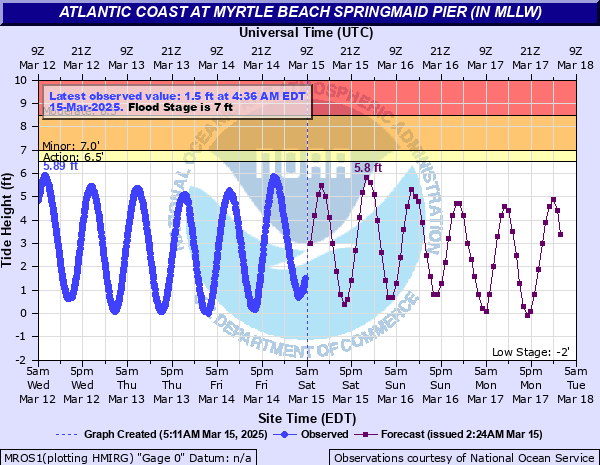
Atlantic Coast at Myrtle Beach Springmaid Pier (IN MLLW)
Critical Stages
6.5' - Action
7' - Flood
8.5' - Moderate
10.5' - Major
Latest Observation
Updated: 10:06 PM EST 12/14/25
Status: No Flooding
Stage: -0.65 ft
Flow: -999 kcfs
Forecast
| Time | Stage (ft) | Flow (kcfs) |
|---|---|---|
| 11 PM 12/14 | -0.3 | -999 |
| 12 AM 12/15 | 0.8 | -999 |
| 1 AM 12/15 | 2.3 | -999 |
| 2 AM 12/15 | 3.8 | -999 |
| 3 AM 12/15 | 4.8 | -999 |
| 4 AM 12/15 | 4.9 | -999 |
| 5 AM 12/15 | 4.3 | -999 |
| 6 AM 12/15 | 3.5 | -999 |
| 7 AM 12/15 | 2.8 | -999 |
| 8 AM 12/15 | 2 | -999 |
| 9 AM 12/15 | 1.4 | -999 |
| 10 AM 12/15 | 1.1 | -999 |
| 11 AM 12/15 | 1.1 | -999 |
| 12 PM 12/15 | 1.4 | -999 |
| 1 PM 12/15 | 2.1 | -999 |
| 2 PM 12/15 | 2.9 | -999 |
| 3 PM 12/15 | 3.6 | -999 |
| 4 PM 12/15 | 4.1 | -999 |
| 5 PM 12/15 | 4 | -999 |
| 6 PM 12/15 | 3.3 | -999 |
| 7 PM 12/15 | 2.4 | -999 |
| 8 PM 12/15 | 1.6 | -999 |
| 9 PM 12/15 | 0.9 | -999 |
| 10 PM 12/15 | 0.5 | -999 |
| 11 PM 12/15 | 0.5 | -999 |
| 12 AM 12/16 | 1.3 | -999 |
| 1 AM 12/16 | 2.1 | -999 |
| 2 AM 12/16 | 3.2 | -999 |
| 3 AM 12/16 | 4.1 | -999 |
| 4 AM 12/16 | 4.7 | -999 |
| 5 AM 12/16 | 4.6 | -999 |
| 6 AM 12/16 | 4.4 | -999 |
| 7 AM 12/16 | 3.7 | -999 |
| 8 AM 12/16 | 2.7 | -999 |
| 9 AM 12/16 | 1.8 | -999 |
| 10 AM 12/16 | 0.9 | -999 |
| 11 AM 12/16 | 0.5 | -999 |
| 12 PM 12/16 | 0.7 | -999 |
| 1 PM 12/16 | 1.4 | -999 |
| 2 PM 12/16 | 2.3 | -999 |
| 3 PM 12/16 | 3.1 | -999 |
| 4 PM 12/16 | 3.7 | -999 |
| 5 PM 12/16 | 3.8 | -999 |
| 6 PM 12/16 | 3.5 | -999 |
| 7 PM 12/16 | 2.9 | -999 |
| 8 PM 12/16 | 2.2 | -999 |
| 9 PM 12/16 | 1.3 | -999 |
| 10 PM 12/16 | 0.6 | -999 |
| 11 PM 12/16 | 0.3 | -999 |
| 12 AM 12/17 | 0.6 | -999 |
| 1 AM 12/17 | 1.2 | -999 |
| 2 AM 12/17 | 2.3 | -999 |
| 3 AM 12/17 | 3.2 | -999 |
| 4 AM 12/17 | 4.4 | -999 |
| 5 AM 12/17 | 5 | -999 |
| 6 AM 12/17 | 4.9 | -999 |
| 7 AM 12/17 | 4.4 | -999 |
| 8 AM 12/17 | 3.4 | -999 |
| 9 AM 12/17 | 2.3 | -999 |
| 10 AM 12/17 | 1.2 | -999 |
| 11 AM 12/17 | 0.4 | -999 |
| 12 PM 12/17 | 0.3 | -999 |
| Time | Stage (ft) | Flow (kcfs) |
|---|---|---|
| 10:18 PM 12/14 | -0.67 | -999 |
| 10:12 PM 12/14 | -0.68 | -999 |
| 10:06 PM 12/14 | -0.65 | -999 |
| 10:00 PM 12/14 | -0.61 | -999 |
| 9:54 PM 12/14 | -0.57 | -999 |
| 9:48 PM 12/14 | -0.56 | -999 |
| 9:42 PM 12/14 | -0.52 | -999 |
| 9:36 PM 12/14 | -0.48 | -999 |
| 9:30 PM 12/14 | -0.43 | -999 |
| 9:24 PM 12/14 | -0.41 | -999 |
| 9:18 PM 12/14 | -0.35 | -999 |
| 9:12 PM 12/14 | -0.26 | -999 |
| 9:06 PM 12/14 | -0.16 | -999 |
| 9:00 PM 12/14 | -0.1 | -999 |
| 8:54 PM 12/14 | -0.07 | -999 |
| 8:48 PM 12/14 | -0.01 | -999 |
| 8:42 PM 12/14 | 0.09 | -999 |
| 8:36 PM 12/14 | 0.2 | -999 |
| 8:30 PM 12/14 | 0.27 | -999 |
| 8:24 PM 12/14 | 0.42 | -999 |
| 8:18 PM 12/14 | 0.51 | -999 |
| 8:12 PM 12/14 | 0.67 | -999 |
| 8:06 PM 12/14 | 0.77 | -999 |
| 8:00 PM 12/14 | 0.88 | -999 |
| 7:54 PM 12/14 | 0.94 | -999 |
| 7:48 PM 12/14 | 1 | -999 |
| 7:42 PM 12/14 | 1.2 | -999 |
| 7:36 PM 12/14 | 1.36 | -999 |
| 7:30 PM 12/14 | 1.55 | -999 |
| 7:24 PM 12/14 | 1.66 | -999 |
15' -
Ocean overwash impacts the entire coast from Myrtle Beach to Garden City and water begins to enter structures on pilings.
12' -
Ocean overwash affects areas with lower dune lines...mainly from Myrtle Beach southward and water enters any ground level beachfront structure.
10.5' -
Ocean overwash in areas unprotected by dunes, including portions Garden City Beach. Water may enter ground level structures in Garden City Beach.
8.5' -
Street flooding continues to deepen and expand on roadways along sounds, swashes, and tidal creeks. Some roads will be impassable. Areas impacted include Cherry Grove between Sea Mountain Highway and Hog Inlet, Shore Drive along Singleton Swash, areas between 48th Avenue South and 46th Avenue South near Whitepoint Swash, North and South Dogwood Drive and adjacent roads in Garden City and Murrells Inlet, and Cypress and Atlantic Avenues in Garden City. Basin Drive and Dolphin Street in Murrells Inlet flood.
8' -
Minor street flooding continues to deepen and expand on roadways near sounds, swashes, and tidal creeks. Some roads may be impassable. This includes areas in Cherry Grove between Sea Mountain Highway and Hog Inlet, Shore Drive along Singleton Swash, areas between 48th Avenue South and 46th Avenue South near Whitepoint Swash, North and South Dogwood Drive and adjacent roads in Garden City and Murrells Inlet, and Cypress and Atlantic Avenues in Garden City. Basin Drive in Murrells Inlet will flood.
7.5' -
Minor street flooding deepens and expands on roadways near sounds, swashes, and tidal creeks. This includes areas in Cherry Grove between Sea Mountain Highway and Hog Inlet, Shore Drive along Singleton Swash, areas between 48th Avenue South and 46th Avenue South near Whitepoint Swash, North and South Dogwood Drive and adjacent roads in Garden City and Murrells Inlet, and Cypress and Atlantic Avenues in Garden City. Basin Drive in Murrells Inlet may begin to flood. Heavy rain near high tide worsens flooding.
7' -
Minor street flooding begins on low-lying roadways along sounds, swashes, and tidal creeks. This includes such areas in Cherry Grove between Sea Mountain Highway and Hog Inlet, Shore Drive along Singleton Swash, multiple locations on North and South Dogwood Drive in Garden City and Murrells Inlet, and both Cypress and Atlantic Avenues in Garden City. Heavy rain near the time of high tide may worsen this flooding or result in flooding of other areas as storm drains back up.
6.5' -
Minor street flooding may begin on North Dogwood Drive in Garden City as water backs up into the storm drains. Heavy rain around the time of high tide would make this flooding worse.
| Date | Stage (ft) |
|---|---|
| Sep 22, 1989 | 16 |
| Oct 8, 2016 | 13.6 |
| Sep 30, 2022 | 10.46 |
| Aug 4, 2020 | 9.83 |
| Dec 17, 2023 | 9.57 |
| Jan 1, 1987 | 9.25 |
| Aug 31, 2023 | 8.92 |
| Nov 24, 2018 | 8.56 |
| Oct 27, 2015 | 8.41 |
| Oct 8, 2016 | 8.37 |
| Nov 7, 2021 | 8.32 |
| Nov 6, 2021 | 8.28 |
| Sep 27, 2015 | 8.24 |
| Nov 15, 2012 | 8.24 |
| Oct 28, 2015 | 8.22 |
| Nov 13, 1981 | 8.2 |
| Dec 16, 2020 | 8.19 |
| Nov 8, 2021 | 8.13 |
| Sep 11, 2017 | 8.12 |
| Dec 22, 2022 | 8.11 |
Data provided by the National Weather Service.