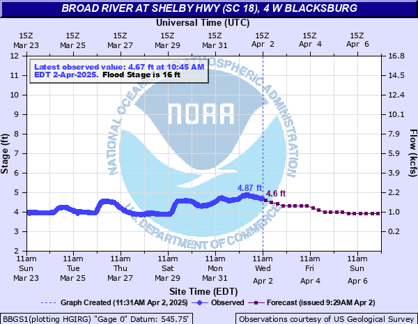
Broad River at Shelby Hwy (SC 18), 4 W Blacksburg
Critical Stages
13' - Action
16' - Flood
22' - Moderate
25' - Major
Latest Observation
Updated: 10:00 AM EST 12/6/25
Status: No Flooding
Stage: 3.03 ft
Flow: 0.453 kcfs
Forecast
Forecast not available for this location.
| Time | Stage (ft) | Flow (kcfs) |
|---|---|---|
| 10:15 AM 12/6 | 3.04 | 0.46 |
| 10:00 AM 12/6 | 3.03 | 0.453 |
| 9:45 AM 12/6 | 3.03 | 0.453 |
| 9:30 AM 12/6 | 3.02 | 0.447 |
| 9:15 AM 12/6 | 3.02 | 0.447 |
| 9:00 AM 12/6 | 3.02 | 0.447 |
| 8:45 AM 12/6 | 3.01 | 0.44 |
| 8:30 AM 12/6 | 3 | 0.434 |
| 8:15 AM 12/6 | 3 | 0.434 |
| 8:00 AM 12/6 | 3 | 0.434 |
| 7:45 AM 12/6 | 3 | 0.434 |
| 7:30 AM 12/6 | 2.99 | 0.428 |
| 7:15 AM 12/6 | 2.99 | 0.428 |
| 7:00 AM 12/6 | 2.98 | 0.421 |
| 6:45 AM 12/6 | 2.98 | 0.421 |
| 6:30 AM 12/6 | 2.98 | 0.421 |
| 6:15 AM 12/6 | 2.97 | 0.415 |
| 6:00 AM 12/6 | 2.98 | 0.421 |
| 5:45 AM 12/6 | 2.98 | 0.421 |
| 5:30 AM 12/6 | 2.97 | 0.415 |
| 5:15 AM 12/6 | 2.98 | 0.421 |
| 5:00 AM 12/6 | 2.97 | 0.415 |
| 4:45 AM 12/6 | 2.97 | 0.415 |
| 4:30 AM 12/6 | 2.97 | 0.415 |
| 4:15 AM 12/6 | 2.97 | 0.415 |
| 4:00 AM 12/6 | 2.97 | 0.415 |
| 3:45 AM 12/6 | 2.97 | 0.415 |
| 3:30 AM 12/6 | 2.97 | 0.415 |
| 3:15 AM 12/6 | 2.97 | 0.415 |
| 3:00 AM 12/6 | 2.97 | 0.415 |
32' -
Major Flooding continues. The Broad River may be reaching the Highway 18 bridge adjacent to the streamgauge site.
25' -
Major Flood Stage. Record flooding is ongoing.
24' -
Moderate Flooding continues. The Broad River may be significantly restricting operations at Lockhart Dam and may be overtopping Cherokee Falls Dam.
22' -
Moderate Flood Stage. Floodwaters are approaching the Gaston Shoals powerhouse and extensive flooding of the adjacent parking lot and fishing access is ongoing. The Broad River is at levels similar to those that occurred in September 2004 due to Hurricane Frances.
20' -
Minor Flooding continues. The Cherokee Falls Hydro Project operations may be impacted by excessively high flows. Floodwaters may be impacting access to the Cherokee Falls powerhouse and inundating residential yards adjacent to the river.
19.5' -
Minor Flooding continues. Several secondary roads near the river may be inundated.
18' -
Minor Flooding continues. The Broad River may be approaching Wolf Den Rd. Floodwaters may be inundating Little Hope Rd. and River Rd.
16' -
Minor Flood Stage. The Broad River may be flooding River Rd. and Little Hope Rd. near US 29. Farmland flooding is continuing adjacent to the river.
15' -
Action Stage Flooding continues. The Broad River may be approaching River Rd. and Little Hope Rd. near US 29. Adjacent farmland and low-lying area flooding is continuing.
14' -
Action Stage Flooding continues. At this level, minor flooding of low-lying farmland along the river may be ongoing. Areas along Buffalo Breek may be beginning to flood due to backwater effects.
13' -
Action Stage. The Broad River may be overflowing its banks and flooding adjacent low-lying areas.
| Date | Stage (ft) |
|---|---|
| Sep 28, 2024 | 26.23 |
| Feb 7, 2020 | 24.18 |
| Sep 8, 2004 | 21.92 |
| Jan 10, 2024 | 21.12 |
| Mar 20, 2003 | 21.06 |
| May 6, 2013 | 19.75 |
| Jan 25, 2010 | 18.31 |
| Oct 8, 2005 | 17.67 |
| Dec 10, 2004 | 16.65 |
| Jul 8, 2005 | 16.2 |
| Dec 27, 2023 | 15.62 |
| Nov 12, 2009 | 15.44 |
| Jan 18, 2013 | 15.09 |
| Mar 2, 2007 | 13.97 |
| Mar 9, 1998 | 13.72 |
| Dec 23, 2013 | 12.8 |
| Jan 9, 1998 | 12.49 |
| Jan 28, 1998 | 12.04 |
| Mar 21, 2000 | 12.01 |
| Dec 1, 2010 | 11.28 |
Data provided by the National Weather Service.