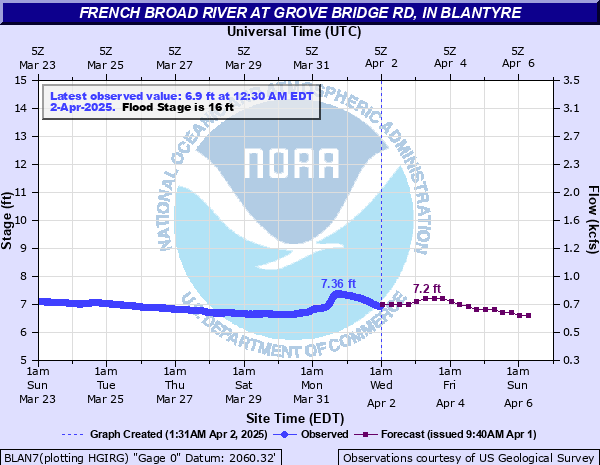
French Broad River at Grove Bridge Rd, in Blantyre
Critical Stages
15' - Action
16' - Flood
19' - Moderate
23' - Major
Latest Observation
Updated: 9:30 AM EST 12/6/25
Status: No Flooding
Stage: 6.01 ft
Flow: 0.491 kcfs
Forecast
| Time | Stage (ft) | Flow (kcfs) |
|---|---|---|
| 1 PM 12/6 | 6 | 0.489 |
| 7 PM 12/6 | 6 | 0.489 |
| 1 AM 12/7 | 6 | 0.489 |
| 7 AM 12/7 | 5.9 | 0.47 |
| 1 PM 12/7 | 5.9 | 0.47 |
| 7 PM 12/7 | 5.9 | 0.47 |
| 1 AM 12/8 | 5.9 | 0.47 |
| 7 AM 12/8 | 5.9 | 0.47 |
| 1 PM 12/8 | 5.9 | 0.47 |
| 7 PM 12/8 | 5.9 | 0.47 |
| 1 AM 12/9 | 5.8 | 0.452 |
| 7 AM 12/9 | 5.8 | 0.452 |
| 1 PM 12/9 | 5.8 | 0.452 |
| 7 PM 12/9 | 5.8 | 0.452 |
| 1 AM 12/10 | 5.8 | 0.452 |
| 7 AM 12/10 | 5.8 | 0.452 |
| 1 PM 12/10 | 5.8 | 0.452 |
| 7 PM 12/10 | 5.8 | 0.452 |
| 1 AM 12/11 | 5.7 | 0.433 |
| 7 AM 12/11 | 5.7 | 0.433 |
| Time | Stage (ft) | Flow (kcfs) |
|---|---|---|
| 9:30 AM 12/6 | 6.01 | 0.491 |
| 9:15 AM 12/6 | 6.01 | 0.491 |
| 9:00 AM 12/6 | 6.01 | 0.491 |
| 8:45 AM 12/6 | 6.02 | 0.493 |
| 8:30 AM 12/6 | 6.02 | 0.493 |
| 8:15 AM 12/6 | 6.02 | 0.493 |
| 8:00 AM 12/6 | 6.03 | 0.495 |
| 7:45 AM 12/6 | 6.03 | 0.495 |
| 7:30 AM 12/6 | 6.03 | 0.495 |
| 7:15 AM 12/6 | 6.04 | 0.497 |
| 7:00 AM 12/6 | 6.04 | 0.497 |
| 6:45 AM 12/6 | 6.04 | 0.497 |
| 6:30 AM 12/6 | 6.04 | 0.497 |
| 6:15 AM 12/6 | 6.04 | 0.497 |
| 6:00 AM 12/6 | 6.04 | 0.497 |
| 5:45 AM 12/6 | 6.05 | 0.499 |
| 5:30 AM 12/6 | 6.05 | 0.499 |
| 5:15 AM 12/6 | 6.05 | 0.499 |
| 5:00 AM 12/6 | 6.05 | 0.499 |
| 4:45 AM 12/6 | 6.05 | 0.499 |
| 4:30 AM 12/6 | 6.05 | 0.499 |
| 4:15 AM 12/6 | 6.05 | 0.499 |
| 4:00 AM 12/6 | 6.05 | 0.499 |
| 3:45 AM 12/6 | 6.05 | 0.499 |
| 3:30 AM 12/6 | 6.05 | 0.499 |
| 3:15 AM 12/6 | 6.05 | 0.499 |
| 3:00 AM 12/6 | 6.05 | 0.499 |
| 2:45 AM 12/6 | 6.05 | 0.499 |
| 2:30 AM 12/6 | 6.06 | 0.501 |
| 2:15 AM 12/6 | 6.06 | 0.501 |
31' -
Record Flooding continues. The bridge at Grove Bridge Rd. and the adjacent gauge site will be inundated.
27.1' -
Record Flood Stage. At this level, floodwaters are likely impacting nearby homes and commercial buildings.
25.5' -
Major Flooding continues. Floodwater levels will be similar to levels that occurred on September 9 , 2004 with Hurricane Frances.
23' -
Major Flood Stage. Significant flooding of secondary roads is likely ongoing. Floodwaters may be inundating portions of US 64. Homes and commercial buildings within the vicinity of US 64 and adjacent secondary roads may be threatened by approaching or rising floodwaters. Floodwaters will reach levels similar to 1994 with Tropical Storm Beryl.
21' -
Moderate Flooding continues. Significant flooding of farmland along the French Broad River is ongoing. Floodwaters are inundating River Rd. and Big Willow Rd. and are likely threatening other roads in the local area including Grove Bridge Rd., Pleasant Grove Rd. and Tally Rd. Floodwaters will be approaching levels similar to levels reached on September 22, 2009.
20' -
Moderate Flooding continues. Significant flooding of farmland along the French Broad River is ongoing. Floodwaters may begin inundating the trailer park on River Ridge Rd. and may be impacting some buildings along US 64 north of Grove Bridge Rd.
19.01' -
...impacts continued from 19.0 statement... Floodwaters may be threatening a trailer park on River Ridge Rd. Floodwaters may be approaching buildings north of Grove Bridge Rd along US 64 and along the river near Brevard. Associated tributaries, including the Little River near Penrose, are likely experiencing significant flooding due to high water levels on the French Broad River.
19' -
Moderate Flood Stage. Extensive flooding of the upper French Broad River Valley is ongoing, resulting in significant farmland inundation and affecting several roads between Rosman and Horse Shoe. Parts of Lyons Mountain Rd, Hannah Ford Rd, Green Rd, Island Ford Rd, Barclay Rd, Wilson Rd, Poplar Ln, River Rd, Pleasant Grove Rd, Butler Bridge Rd, and Big Willow Rd are likely inundated by at least 1-3 feet of floodwaters. Impacts continued in 19.01 statement...
18' -
Minor Flooding continues. Widespread farmland flooding between the French Broad River and the old railroad bed is ongoing. The river may be overtopping the old railroad bed near Fodderstack Mountain Rd. and River Ridge Rd. The intersection of River Rd. and Big Willow Rd. is inundated with several inches of water.
17' -
Minor Flooding continues. Floodwaters continue to inundate farmland between the French Broad River and the old railroad bed. Floodwaters may start to inundate the shoulders of River Road near the Big Willow Road intersection. Floodwaters continue to impact boat access areas at Grove Bridge Rd. and Crab Creek Rd.
16' -
Minor Flood Stage. Farmland flooding continues on both sides of the French Broad River. Floodwaters begin to impact boat access areas at Grove Bridge Rd. and Crab Creek Rd.
15' -
Action Stage. Most farm fields are flooding between the French Broad River and Brevard Rd. and between the French Broad River and Pleasant Grove Rd.
| Date | Stage (ft) |
|---|---|
| Sep 28, 2024 | 28.43 |
| Jul 16, 1916 | 27.1 |
| Sep 9, 2004 | 25.81 |
| Oct 4, 1964 | 25.5 |
| Aug 18, 1994 | 23.81 |
| Aug 13, 1994 | 23 |
| Aug 16, 1928 | 22.9 |
| Jan 8, 1998 | 22.61 |
| Mar 5, 1979 | 22.01 |
| Jan 23, 1906 | 22 |
| Aug 13, 1940 | 21.88 |
| Dec 29, 2018 | 21.7 |
| May 28, 1973 | 21.41 |
| Sep 30, 1964 | 21.27 |
| May 29, 1976 | 21.12 |
| Feb 13, 1966 | 21.11 |
| Sep 22, 2009 | 21.08 |
| Aug 31, 1910 | 21 |
| Jun 5, 1967 | 20.9 |
| Aug 24, 1967 | 20.75 |
Data provided by the National Weather Service.