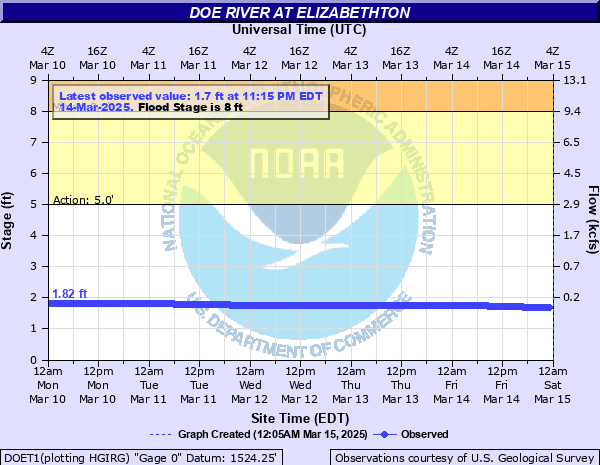
Doe River at Elizabethton
Critical Stages
5' - Action
8' - Flood
9' - Moderate
10' - Major
Latest Observation
Updated: 10:15 AM EST 12/6/25
Status: No Flooding
Stage: 1.54 ft
Flow: 0.323 kcfs
Forecast
Forecast not available for this location.
| Time | Stage (ft) | Flow (kcfs) |
|---|---|---|
| 10:15 AM 12/6 | 1.54 | 0.323 |
| 10:00 AM 12/6 | 1.54 | 0.323 |
| 9:45 AM 12/6 | 1.54 | 0.323 |
| 9:30 AM 12/6 | 1.54 | 0.323 |
| 9:15 AM 12/6 | 1.54 | 0.323 |
| 9:00 AM 12/6 | 1.54 | 0.323 |
| 8:45 AM 12/6 | 1.54 | 0.323 |
| 8:30 AM 12/6 | 1.54 | 0.323 |
| 8:15 AM 12/6 | 1.54 | 0.323 |
| 8:00 AM 12/6 | 1.54 | 0.323 |
| 7:45 AM 12/6 | 1.54 | 0.323 |
| 7:30 AM 12/6 | 1.54 | 0.323 |
| 7:15 AM 12/6 | 1.54 | 0.323 |
| 7:00 AM 12/6 | 1.54 | 0.323 |
| 6:45 AM 12/6 | 1.54 | 0.323 |
| 6:30 AM 12/6 | 1.54 | 0.323 |
| 6:15 AM 12/6 | 1.54 | 0.323 |
| 6:00 AM 12/6 | 1.54 | 0.323 |
| 5:45 AM 12/6 | 1.54 | 0.323 |
| 5:30 AM 12/6 | 1.54 | 0.323 |
| 5:15 AM 12/6 | 1.54 | 0.323 |
| 5:00 AM 12/6 | 1.54 | 0.323 |
| 4:45 AM 12/6 | 1.54 | 0.323 |
| 4:30 AM 12/6 | 1.54 | 0.323 |
| 4:15 AM 12/6 | 1.54 | 0.323 |
| 4:00 AM 12/6 | 1.54 | 0.323 |
| 3:45 AM 12/6 | 1.54 | 0.323 |
| 3:30 AM 12/6 | 1.54 | 0.323 |
| 3:15 AM 12/6 | 1.54 | 0.323 |
| 3:00 AM 12/6 | 1.54 | 0.323 |
12.5' -
Floor of the gage well house. The Elizabethton Food City store might take water.
12' -
Catastrophic flooding never before seen. Multiplied dozens of homes and structures flood all along the river. The river reaches the road surface of the Rod Jenkins Bridge. Many homes along River Road and Edgewater Road are flooded. The covered bridge in Elizabethton may be damaged.
11.1' -
The Elizabethton Food City parking lot floods but the store does not.
11' -
Extensive Helene-like flooding from Roan Mountain to Hampton to Elizabethton. Main St in Roan Mountain floods. Hampton High School property is inundated, some structures take water. A split level home on Spring Street in Hampton takes 4 ft of water, others also flood. Elizabethton experiences inundation between the Doe River and Hwy 19E from Cat Island Park to the Watauga River, including the Detention Center property, Broad St near Hwy 19E, as well as points upstream. Rivers Edge Fellowship church floods.
10.5' -
Water may reach floors of some homes on the east side of the river, from South Main Street across from the gage house, downstream to Third Street at the covered bridge. Water also reaches the bottom of the side walls of the covered bridge. The river reaches the bottoms of the Rod Jenkins Bridge and the Long Hollow Road bridge. Some homes along River Road and Edgewater Road may begin to take water. Flooding along Riverview Drive.
10' -
Flood waters may be spilling into the Cat Island Park area and the surrounding streets.
8' -
Flooding of yards along the river, including on South Main Street, River Road, and streamside of Edgewater Road. Flooding possible of some structures on Spring Street in Hampton. Often there are initial flash flooding problems around the Roan Mountain community for this Elizabethton gage to reach this stage afterward.
| Date | Stage (ft) |
|---|---|
| Sep 27, 2024 | 11.1 |
| Jan 8, 1998 | 10.92 |
| May 21, 1901 | 10.5 |
| Nov 6, 1977 | 9.34 |
| Nov 19, 2003 | 8.2 |
| Jan 14, 1995 | 7.9 |
| Mar 26, 1965 | 7.35 |
| Mar 12, 1963 | 7.31 |
| Apr 13, 2020 | 7.21 |
| Dec 28, 2018 | 6.68 |
| Oct 23, 2017 | 6.14 |
| Feb 6, 2020 | 6.05 |
| Feb 23, 2019 | 6.02 |
Data provided by the National Weather Service.