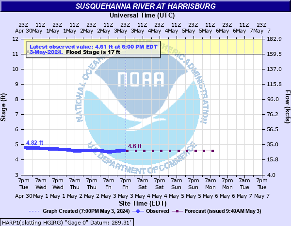
Susquehanna River at Harrisburg
Critical Stages
11' - Action
17' - Flood
20' - Moderate
23' - Major
Latest Observation
Updated: 8:00 AM EST 12/6/25
Status: No Flooding
Stage: 3.76 ft
Flow: 12.3 kcfs
Forecast
| Time | Stage (ft) | Flow (kcfs) |
|---|---|---|
| 1 PM 12/6 | 3.8 | 12.9 |
| 7 PM 12/6 | 3.7 | 11.5 |
| 1 AM 12/7 | 3.7 | 11.5 |
| 7 AM 12/7 | 3.7 | 11.5 |
| 1 PM 12/7 | 3.7 | 11.5 |
| 7 PM 12/7 | 3.7 | 11.5 |
| 1 AM 12/8 | 3.7 | 11.5 |
| 7 AM 12/8 | 3.7 | 11.5 |
| Time | Stage (ft) | Flow (kcfs) |
|---|---|---|
| 8:00 AM 12/6 | 3.76 | 12.3 |
| 7:30 AM 12/6 | 3.76 | 12.3 |
| 7:00 AM 12/6 | 3.76 | 12.3 |
| 6:30 AM 12/6 | 3.76 | 12.3 |
| 6:00 AM 12/6 | 3.76 | 12.3 |
| 5:30 AM 12/6 | 3.76 | 12.3 |
| 5:00 AM 12/6 | 3.76 | 12.3 |
| 4:30 AM 12/6 | 3.76 | 12.3 |
| 4:00 AM 12/6 | 3.76 | 12.3 |
| 3:30 AM 12/6 | 3.76 | 12.3 |
| 3:00 AM 12/6 | 3.76 | 12.3 |
| 2:30 AM 12/6 | 3.77 | 12.4 |
| 2:00 AM 12/6 | 3.77 | 12.4 |
| 1:30 AM 12/6 | 3.77 | 12.4 |
| 1:00 AM 12/6 | 3.77 | 12.4 |
| 12:30 AM 12/6 | 3.77 | 12.4 |
| 12:00 AM 12/6 | 3.77 | 12.4 |
| 11:30 PM 12/5 | 3.77 | 12.4 |
| 11:00 PM 12/5 | 3.77 | 12.4 |
| 10:30 PM 12/5 | 3.77 | 12.4 |
| 10:00 PM 12/5 | 3.77 | 12.4 |
| 9:30 PM 12/5 | 3.77 | 12.4 |
| 9:00 PM 12/5 | 3.77 | 12.4 |
| 8:30 PM 12/5 | 3.77 | 12.4 |
| 8:00 PM 12/5 | 3.77 | 12.4 |
| 7:30 PM 12/5 | 3.77 | 12.4 |
| 7:00 PM 12/5 | 3.77 | 12.4 |
| 6:30 PM 12/5 | 3.78 | 12.6 |
| 6:00 PM 12/5 | 3.78 | 12.6 |
| 5:30 PM 12/5 | 3.78 | 12.6 |
37' -
FEMA 0.2 0X0P+0nnual Chance Flood Level (500 year flood).
35' -
Flood waters begin to reach the Harvey Taylor Bridge.
33.3' -
Flood of record from Hurricane Agnes in 1972.
32' -
Widespread flooding occurs on both banks. The square and central business district in Harrisburg begin to be affected.
30' -
Widespread flooding occurs on both banks.
29' -
FEMA 1 0X0P+0nnual Chance Flood Level (100-year flood). Flood waters begin to reach the Market Street Bridge.
28' -
Widespread flooding occurs in the residential sections of Front and Second Streets and in the Shipoke area of Harrisburg. Flooding reaches Italian Lake Park in Harrisburg.
26' -
FEMA 2 0X0P+0nnual Chance Flood Level (50-year flood). Flood waters begin to reach the Walnut Street Bridge. Green and Vaughn Streets flood.
24' -
The residential section of Front and Second Streets in Harrisburg flood at this level. Cameron Street in Harrisburg floods due to backwater from Paxton Creek.
23' -
Evacuations are necessary in the Shipoke area of Harrisburg. Listen to local emergency officials for specific details. The water level reaches the corner of Kelker and Front Streets. Delaware Street, Geiger Street and Maclay Streets may also be impacted.
22.5' -
US 22/322 in the vicinity of the Dauphin Narrows is impacted by flood waters.
21' -
Homes on both banks are affected by high water. This is the approximate level of Routes 11 and 15, upstream of the Market Street Bridge. Flood waters begin to reach South Main Street in Marysville.
20.5' -
FEMA 10 0X0P+0nnual Chance Flood Level (10-year flood).
20' -
Riverfront Park in Harrisburgh begins to flood.
19' -
A number of homes in West Fairview, Dauphin, and Harrisburg flood. Flood waters begin to reach Front Street in East Pennsboro Township in Cumberland County.
17' -
Basements of residences and businesses on both banks flood. The parking lot on City Island begins to take on water.
15' -
The recreation area of City Island is evacuated. River interests are encouraged to monitor conditions.
13' -
The recreation area on City Island is evacuated. River interests are encouraged to monitor conditions.
11' -
Recreational use of City Island begins to be curtailed. River interests are encouraged to monitor conditions.
| Date | Stage (ft) |
|---|---|
| Jun 24, 1972 | 33.27 |
| Mar 19, 1936 | 29.23 |
| Jun 2, 1889 | 26.8 |
| May 22, 1894 | 25.7 |
| Sep 9, 2011 | 25.17 |
| Jan 20, 1996 | 25.08 |
| Jan 21, 1996 | 24.66 |
| Sep 19, 2004 | 24.4 |
| Sep 27, 1975 | 23.81 |
| May 29, 1946 | 21.8 |
| Mar 12, 1964 | 21.51 |
| Feb 16, 1984 | 20.74 |
| Mar 13, 1936 | 20.52 |
| Apr 2, 1993 | 20.5 |
| Mar 7, 1979 | 20.43 |
| Mar 12, 2011 | 20.09 |
| Apr 2, 1940 | 19.8 |
| Jun 29, 2006 | 19.66 |
| Jan 1, 1943 | 19.4 |
| Nov 27, 1950 | 19.3 |
Data provided by the National Weather Service.