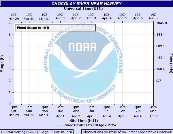
Chocolay River near Harvey
Critical Stages
9.5' - Action
10' - Flood
11.5' - Moderate
13' - Major
Latest Observation
Updated: 7:03 PM LMT 12/31/00
Status: Obs Not Current
Stage: -999 ft
Flow: -999 kcfs
Forecast
Forecast not available for this location.
Observation history not available.
14.5' -
Water reaches the bottom of the M-28 bridge
13.5' -
Green Garden Road may be closed. Mangum Road will be covered in water and may be closed. Flood waters reach the April 1985 high water mark
12' -
Homes in low-lying areas along Riverside Road and homes in the 200 block of Timber Lane will be inundated. Backwater effects near the mouth of the river may impact homes on Motel Drive
11.5' -
The fishing pier and parking lot near the M-28 bridge will be under water. Timber Lane and Riverside Road may be closed. Homes along Timber Lane...and some along Riverside Road...will experience extensive flooding
10' -
Water inundates the entire parking lot at the M-28 bridge...and the fishing pier begins to be submerged. Water inundates low lying areas along Timber Lane and Riverside Road downstream of the river gauge site
9' -
Water begins to inundate the parking lot where M-28 crosses the Chocolay River...as well as low lying areas along Timber Lane and towards the mouth of the river
| Date | Stage (ft) |
|---|---|
| Apr 20, 1985 | 13.5 |
| May 13, 2006 | 11.7 |
| Nov 7, 1988 | 11.05 |
| Oct 19, 2016 | 10.84 |
| Sep 6, 2018 | 10.8 |
| Apr 13, 2023 | 10.35 |
| Apr 15, 2022 | 10.34 |
| Apr 16, 2002 | 10.1 |
| Apr 29, 2013 | 10.06 |
| Apr 12, 2011 | 9.96 |
| Mar 16, 1990 | 9.65 |
| Apr 14, 2015 | 9.5 |
| Apr 7, 1997 | 9.46 |
| Apr 19, 2008 | 9.4 |
| Apr 19, 2001 | 9.4 |
| Apr 26, 1996 | 9.27 |
| Apr 22, 1992 | 9.09 |
| Mar 31, 1998 | 8.8 |
| Jun 24, 2024 | 8.62 |
| Mar 27, 2007 | 8.56 |
Data provided by the National Weather Service.