« Back to New Saint Marcus Cemetery Rivers
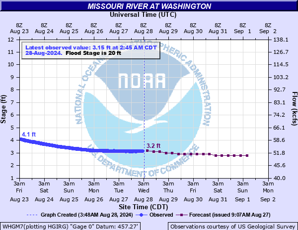
Missouri River at Washington
Critical Stages
18' - Action
20' - Flood
28' - Moderate
31' - Major
Latest Observation
Updated: 6:45 AM CST 12/6/25
Status: No Flooding
Stage: 1.1 ft
Flow: 37.1 kcfs
Forecast
| Time | Stage (ft) | Flow (kcfs) |
|---|---|---|
| 12 PM 12/6 | 1.1 | 37.1 |
| 6 PM 12/6 | 1 | 36.6 |
| 12 AM 12/7 | 0.8 | 35.5 |
| 6 AM 12/7 | 0.7 | 35 |
| 12 PM 12/7 | 0.6 | 34.5 |
| 6 PM 12/7 | 0.5 | 34 |
| 12 AM 12/8 | 0.4 | 33.5 |
| 6 AM 12/8 | 0.3 | 33 |
| 12 PM 12/8 | 0.3 | 33 |
| 6 PM 12/8 | 0.2 | 32.5 |
| 12 AM 12/9 | 0.2 | 32.5 |
| 6 AM 12/9 | 0.2 | 32.5 |
| 12 PM 12/9 | 0.1 | 32 |
| 6 PM 12/9 | 0.1 | 32 |
| 12 AM 12/10 | 0.1 | 32 |
| 6 AM 12/10 | 0.1 | 32 |
| Time | Stage (ft) | Flow (kcfs) |
|---|---|---|
| 6:45 AM 12/6 | 1.1 | 37.1 |
| 6:30 AM 12/6 | 1.11 | 37.2 |
| 6:15 AM 12/6 | 1.11 | 37.2 |
| 6:00 AM 12/6 | 1.12 | 37.2 |
| 5:45 AM 12/6 | 1.12 | 37.2 |
| 5:30 AM 12/6 | 1.13 | 37.3 |
| 5:15 AM 12/6 | 1.12 | 37.2 |
| 5:00 AM 12/6 | 1.14 | 37.3 |
| 4:45 AM 12/6 | 1.14 | 37.3 |
| 4:30 AM 12/6 | 1.13 | 37.3 |
| 4:15 AM 12/6 | 1.13 | 37.3 |
| 4:00 AM 12/6 | 1.15 | 37.4 |
| 3:45 AM 12/6 | 1.15 | 37.4 |
| 3:30 AM 12/6 | 1.15 | 37.4 |
| 3:15 AM 12/6 | 1.17 | 37.5 |
| 3:00 AM 12/6 | 1.16 | 37.5 |
| 2:45 AM 12/6 | 1.17 | 37.5 |
| 2:30 AM 12/6 | 1.16 | 37.5 |
| 2:15 AM 12/6 | 1.19 | 37.6 |
| 2:00 AM 12/6 | 1.18 | 37.6 |
| 1:45 AM 12/6 | 1.19 | 37.6 |
| 1:30 AM 12/6 | 1.2 | 37.7 |
| 1:15 AM 12/6 | 1.2 | 37.7 |
| 1:00 AM 12/6 | 1.19 | 37.6 |
| 12:45 AM 12/6 | 1.2 | 37.7 |
| 12:30 AM 12/6 | 1.2 | 37.7 |
| 12:15 AM 12/6 | 1.21 | 37.7 |
| 12:00 AM 12/6 | 1.22 | 37.8 |
| 11:45 PM 12/5 | 1.22 | 37.8 |
| 11:30 PM 12/5 | 1.22 | 37.8 |
34.5' -
The railroad crossing at Lafayette Street floods near this height.
34' -
The main office and the RIAS pump building at the old Water Treatment Plant flood near this height.
33' -
Union Pacific Railroad tracks begin to flood in town.
32.5' -
Missouri Valley Levee District Section 1 protecting farms between Treloar and Marthasville is overtopped near this height.
32' -
The Highway 47 bridge closes near this height. Southbend Drive between Ninth Street and Steamboat Street closes near this height. Secondary buildings at the old Water Treatment Plant flood. The Missouri Valley Levee District Section 2 south of Marthasville will overtop near this height.
31.9' -
Ninth Street and International Avenue begin flooding near this height.
30.9' -
Westlink Drive begins flooding near the recycling center.
30.2' -
East Fifth Street at Old Highway 100 and Westlink Drive between Edison Brothers and West Main Street both close near this height. Also, Missouri State Highway F along Femme Osage Creek northwest of Defiance will be closed due to backwater near this height.
30' -
The West End Lift Station at Front Street and Tiemann Drive in Washington flood near this height.
29.4' -
West Main and Tiemannn Drive begins flooding near this height.
29' -
State Highway 47 begins to flood near Augusta Bottom Road and at Lake Creek Bridge near the Highway 94 turnoff to Dutzow.
27.6' -
Near this height...Missouri Highway 94 begins flooding near Terry Road about a mile southwest of Matson.
26.7' -
The Holtmeier Levee along the right bank 4 to 5 miles northwest of Washington will overtop near this height.
26.5' -
The Tuque Creek levee along the left bank between Marthasville and Washington and the Labadie Bottom and St. Albans levees will overtop near this height.
26' -
Agricultural land on the left bank begins to flood. St. Albans Partners levee will overtop near this height.
24.5' -
Augusta Bottom Road begins flooding east of Highway 47.
23.8' -
Callaway Fork Road north of Highway F begins flooding in western St. Charles County.
23.5' -
Riverfront Trail 2.25 miles east of the last bench in the woods floods.
21' -
Wastewater plant turns pumps on.
17.5' -
Lower River front parking lot is closed
2' -
This level represents the end of the city boat ramp. Below this level, the boat ramp drops straight down, making it dangerous for boats to safely launch into or be taken from the river.
| Date | Stage (ft) |
|---|---|
| Jul 31, 1993 | 35.4 |
| May 19, 1995 | 32.9 |
| Oct 6, 1986 | 32.5 |
| Jun 1, 1844 | 32.25 |
| May 4, 2017 | 31.88 |
| Jul 19, 1951 | 30.9 |
| Dec 30, 2015 | 30.17 |
| Apr 24, 1973 | 30.1 |
| Sep 24, 1993 | 29.6 |
| Jun 8, 2019 | 29.28 |
| Apr 14, 1994 | 29.2 |
| Jun 2, 2013 | 28.99 |
| May 28, 1990 | 28.4 |
| Dec 7, 1982 | 28.3 |
| Sep 16, 2008 | 27.86 |
| Jul 1, 1953 | 27.7 |
| Jun 26, 1967 | 27.6 |
| May 10, 1961 | 27.2 |
| May 14, 2002 | 26.7 |
| Jun 20, 2015 | 26.48 |
Data provided by the National Weather Service.