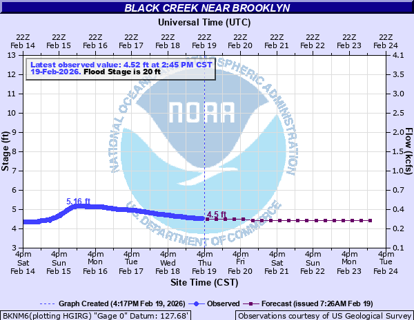
Black Creek near Brooklyn
Critical Stages
15' - Action
20' - Flood
25' - Moderate
29' - Major
Latest Observation
Updated: 12:45 PM CST 12/15/25
Status: No Flooding
Stage: 4.05 ft
Flow: 0.211 kcfs
Forecast
| Time | Stage (ft) | Flow (kcfs) |
|---|---|---|
| 6 PM 12/15 | 4.1 | 0.22 |
| 12 AM 12/16 | 4 | 0.202 |
| 6 AM 12/16 | 4 | 0.202 |
| 12 PM 12/16 | 4 | 0.202 |
| 6 PM 12/16 | 4 | 0.202 |
| 12 AM 12/17 | 4 | 0.202 |
| 6 AM 12/17 | 4 | 0.202 |
| 12 PM 12/17 | 4 | 0.202 |
| 6 PM 12/17 | 4 | 0.202 |
| 12 AM 12/18 | 4 | 0.202 |
| 6 AM 12/18 | 4 | 0.202 |
| 12 PM 12/18 | 4 | 0.202 |
| 6 PM 12/18 | 4 | 0.202 |
| 12 AM 12/19 | 3.9 | 0.185 |
| 6 AM 12/19 | 3.9 | 0.185 |
| 12 PM 12/19 | 3.9 | 0.185 |
| 6 PM 12/19 | 3.9 | 0.185 |
| 12 AM 12/20 | 3.9 | 0.185 |
| 6 AM 12/20 | 3.9 | 0.185 |
| Time | Stage (ft) | Flow (kcfs) |
|---|---|---|
| 12:45 PM 12/15 | 4.05 | 0.211 |
| 12:30 PM 12/15 | 4.05 | 0.211 |
| 12:15 PM 12/15 | 4.05 | 0.211 |
| 12:00 PM 12/15 | 4.05 | 0.211 |
| 11:45 AM 12/15 | 4.05 | 0.211 |
| 11:30 AM 12/15 | 4.05 | 0.211 |
| 11:15 AM 12/15 | 4.04 | 0.209 |
| 11:00 AM 12/15 | 4.04 | 0.209 |
| 10:45 AM 12/15 | 4.04 | 0.209 |
| 10:30 AM 12/15 | 4.04 | 0.209 |
| 10:15 AM 12/15 | 4.03 | 0.207 |
| 10:00 AM 12/15 | 4.04 | 0.209 |
| 9:45 AM 12/15 | 4.03 | 0.207 |
| 9:30 AM 12/15 | 4.03 | 0.207 |
| 9:15 AM 12/15 | 4.03 | 0.207 |
| 9:00 AM 12/15 | 4.04 | 0.209 |
| 8:45 AM 12/15 | 4.04 | 0.209 |
| 8:30 AM 12/15 | 4.05 | 0.211 |
| 8:15 AM 12/15 | 4.05 | 0.211 |
| 8:00 AM 12/15 | 4.05 | 0.211 |
| 7:45 AM 12/15 | 4.05 | 0.211 |
| 7:30 AM 12/15 | 4.05 | 0.211 |
| 7:15 AM 12/15 | 4.05 | 0.211 |
| 7:00 AM 12/15 | 4.06 | 0.213 |
| 6:45 AM 12/15 | 4.06 | 0.213 |
| 6:30 AM 12/15 | 4.06 | 0.213 |
| 6:15 AM 12/15 | 4.06 | 0.213 |
| 6:00 AM 12/15 | 4.06 | 0.213 |
| 5:45 AM 12/15 | 4.06 | 0.213 |
| 5:30 AM 12/15 | 4.06 | 0.213 |
31.87' -
Water covers most of Highway 49 just south of town.
30.1' -
Water is covering most of Highway 49 bridge, 1 mile southwest of brooklyn.
29.96' -
Evacuation of residents is recommended. Flooding occurs across much of Brooklyn on the southside of Main Street and also the trailer park off Hobson Street.
29.48' -
Water covers both ends of Old Highway 49 bridge on the south side of town.
26' -
Water is covering southern portions of Main Street in the city of Brooklyn.
25' -
Several structures flood along Carnes Road just upstream of Brooklyn.
24.9' -
Water begins to affect homes on the south side of Main Street.
22' -
Water approaches the south side of Brooklyn.
21.8' -
Portions of JC Burt Road flood in the Camp Dantzler area begin to flood.
20' -
Widespread flooding of lowland approximately 5 miles up and downstream of the gage site.
16.5' -
Parking areas flood along the creek.
13' -
Flooding occurs along lowland near the river.
| Date | Stage (ft) |
|---|---|
| Apr 7, 1983 | 29.96 |
| Aug 31, 2012 | 26.96 |
| Feb 18, 1961 | 25.7 |
| Mar 13, 2016 | 25.36 |
| May 12, 2019 | 25.34 |
| Dec 29, 2018 | 25.32 |
| Apr 14, 1974 | 25.32 |
| Jan 21, 1993 | 25.29 |
| Apr 4, 1979 | 24.6 |
| May 20, 1980 | 23.25 |
| Mar 30, 1980 | 22.69 |
| Apr 14, 1980 | 22.27 |
| Mar 29, 2009 | 22.26 |
| Jul 2, 2003 | 21.8 |
| Jun 2, 1990 | 21.74 |
| Jan 8, 1998 | 21.59 |
| Apr 1, 2005 | 21.46 |
| Mar 23, 2012 | 21.36 |
| Jan 31, 1999 | 21.29 |
| Jun 12, 2001 | 21.16 |
Data provided by the National Weather Service.