Deep Fork River near Beggs
Critical Stages
18' - Action
18' - Flood
22' - Moderate
27' - Major
Latest Observation
Updated: 10:15 PM CST 12/6/25
Status: No Flooding
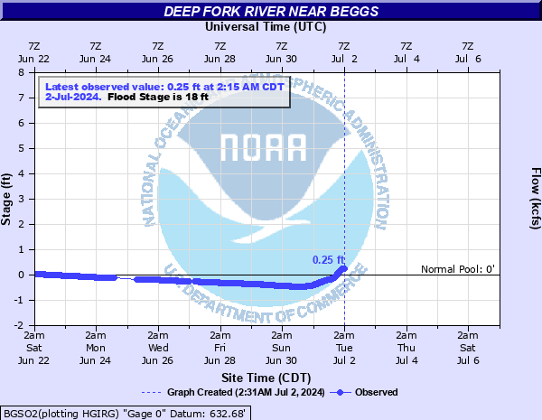
Stage: 0.25 ft
Flow: 0.0803 kcfs
Forecast
Forecast not available for this location.
| Time | Stage (ft) | Flow (kcfs) |
|---|---|---|
| 10:15 PM 12/6 | 0.25 | 0.0803 |
| 10:00 PM 12/6 | 0.25 | 0.0803 |
| 9:45 PM 12/6 | 0.25 | 0.0803 |
| 9:30 PM 12/6 | 0.25 | 0.0803 |
| 9:15 PM 12/6 | 0.25 | 0.0803 |
| 9:00 PM 12/6 | 0.25 | 0.0803 |
| 8:45 PM 12/6 | 0.25 | 0.0803 |
| 8:30 PM 12/6 | 0.25 | 0.0803 |
| 8:15 PM 12/6 | 0.25 | 0.0803 |
| 8:00 PM 12/6 | 0.25 | 0.0803 |
| 7:45 PM 12/6 | 0.26 | 0.0821 |
| 7:30 PM 12/6 | 0.25 | 0.0803 |
| 7:15 PM 12/6 | 0.26 | 0.0821 |
| 7:00 PM 12/6 | 0.26 | 0.0821 |
| 6:45 PM 12/6 | 0.26 | 0.0821 |
| 6:30 PM 12/6 | 0.26 | 0.0821 |
| 6:15 PM 12/6 | 0.26 | 0.0821 |
| 6:00 PM 12/6 | 0.26 | 0.0821 |
| 5:45 PM 12/6 | 0.26 | 0.0821 |
| 5:30 PM 12/6 | 0.26 | 0.0821 |
| 5:15 PM 12/6 | 0.26 | 0.0821 |
| 5:00 PM 12/6 | 0.26 | 0.0821 |
| 4:45 PM 12/6 | 0.26 | 0.0821 |
| 4:30 PM 12/6 | 0.26 | 0.0821 |
| 4:15 PM 12/6 | 0.26 | 0.0821 |
| 4:00 PM 12/6 | 0.26 | 0.0821 |
| 3:45 PM 12/6 | 0.26 | 0.0821 |
| 3:30 PM 12/6 | 0.26 | 0.0821 |
| 3:15 PM 12/6 | 0.26 | 0.0821 |
| 3:00 PM 12/6 | 0.26 | 0.0821 |
33' -
very severe flooding occurs. Local roads northwest of Okmulgee are closed. Suburban homes northwest of the city become flooded. 20th Street in Okmulgee is closed and nearby businesses may be flooded. This is an extremely dangerous and life threatening situation. This will be similar to the flood level that occurred in June 1948.
30' -
very severe flooding occurs. Local roads northwest of Okmulgee are closed. Suburban homes northwest of the city become flooded. 20th Street in Okmulgee is closed and nearby businesses may be flooded. This is an extremely dangerous and life threatening situation.
28' -
severe agricultural flooding occurs. Some local roads are closed northwest of Okmulgee with some suburban homes northwest of Okmulgee suffering minor flooding. Dentonville Road southwest of Beggs is closed. This will exceed the flooding which occurred on April 29, 1999 when the river crested at 27.10 feet. This is an extremely dangerous and life threatening situation.
27' -
severe agricultural flooding occurs. Some local roads west and northwest of Okmulgee are closed and suburban homes become isolated and threatened by high water. Dentonville Road southwest of Beggs is closed. This will compare with flooding which occurred on June 20, 2015 when the river crested at 27.44 feet, and on April 29, 1999 when the river crested at 27.10 feet. This is a dangerous and life threatening situation.
26' -
Dentonville Road southwest of Beggs is closed. Some local roads become covered by water northwest of Okmulgee, isolating several homes.
25' -
several county roads northwest of Okmulgee are closed and some homes may be isolated by high water. Dentonville Road southwest of Beggs is closed.
24' -
some county roads south of Beggs and northwest of Okmulgee are flooded. Dentonville Road southwest of Beggs may be impassable.
22' -
moderate flooding of pasture lands occurs. County roads south of Beggs and suburban roads northwest of Okmulgee are covered by water. Water is about half a foot above the bottom of the Dentonville Road bridge over the river.
21' -
widespread flooding of agricultural lands occurs. County roads south of Beggs become impassable including Webster Road. Some county roads northwest of Okmulgee are covered by water. Water reaches the bottom of the Dentonville Road bridge over the river at 21.5 feet.
20' -
minor flooding of agricultural lands occurs. Webster Road north of the gage site becomes impassable as well as some other county roads south of Beggs.
19' -
minor agricultural flooding occurs. Webster Road north of the gage site is impassable.
18' -
minor lowland flooding occurs. Webster Road north of the gage site may not be passable.
| Date | Stage (ft) |
|---|---|
| May 11, 1943 | 34.55 |
| Apr 15, 1945 | 34.11 |
| Jun 24, 1948 | 33.35 |
| Mar 16, 1990 | 31.19 |
| May 6, 2022 | 30.94 |
| Jun 13, 1974 | 30.69 |
| Nov 6, 1974 | 30.36 |
| May 14, 1993 | 30.01 |
| Jun 11, 1941 | 29.78 |
| May 26, 1957 | 29.75 |
| Feb 27, 1985 | 29.65 |
| Nov 3, 1941 | 28.79 |
| May 20, 1943 | 28.05 |
| May 24, 1949 | 27.8 |
| Apr 23, 1942 | 27.75 |
| Apr 5, 1988 | 27.53 |
| May 5, 1988 | 27.53 |
| Apr 21, 1990 | 27.48 |
| May 12, 1995 | 27.32 |
| Jun 20, 2015 | 27.25 |
Data provided by the National Weather Service.