Black Bear Creek at Pawnee
Critical Stages
17' - Action
17' - Flood
21' - Moderate
25' - Major
Latest Observation
Updated: 9:30 PM CST 12/6/25
Status: No Flooding
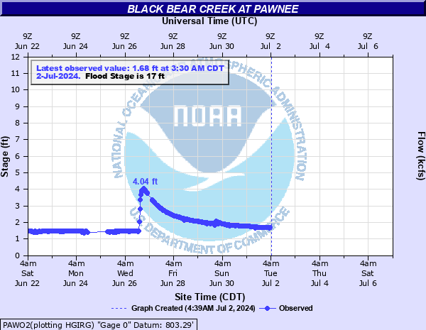
Stage: 1.66 ft
Flow: 0.0003 kcfs
Forecast
Forecast not available for this location.
| Time | Stage (ft) | Flow (kcfs) |
|---|---|---|
| 10:30 PM 12/6 | 1.68 | 0.0003 |
| 10:00 PM 12/6 | 1.68 | 0.0003 |
| 9:30 PM 12/6 | 1.66 | 0.0003 |
| 9:00 PM 12/6 | 1.68 | 0.0003 |
| 8:30 PM 12/6 | 1.68 | 0.0003 |
| 8:00 PM 12/6 | 1.68 | 0.0003 |
| 7:30 PM 12/6 | 1.68 | 0.0003 |
| 7:00 PM 12/6 | 1.68 | 0.0003 |
| 6:30 PM 12/6 | 1.68 | 0.0003 |
| 6:00 PM 12/6 | 1.68 | 0.0003 |
| 5:30 PM 12/6 | 1.68 | 0.0003 |
| 5:00 PM 12/6 | 1.68 | 0.0003 |
| 4:30 PM 12/6 | 1.68 | 0.0003 |
| 4:00 PM 12/6 | 1.68 | 0.0003 |
| 3:30 PM 12/6 | 1.68 | 0.0003 |
| 3:00 PM 12/6 | 1.62 | 0.0002 |
| 2:30 PM 12/6 | 1.65 | 0.0002 |
| 2:00 PM 12/6 | 1.65 | 0.0002 |
| 1:30 PM 12/6 | 1.67 | 0.0003 |
| 1:00 PM 12/6 | 1.68 | 0.0003 |
| 12:30 PM 12/6 | 1.68 | 0.0003 |
| 12:00 PM 12/6 | 1.69 | 0.0004 |
| 11:30 AM 12/6 | 1.68 | 0.0003 |
| 11:00 AM 12/6 | 1.69 | 0.0004 |
| 10:30 AM 12/6 | 1.69 | 0.0004 |
| 10:00 AM 12/6 | 1.69 | 0.0004 |
| 9:30 AM 12/6 | 1.68 | 0.0003 |
| 9:00 AM 12/6 | 1.68 | 0.0003 |
| 8:30 AM 12/6 | 1.69 | 0.0004 |
| 8:00 AM 12/6 | 1.7 | 0.0004 |
29' -
damaging flooding occurs from west of Pawnee to its confluence with the Arkansas River. Extreme overflows flood some residences with depths of several feet. Around 10 city blocks are affected. The all-time record flood was 31.4 feet on October 3, 1959. This is an extremely dangerous and life threatening situation.
27' -
very severe flooding occurs from west of Pawnee to its confluence with the Arkansas River. Overflows flood some residences and isolate many other homes. This is similar to the flood of October 5, 1986 when the stage crested at 27.3 feet. This is an extremely dangerous and life threatening situation.
25' -
severe flooding occurs from west of Pawnee to its confluence with the Arkansas River. Overflows isolate or flood some residences. This is an extremely dangerous and life threatening situation.
23' -
moderate agricultural flooding occurs. The access road to the Pawnee Indian Agency and Hospital are closed. The Pawnee County Fairgrounds are flooded.
21' -
moderate agricultural flooding occurs. The Pawnee County Fairgrounds are flooded. The access road to the Pawnee Indian Agency and Hospital becomes impassable.
19' -
minor agricultural flooding occurs. The Pawnee County Fairgrounds and some access roads begin to flood.
17' -
minor farm and ranchland flooding occurs.
| Date | Stage (ft) |
|---|---|
| Oct 3, 1959 | 31.43 |
| May 19, 1943 | 28.19 |
| Sep 30, 1945 | 28.11 |
| May 25, 1908 | 27.3 |
| Oct 5, 1986 | 27.3 |
| Sep 14, 1961 | 27.16 |
| Nov 4, 1974 | 26.87 |
| May 21, 2019 | 26.18 |
| May 18, 1957 | 25.26 |
| Mar 12, 1974 | 24.43 |
| May 23, 2019 | 23.87 |
| May 10, 1993 | 23.24 |
| Jun 25, 1957 | 22.56 |
| Apr 16, 1947 | 22.55 |
| Oct 30, 1974 | 22.35 |
| May 28, 1955 | 21.78 |
| May 22, 1955 | 21.74 |
| Oct 12, 1961 | 21.68 |
| Sep 20, 1974 | 21.33 |
| Oct 4, 2017 | 21.16 |
Data provided by the National Weather Service.