Polecat Creek near Sapulpa
Critical Stages
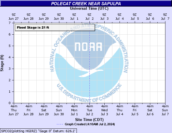
21' - Action
21' - Flood
25' - Moderate
30' - Major
Latest Observation
Updated: 6:09 PM LMT 12/31/00
Status: Obs Not Current
Stage: -999 ft
Flow: -999 kcfs
Forecast
Forecast not available for this location.
Observation history not available.
32' -
disastrous flooding affects suburban and rural lands between Sapulpa and Jenks. Several local highways are closed. Some suburban homes are flooded, while others are surrounded and cut off from access. This is an extremely dangerous and life threatening situation.
30' -
very severe flooding affects rural lands between Sapulpa and Jenks. Many local roads are closed. Some suburban homes are flooded, and others are surrounded by high water. This is an extremely dangerous and life threatening situation.
28' -
severe flooding affects pasturelands, oil fields, and county roads between Sapulpa and Jenks. Barns and oil field storage tanks may be flooded. Suburban homes will have water in yards.
26' -
moderate flooding affects pasturelands and suburban roads between Sapulpa and Jenks. Livestock barns and other outbuildings are flooded.
25' -
moderate flooding affects pasturelands and oil fields between Sapulpa and the Tulsa County line. Barns and other outbuildings experience minor flooding.
24' -
widespread flooding affects pasturelands and oil fields between Sapulpa and the Tulsa County line. Barns and other outbuildings may be threatened by minor flooding.
22' -
minor flooding of pasturelands and oil fields occurs.
21' -
minor agricultural flooding occurs.
| Date | Stage (ft) |
|---|---|
| May 10, 1943 | 33.7 |
| Sep 4, 1940 | 32 |
| May 6, 2000 | 31.7 |
| Jun 9, 1974 | 30.85 |
| Jun 15, 1957 | 30 |
| May 17, 1943 | 29.8 |
| Jun 19, 2015 | 29.75 |
| Jun 24, 1948 | 29.6 |
| Oct 2, 1986 | 29.3 |
| Apr 30, 1970 | 28.52 |
| Oct 1, 1941 | 28.3 |
| Dec 27, 2015 | 28.2 |
| Jun 15, 2007 | 28.15 |
| May 21, 2019 | 28 |
| May 24, 2015 | 28 |
| Jun 25, 1958 | 28 |
| May 1, 2025 | 28 |
| May 20, 1949 | 28 |
| Sep 6, 1971 | 27.93 |
| Apr 28, 1998 | 27.4 |
Data provided by the National Weather Service.