« Back to North Sandwich Rivers
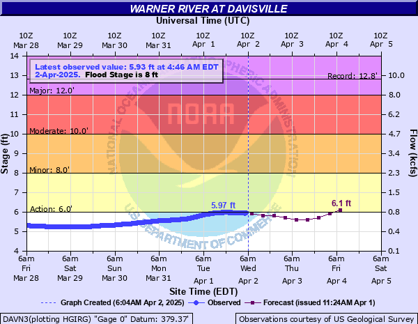
Warner River at Davisville
Critical Stages
6' - Action
8' - Flood
10' - Moderate
12' - Major
Latest Observation
Updated: 4:30 PM EST 12/5/25
Status: No Flooding
Stage: 3.66 ft
Flow: 0.0584 kcfs
Forecast
| Time | Stage (ft) | Flow (kcfs) |
|---|---|---|
| 7 PM 12/5 | 3.6 | 0.052 |
| 1 AM 12/6 | 3.6 | 0.052 |
| 7 AM 12/6 | 3.6 | 0.052 |
| 1 PM 12/6 | 3.6 | 0.052 |
| 7 PM 12/6 | 3.6 | 0.052 |
| 1 AM 12/7 | 3.6 | 0.052 |
| 7 AM 12/7 | 3.6 | 0.052 |
| 1 PM 12/7 | 3.6 | 0.052 |
| 7 PM 12/7 | 3.6 | 0.052 |
| 1 AM 12/8 | 3.6 | 0.052 |
| 7 AM 12/8 | 3.6 | 0.052 |
| Time | Stage (ft) | Flow (kcfs) |
|---|---|---|
| 4:30 PM 12/5 | 3.66 | 0.0584 |
| 4:15 PM 12/5 | 3.65 | 0.0573 |
| 4:00 PM 12/5 | 3.65 | 0.0573 |
| 3:45 PM 12/5 | 3.65 | 0.0573 |
| 3:30 PM 12/5 | 3.64 | 0.0562 |
| 3:15 PM 12/5 | 3.64 | 0.0562 |
| 3:00 PM 12/5 | 3.64 | 0.0562 |
| 2:45 PM 12/5 | 3.63 | 0.0551 |
| 2:30 PM 12/5 | 3.63 | 0.0551 |
| 2:15 PM 12/5 | 3.63 | 0.0551 |
| 2:00 PM 12/5 | 3.63 | 0.0551 |
| 1:45 PM 12/5 | 3.63 | 0.0551 |
| 1:30 PM 12/5 | 3.63 | 0.0551 |
| 1:15 PM 12/5 | 3.63 | 0.0551 |
| 1:00 PM 12/5 | 3.63 | 0.0551 |
| 12:45 PM 12/5 | 3.63 | 0.0551 |
| 12:30 PM 12/5 | 3.63 | 0.0551 |
| 12:15 PM 12/5 | 3.63 | 0.0551 |
| 12:00 PM 12/5 | 3.62 | 0.0541 |
| 11:45 AM 12/5 | 3.62 | 0.0541 |
| 11:30 AM 12/5 | 3.62 | 0.0541 |
| 11:15 AM 12/5 | 3.62 | 0.0541 |
| 11:00 AM 12/5 | 3.61 | 0.053 |
| 10:45 AM 12/5 | 3.61 | 0.053 |
| 10:30 AM 12/5 | 3.61 | 0.053 |
| 10:15 AM 12/5 | 3.6 | 0.052 |
| 10:00 AM 12/5 | 3.6 | 0.052 |
| 9:45 AM 12/5 | 3.6 | 0.052 |
| 9:30 AM 12/5 | 3.6 | 0.052 |
| 9:15 AM 12/5 | 3.59 | 0.0509 |
13' -
In Warner, Depot Street floods with water surrounding businesses. Chemical Lane flooded near the confluence with the Silver Brook, cutting off access to a dozen properties including those on Willey Lane. Wallaby Colby Lane flooded. In Hopkinton, homes along Deer Path, Well House, and Dustin Roads are at risk from high water especially if the Contoocook River is also at high flows.
12' -
In Warner, areas that flood are West Roby District Road, West Joppa Road covered bridge, Waterloo Road covered bridge, Morse Lane, and the Tom Pond area experience flooding. Properties south of Depot Street are inundated with impacts to parking areas. Significant flooding to Riverside Park.
10' -
Low lying roads along the Warner River begin to have a flood threat. The most flood prone areas include West Joppa Road in Warner, cutting off access to the Dalton covered bridge.
9.5' -
Basement flooding of properties along Tom's Pond in Warner begins.
8.5' -
Properties along Tom's Pond including Pine Lane in Warner are flooded with water overtopping retention walls.
8' -
Riverside Road floods along with increasing depths over recreational fields in Warner.
6.5' -
Although no structures are affected, water inundates recreational areas in Warner and Davisville. The river is at bankfull in other reaches, some erosion may occur.
| Date | Stage (ft) |
|---|---|
| Sep 22, 1938 | 12.8 |
| May 15, 2006 | 12.35 |
| Apr 16, 2007 | 11.87 |
| Oct 9, 2005 | 10.14 |
| Mar 27, 1953 | 9.88 |
| Apr 5, 1960 | 9.78 |
| Jun 25, 1944 | 9.64 |
| Mar 14, 1977 | 9.42 |
| Apr 3, 1951 | 9.39 |
| Apr 3, 2005 | 9.11 |
| Jul 30, 2021 | 8.63 |
| Dec 24, 2022 | 8.62 |
| Apr 2, 2004 | 8.58 |
| May 10, 2025 | 8.58 |
| Apr 2, 1976 | 8.51 |
| Dec 19, 2023 | 8.45 |
| Dec 22, 1973 | 8.43 |
| Jul 17, 2023 | 8.38 |
| Mar 31, 2010 | 8.37 |
| Apr 24, 2001 | 8.1 |
Data provided by the National Weather Service.