« Back to Northern Lights Rivers
East Branch of the Ausable River at Au Sable Forks
Critical Stages
6' - Action
7' - Flood
9' - Moderate
11' - Major
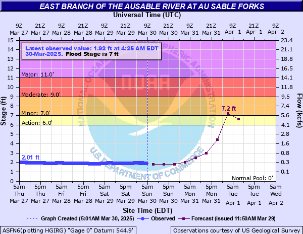
Latest Observation
Updated: 2:15 AM EST 12/15/25
Status: No Flooding
Stage: 1.64 ft
Flow: 0.179 kcfs
Forecast
| Time | Stage (ft) | Flow (kcfs) |
|---|---|---|
| 7 AM 12/15 | 1.2 | 0.081 |
| 1 PM 12/15 | 1.2 | 0.081 |
| 7 PM 12/15 | 1.2 | 0.081 |
| 1 AM 12/16 | 1.2 | 0.081 |
| 7 AM 12/16 | 1.2 | 0.081 |
| 1 PM 12/16 | 1.2 | 0.081 |
| 7 PM 12/16 | 1.2 | 0.081 |
| 1 AM 12/17 | 1.2 | 0.081 |
| 7 AM 12/17 | 1.2 | 0.081 |
| Time | Stage (ft) | Flow (kcfs) |
|---|---|---|
| 2:15 AM 12/15 | 1.64 | 0.179 |
| 2:00 AM 12/15 | 1.64 | 0.179 |
| 1:45 AM 12/15 | 1.65 | 0.182 |
| 1:30 AM 12/15 | 1.65 | 0.182 |
| 1:15 AM 12/15 | 1.65 | 0.182 |
| 1:00 AM 12/15 | 1.65 | 0.182 |
| 12:45 AM 12/15 | 1.65 | 0.182 |
| 12:30 AM 12/15 | 1.65 | 0.182 |
| 12:15 AM 12/15 | 1.65 | 0.182 |
| 12:00 AM 12/15 | 1.66 | 0.184 |
| 11:45 PM 12/14 | 1.66 | 0.184 |
| 11:30 PM 12/14 | 1.67 | 0.187 |
| 11:15 PM 12/14 | 1.67 | 0.187 |
| 11:00 PM 12/14 | 1.67 | 0.187 |
| 10:45 PM 12/14 | 1.67 | 0.187 |
| 10:30 PM 12/14 | 1.68 | 0.19 |
| 10:15 PM 12/14 | 1.68 | 0.19 |
| 10:00 PM 12/14 | 1.68 | 0.19 |
| 9:45 PM 12/14 | 1.68 | 0.19 |
| 9:30 PM 12/14 | 1.68 | 0.19 |
| 9:15 PM 12/14 | 1.68 | 0.19 |
| 9:00 PM 12/14 | 1.68 | 0.19 |
| 8:45 PM 12/14 | 1.68 | 0.19 |
| 8:30 PM 12/14 | 1.68 | 0.19 |
| 8:15 PM 12/14 | 1.68 | 0.19 |
| 8:00 PM 12/14 | 1.68 | 0.19 |
| 7:45 PM 12/14 | 1.68 | 0.19 |
| 7:30 PM 12/14 | 1.68 | 0.19 |
| 7:15 PM 12/14 | 1.68 | 0.19 |
| 7:00 PM 12/14 | 1.68 | 0.19 |
18' -
Record flooding will occur throughout the Ausable valley with numerous homes and businesses flooded or becoming isolated by high water. Large sections of Routes 9N and 73 will flood and become impassable. Ausable Village may become isolated with large areas of the town flooded, such as Main Street, the Main Street bridge and the Jersey bridge. Safe access to many homes and businesses will be blocked by high water.
15' -
Severe flooding will be seen throughout much of the Ausable Valley from Keene to Jay, downstream through Ausable Village and Keeseville. Numerous sections of Routes 9n and 73 will flood with some homes and businesses becoming isolated by high water, similar to the flood of November 1996. In Ausable Village, Grove Road, School Street, Intervale Avenue, and homes in the Jersey area will flood. In Keeseville, the wastewater treatment plant and several homes and businesses along Route 9 will flood.
13' -
Major flooding will occur in many portions of the Ausable Valley. In Ausable Village, homes in the Jersey area and other lowland areas will likely flood. Several feet of water will cover Intervale Avenue, and portions of Grove Road and School Street may experience high water. Sections of Routes 9N and 73 will flood. In Keeseville, the wastewater treatment plant, as well as homes and businesses along Route 9 will likely flood. This stage is equivalent to the FEMA 1 Percent Annual Chance Flood.
11' -
Major flooding will likely occur in portions of the Ausable River valley. In Ausable Village, homes in the Jersey area including Intervale Avenue will flood. Water will cover Route 9N near Stickney Bridge including Clark Lane and Carey Road. Water will approach Route 9N near Stone House Road. In Keeseville, the wastewater treatment plant and businesses along Route 9 may flood. In Keene, water will cover Hulls Falls Road, Routes 73 and 9N near Marcy field. The Keene business district may also flood.
10' -
Parkland and adjacent parking lots will flood in Ausable Forks. In Jay, portions of Route 9N near Stickney Bridge will flood. Water will back up onto Clark Lane and Carey Road. Downstream in Keeseville, water will approach businesses along north Ausable Street, as well as the Keeseville wastewater treatment plant. Upstream in Keene, water will cover Hulls Falls Road and Routes 73 and 9N near Marcy Field.
9' -
In Jay, water will approach Route 9N in the Stickney Bridge area. In Keene, water will cover Hulls Falls Road, and Routes 73 and 9N near Marcy Field.
8' -
In Jay, water will cover Route 9N near Trumbulls Corner. Minor flooding can occur in Keene. Water begins to overflow onto Hulls Falls Road, Route 73, and Route 9N near Marcy Field. High water will impact interests at Alice Falls near Keeseville.
7' -
Minor flooding can occur in Keene. Water begins to overflow onto Hulls Falls Road, Route 73, and Route 9N near Marcy Field. High water will impact interests at Alice Falls near Keeseville.
| Date | Stage (ft) |
|---|---|
| Aug 29, 2011 | 18.51 |
| Feb 18, 2022 | 15.82 |
| Nov 9, 1996 | 15.22 |
| Feb 23, 1990 | 13.96 |
| Jan 12, 2018 | 13.27 |
| Sep 22, 1938 | 12.91 |
| Jan 19, 1996 | 11.93 |
| Dec 18, 2023 | 11.83 |
| Feb 11, 1981 | 11.7 |
| Feb 3, 1983 | 11.63 |
| Dec 31, 1948 | 11.6 |
| Apr 28, 2011 | 11.48 |
| Mar 28, 1925 | 11.4 |
| Nov 1, 2019 | 11.27 |
| Nov 27, 1979 | 11.13 |
| Oct 1, 1924 | 10.85 |
| Mar 11, 1992 | 10.5 |
| Apr 27, 2011 | 10.2 |
| Jan 24, 1999 | 9.71 |
| Jun 28, 2013 | 9.65 |
Data provided by the National Weather Service.