« Back to Northern Lights Rivers
Missisquoi River at East Berkshire
Critical Stages
11' - Action
13' - Flood
14' - Moderate
16' - Major
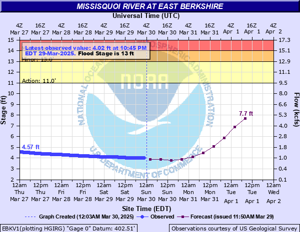
Latest Observation
Updated: 1:45 AM EST 12/15/25
Status: No Flooding
Stage: 4.2 ft
Flow: 1.14 kcfs
Forecast
| Time | Stage (ft) | Flow (kcfs) |
|---|---|---|
| 7 AM 12/15 | 2.9 | 0.386 |
| 1 PM 12/15 | 2.9 | 0.386 |
| 7 PM 12/15 | 2.8 | 0.348 |
| 1 AM 12/16 | 2.8 | 0.348 |
| 7 AM 12/16 | 2.8 | 0.348 |
| 1 PM 12/16 | 2.8 | 0.348 |
| 7 PM 12/16 | 2.8 | 0.348 |
| 1 AM 12/17 | 2.8 | 0.348 |
| 7 AM 12/17 | 2.8 | 0.348 |
| Time | Stage (ft) | Flow (kcfs) |
|---|---|---|
| 2:45 AM 12/15 | 4.2 | 1.14 |
| 2:30 AM 12/15 | 4.2 | 1.14 |
| 2:15 AM 12/15 | 4.2 | 1.14 |
| 2:00 AM 12/15 | 4.2 | 1.14 |
| 1:45 AM 12/15 | 4.2 | 1.14 |
| 1:30 AM 12/15 | 4.2 | 1.14 |
| 1:15 AM 12/15 | 4.19 | 1.14 |
| 1:00 AM 12/15 | 4.19 | 1.14 |
| 12:45 AM 12/15 | 4.19 | 1.14 |
| 12:30 AM 12/15 | 4.19 | 1.14 |
| 12:15 AM 12/15 | 4.19 | 1.14 |
| 12:00 AM 12/15 | 4.19 | 1.14 |
| 11:45 PM 12/14 | 4.19 | 1.14 |
| 11:30 PM 12/14 | 4.19 | 1.14 |
| 11:15 PM 12/14 | 4.19 | 1.14 |
| 11:00 PM 12/14 | 4.19 | 1.14 |
| 10:45 PM 12/14 | 4.2 | 1.14 |
| 10:30 PM 12/14 | 4.2 | 1.14 |
| 10:15 PM 12/14 | 4.2 | 1.14 |
| 10:00 PM 12/14 | 4.21 | 1.15 |
| 9:45 PM 12/14 | 4.21 | 1.15 |
| 9:30 PM 12/14 | 4.22 | 1.16 |
| 9:15 PM 12/14 | 4.22 | 1.16 |
| 9:00 PM 12/14 | 4.22 | 1.16 |
| 8:45 PM 12/14 | 4.23 | 1.17 |
| 8:30 PM 12/14 | 4.23 | 1.17 |
| 8:15 PM 12/14 | 4.23 | 1.17 |
| 8:00 PM 12/14 | 4.24 | 1.17 |
| 7:45 PM 12/14 | 4.25 | 1.18 |
| 7:30 PM 12/14 | 4.25 | 1.18 |
23' -
Devastating flooding occurs. This stage equals the Great Flood of 1927. Bridges on Routes 118, 108, and 105 will be covered in water, and may be destroyed. Large sections of Routes 118, 108, and 105 and local roads will be covered in water. Water will inundate homes in East Berkshire and Enosburg Falls.
17' -
Severe flooding will occur from Richford downstream to Sheldon along the Missisquoi. Water will enter homes in East Berkshire, and cover portions of Route 118 near East Berkshire and Route 105 between East Berkshire and Enosburg Falls. Missisquoi Street in Enosburg Falls will flood. Flooding of farmland will be widespread along the Missisquoi in Franklin county. This stage is equivalent to the FEMA 1 Percent Annual Chance Flood.
16' -
There will be widespread flooding along the Missisquoi from Richford to Sheldon. Water will cover portions of Route 105 between Enosburg Falls and East Berkshire, and will approach Route 236 in Sheldon and Route 118 in East Berkshire. There will be extensive field flooding.
14' -
Widespread flooding of low lying fields and roadways will occur from Richford to Enosburg. Water will approach Route 118 at East Berkshire, and Route 105 between Enosburg Falls and East Berkshire. Yards will be flooded in East Berkshire.
13' -
Widespread flooding of low lying fields and some low lying roads will occur along the Missisquoi from Richford to Enosburg. Water will enter the yards of riverside homes in East Berkshire.
| Date | Stage (ft) |
|---|---|
| Nov 4, 1927 | 23.1 |
| Mar 15, 1946 | 18.92 |
| Apr 1, 1918 | 17.5 |
| Apr 18, 1982 | 17.45 |
| Feb 28, 2000 | 17.42 |
| Mar 31, 1998 | 17.09 |
| Mar 5, 1964 | 17.07 |
| Mar 7, 1979 | 16.72 |
| Feb 25, 1985 | 16.69 |
| Apr 4, 1959 | 16.63 |
| Nov 1, 2019 | 16.49 |
| Mar 21, 1981 | 16.3 |
| Feb 15, 1984 | 16.06 |
| Mar 11, 1992 | 16.06 |
| Mar 15, 1977 | 16 |
| Jul 15, 1997 | 15.75 |
| Apr 16, 2014 | 15.64 |
| Jan 1, 1998 | 15.54 |
| Mar 27, 2007 | 15.2 |
| May 4, 1940 | 15.15 |
Data provided by the National Weather Service.