« Back to Northern Lights Rivers
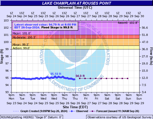
Lake Champlain at Rouses Point
Critical Stages
99' - Action
99.5' - Flood
100.5' - Moderate
101' - Major
Latest Observation
Updated: 2:00 AM EST 12/15/25
Status: No Flooding
Stage: 94.28 ft
Flow: 8.56 kcfs
Forecast
| Time | Stage (ft) | Flow (kcfs) |
|---|---|---|
| 7 AM 12/15 | 94.3 | 8.64 |
| 1 PM 12/15 | 94.3 | 8.64 |
| 7 PM 12/15 | 94.3 | 8.64 |
| 1 AM 12/16 | 94.3 | 8.64 |
| 7 AM 12/16 | 94.3 | 8.64 |
| 1 PM 12/16 | 94.3 | 8.64 |
| 7 PM 12/16 | 94.3 | 8.64 |
| 1 AM 12/17 | 94.3 | 8.64 |
| 7 AM 12/17 | 94.3 | 8.64 |
| Time | Stage (ft) | Flow (kcfs) |
|---|---|---|
| 2:00 AM 12/15 | 94.28 | 8.56 |
| 1:45 AM 12/15 | 94.28 | 8.56 |
| 1:30 AM 12/15 | 94.28 | 8.56 |
| 1:15 AM 12/15 | 94.28 | 8.56 |
| 1:00 AM 12/15 | 94.28 | 8.56 |
| 12:45 AM 12/15 | 94.28 | 8.56 |
| 12:30 AM 12/15 | 94.27 | 8.52 |
| 12:15 AM 12/15 | 94.27 | 8.52 |
| 12:00 AM 12/15 | 94.27 | 8.52 |
| 11:45 PM 12/14 | 94.27 | 8.52 |
| 11:30 PM 12/14 | 94.27 | 8.52 |
| 11:15 PM 12/14 | 94.27 | 8.52 |
| 11:00 PM 12/14 | 94.27 | 8.52 |
| 10:45 PM 12/14 | 94.27 | 8.52 |
| 10:30 PM 12/14 | 94.24 | 8.4 |
| 10:15 PM 12/14 | 94.24 | 8.4 |
| 10:00 PM 12/14 | 94.24 | 8.4 |
| 9:45 PM 12/14 | 94.24 | 8.4 |
| 9:30 PM 12/14 | 94.24 | 8.4 |
| 9:15 PM 12/14 | 94.25 | 8.44 |
| 9:00 PM 12/14 | 94.27 | 8.52 |
| 8:45 PM 12/14 | 94.28 | 8.56 |
| 8:30 PM 12/14 | 94.3 | 8.64 |
| 8:15 PM 12/14 | 94.31 | 8.68 |
| 8:00 PM 12/14 | 94.31 | 8.68 |
| 7:45 PM 12/14 | 94.31 | 8.68 |
| 7:30 PM 12/14 | 94.31 | 8.68 |
| 7:15 PM 12/14 | 94.31 | 8.68 |
| 7:00 PM 12/14 | 94.3 | 8.64 |
| 6:45 PM 12/14 | 94.28 | 8.56 |
102.5' -
There will be extensive severe shoreline flooding of homes and local roads. The following highways in vermont will flood: Routes 2 and 78 to Grand Isle County, Route 129 from Alburgh to Isle Lamotte, Route 36 in Saint Albans, and Route 125 at Chimney Point in Addison. In Plattsburgh New York, Route 9 will flood. Wind and wave action will cause structural damage to flooded homes and camps, and erode roadbeds.
102' -
Widespread severe flooding occurs. Lakeshore homes will be flooded and local roads will be inundated. In Vermont, the following highways will flood: Route 125 at Chimney Point in Addison, Route 36 In St. Albans, Route 7 near Highgate State Park, Route 129 from Alburgh to Isle La Motte, Route 2 at the Sand Bar and Between Route 78 and route 129 in Alburgh. In New York, the following highways will flood: Route 9 in Plattsburgh near Route 314, Route 9n near Route 185, and Route 185.
101.5' -
Widespread severe flooding will occur. Lakeshore homes and roads will be inundated. In Vermont, Route 36 in St. Albans Bay, and Route 125 at Chimney Point in Addison will flood. In New York, Route 9n south of Port Henry will flood. Wind and wave action will compound flooding, and may damage exposed shoreline structures.
101' -
Severe flooding occurs, with widespread inundation of lake side properties, and closure of low lying roads. Wind and wave action will compound flood impacts on exposed shorelines.
100.5' -
Flooding affects low lying roads and property, and wind and wave action on exposed shorelines becomes a problem. If lake ice is present, structural damage can occur. Portions of the Burlington waterfront will flood, including the King Street ferry dock and Perkins Pier.
99.5' -
Minor flooding is expected with water beginning to enter some lake front properties. Water also begins to threaten low lying roads, piers, and docks such as Perkins Pier and the King Street Ferry Dock on the Burlington waterfront. Wave action can compound flooding on windward facing shorelines.
99' -
Minor shoreline flooding may occur under windy conditions where the action of waves may cause splashover on some low lying lakeside properties.
| Date | Stage (ft) |
|---|---|
| May 6, 2011 | 102.77 |
| May 4, 1869 | 101.67 |
| Apr 25, 1993 | 101.45 |
| Apr 28, 1993 | 101.43 |
| Mar 30, 1903 | 101.37 |
| Apr 5, 1998 | 101.28 |
| Apr 5, 1976 | 101.21 |
| Apr 29, 1994 | 101.19 |
| Mar 27, 1936 | 101.18 |
| May 7, 1983 | 101.18 |
| May 11, 1972 | 101.11 |
| May 12, 1971 | 100.89 |
| May 18, 2000 | 100.84 |
| May 16, 1996 | 100.6 |
| Apr 25, 1969 | 100.56 |
| Apr 26, 2001 | 100.44 |
| Apr 29, 2019 | 100.43 |
| Apr 23, 2008 | 100.32 |
| Apr 30, 2007 | 100.3 |
| May 1, 1970 | 100.29 |
Data provided by the National Weather Service.