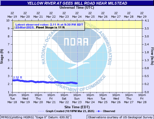
Yellow River at Gees Mill Road near Milstead
Critical Stages
9' - Action
11' - Flood
16' - Moderate
20' - Major
Latest Observation
Updated: 5:30 PM EST 12/5/25
Status: No Flooding
Stage: 2.38 ft
Flow: 0.319 kcfs
Forecast
Forecast not available for this location.
| Time | Stage (ft) | Flow (kcfs) |
|---|---|---|
| 5:30 PM 12/5 | 2.38 | 0.319 |
| 5:15 PM 12/5 | 2.38 | 0.319 |
| 5:00 PM 12/5 | 2.36 | 0.313 |
| 4:45 PM 12/5 | 2.36 | 0.313 |
| 4:30 PM 12/5 | 2.36 | 0.313 |
| 4:15 PM 12/5 | 2.35 | 0.31 |
| 4:00 PM 12/5 | 2.35 | 0.31 |
| 3:45 PM 12/5 | 2.34 | 0.307 |
| 3:30 PM 12/5 | 2.33 | 0.305 |
| 3:15 PM 12/5 | 2.32 | 0.302 |
| 3:00 PM 12/5 | 2.3 | 0.296 |
| 2:45 PM 12/5 | 2.28 | 0.29 |
| 2:30 PM 12/5 | 2.27 | 0.287 |
| 2:15 PM 12/5 | 2.27 | 0.287 |
| 2:00 PM 12/5 | 2.27 | 0.287 |
| 1:45 PM 12/5 | 2.27 | 0.287 |
| 1:30 PM 12/5 | 2.25 | 0.282 |
| 1:15 PM 12/5 | 2.24 | 0.279 |
| 1:00 PM 12/5 | 2.24 | 0.279 |
| 12:45 PM 12/5 | 2.23 | 0.276 |
| 12:30 PM 12/5 | 2.22 | 0.273 |
| 12:15 PM 12/5 | 2.22 | 0.273 |
| 12:00 PM 12/5 | 2.21 | 0.271 |
| 11:45 AM 12/5 | 2.21 | 0.271 |
| 11:30 AM 12/5 | 2.21 | 0.271 |
| 11:15 AM 12/5 | 2.21 | 0.271 |
| 11:00 AM 12/5 | 2.2 | 0.268 |
| 10:45 AM 12/5 | 2.19 | 0.265 |
| 10:30 AM 12/5 | 2.2 | 0.268 |
| 10:15 AM 12/5 | 2.2 | 0.268 |
26' -
Major and Extensive flooding occurs. In Newton County...Between 50 and 100 homes will flood in the Riverside Estates Mobile Home Park along East Dollar Circle and West Dollar Circle. Evacuations are required. In Rockdale County...flooding expands in the Lake Capri subdivision. Flooding occurs along the several roads including Lake Sorrento Court...Lake Capri Drive...Capistrano Way...Rivieria...and Westminister Lane. Several homes will experience flooding.
24' -
Major flooding expands. In Newton County...Between 25 to 50 homes will flood in the Riverside Estates Mobile Home Park along West Dollar Circle. Evacuations are required. In Rockdale County...flooding expands in the Lake Capri subdivision. Flooding occurs along the several roads including Lake Sorrento Court...Lake Capri Drive...Capistrano Way...Rivieria...and Westminister Lane. Several homes will experience flooding.
22' -
Major flooding expands. Gees Mill Road floods in low areas near the Yellow River in Rockdale County. In Rockdale County...flooding expands in the Lake Capri subdivision. Flooding occurs along the several roads including Lake Sorrento Court...Lake Capri Drive...Capistrano Way...Rivieria...and Westminister Lane. Several homes will experience flooding.
20' -
Major flooding begins. In Newton County...Riverside Estates Travel and Mobile Home Park floods. West Dollar and Sycamore Roads flood. Between 10 to 25 homes will flood...trailors will need to be moved to higher ground and evacuations will be required. In Rockdale County...flooding expands in the Lake Capri subdivision. Flooding occurs along the several roads including Lake Sorrento Court...Lake Capri Drive...Capistrano Way...Rivieria...and Westminister Lane. Several homes will experience flooding.
16' -
Moderate flooding begins. In Newton County...Riverside Estates Travel and Mobile Home Park begins to experience significant flooding. Trailers must be moved to higher ground and several mobile homes will flood. Evacuations may be needed. In Rockdale County...some flooding begins in the Lake Capri subdivision.
13' -
Minor flooding continues to expand into the woodlands...fields and pasture along the river upstream and downstream from the gage on Gees Mill Road in Rockdale County. Most of Sockwell Road by the river in Newton County will be flooded with up to 4 feet of water. Minor flooding also occurs in Newton County in the Riverside Estates Travel and Trailer Park. Any trailers near the river may need to be moved to higher ground. A playground by the river will begin to flood.
12' -
Minor flooding continues in the woodlands...fields and pasture along the river upstream and downstream from the gage on Gees Mill Road in Rockdale County. Large portions of Sockwell Road by the river in Newton County will be up to 3 feet under water.
11' -
Flood Stage is reached. Minor flooding begins in the woodlands...fields and pasture along the river upstream and downstream from the gage on Gees Mill Road in Rockdale County. Portions of Sockwell Road by the river in Newton County will be around two feet under water.
10' -
Bankfull conditions continue upstream and downstream from the gage on Gees Mill Road in Rockdale County. Portions of Sockwell Road by the river in Newton County will be around one foot under water.
9' -
Bankfull conditions are reached upstream and downstream from the gage on Gees Mill Road in Rockdale County. Low portions of Sockwell Road near the river in Newton County will begin to flood.
| Date | Stage (ft) |
|---|---|
| Sep 22, 2009 | 22.54 |
| Dec 25, 2015 | 16.47 |
| Jul 8, 2005 | 16.36 |
| Sep 28, 2024 | 16.34 |
| May 7, 2003 | 16.31 |
| Apr 20, 2019 | 15.49 |
| Sep 18, 2004 | 14.31 |
| Mar 20, 2003 | 14.26 |
| Apr 1, 2005 | 14.07 |
| Apr 1, 2005 | 14.07 |
| Jan 10, 2024 | 14.06 |
| Mar 29, 2005 | 13.91 |
| Feb 7, 2020 | 13.67 |
| Nov 12, 2009 | 13.6 |
| Jan 25, 2010 | 13.58 |
| Feb 14, 2025 | 13.58 |
| Oct 14, 2009 | 13.44 |
| Mar 7, 2024 | 13.38 |
| Oct 12, 2020 | 13.35 |
| Dec 30, 2018 | 13.12 |
Data provided by the National Weather Service.